The ferry crossing
The short ferry route between Lévis and Quebec City crosses one of the narrowest parts of the St. Lawrence, linking the two cities facing each other.
Minimalist map poster · Canada
46.8033° N / 71.1779° W
A long shoreline city along the south bank of the St. Lawrence, facing the cliffs and old walls of Quebec City


One city, five moods
Ekamowa emwit style ouga bwe ouga ekamowa e dedaña ñan bwega. Style otata a kor eangan — eprint, eframe ke HD files.
 Pixel ekwan · 24 × 36″ print file
Print-sharp
Enin 100% crop eo mai print file eo elango. Poster otata — eprint, eframe ke edownload — erender iaan server bwir e 300 DPI, dedaña ñan 7,200 × 10,800 pixels, bwe lane ekekedik ekwan ebwe crisp iaan print 24 × 36″.
Ituro


The map
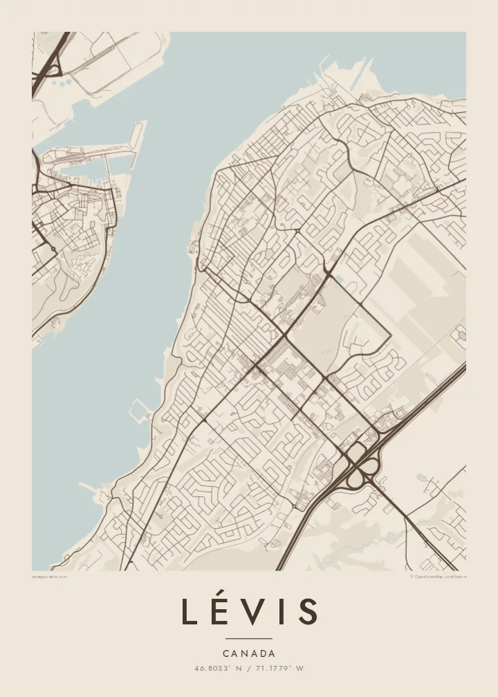
Lévis stretches along the south shore of the St. Lawrence River, directly across from Quebec City. On a map, the city is long and narrow in its older parts, following the river for many kilometres. A steep escarpment separates the lower waterfront from the upper town, and later neighbourhoods have spread inland across the plateau.
A ferry has linked Lévis to Quebec City for generations, and the crossing is a short trip across a narrow reach of the river. At the western end, the Quebec Bridge and the Pierre Laporte Bridge span the St. Lawrence close together. Lévis is also where Alphonse Desjardins founded the first caisse populaire in 1900, the origin of the Desjardins cooperative movement.
A Lévis map poster draws the south bank as a strong line of streets facing the wide river. The Chaudière River reaches the St. Lawrence to the west, and the two bridges add clean strokes across the water. If the frame is slightly wider, the old city of Quebec appears on the opposite shore.
The short ferry route between Lévis and Quebec City crosses one of the narrowest parts of the St. Lawrence, linking the two cities facing each other.
The Quebec Bridge and the Pierre Laporte Bridge cross the river side by side at the western end of the city, forming two parallel lines over the water.
A cliff separates the narrow riverside strip from the upper town, and roads climb it on steep curving routes that stand out against the grid above.
Make it yours
Add a date, a name or a line of your own, switch style, size or orientation.
Preview ededa low-resolution im watermark. Print im HD files erender iaan 300 DPI, dedaña ñan 7,200 × 10,800 px, ededa watermark.
Why Lévis
Lévis is often seen as the view of Quebec City, but for people who live there it is a city with its own identity. A map that puts its shoreline first gives the south bank the attention it deserves.
You can change the title, the subtitle and the coordinates line, in English or French. Five styles are available: Classic black and white, Noir, Paper, Blueprint and Sand. Noir makes the river an especially deep, dramatic band.
Oder poster Lévis| Print size | Resolution | Files |
|---|---|---|
| 30 × 40 cm (11.8 × 15.7″) | 3,543 × 4,724 px | PNG · PDF |
| 29.7 × 42 cm (A3, 11.7 × 16.5″) | 3,508 × 4,961 px | PNG · PDF |
| 42 × 59.4 cm (A2, 16.5 × 23.4″) | 4,961 × 7,016 px | PNG · PDF |
| 45.7 × 61 cm (18 × 24″) | 5,400 × 7,200 px | PNG · PDF |
| 50 × 70 cm (19.7 × 27.6″) | 5,906 × 8,268 px | PNG · PDF |
| 61 × 91.4 cm (24 × 36″) | 7,200 × 10,800 px | PNG · PDF |
For comparison, the free preview is 900 px wide, watermarked and meant for screens. The HD files have up to 8× the resolution in each direction and print cleanly at full poster size.
Emwit style iaan capña page, im dogen Printed Poster — size eo, im framme ouga tomwin — ke Digital HD Files. Checkout eaer sit step, im order page bwira eupdate iaan payment eo emej.
Eprint iaan matte paper 200 gsm, iaan size eo eo, mai 30 × 40 cm ñan 24 × 36″. Poster eprint eo emeja iaan {printFrom}, shipping ededo.
Eko. Emwit frame wood solid iaan black, white, oak natural ke wood dark. Etaña shatterproof glazing im ready ñan hang. Poster eframe emeja iaan {framedFrom}, shipping ededo.
Eaeoen e ngaaba ngeni ouwa age ngaabe. Ngaeo poster e ibiyaneo ibon e print partner eg ibom ngaen ingi ngae 30+ eben, e naeo e yan ngaae e 3–7 aon wan ewa. Kom ngaa e eain ingi tracking ibon My Orders. Tauweo ebe 2–5 wik, ingi ibon ngaen ibun e ngaeo ngaeigie, e saet e sooe nuwe kom e pae.
Kabun photo bwira iaan 14 aean mai delivery, im bwira ereprint ededo ke erefund.
Eko. Iaan editor page eanin, ouga change title, subtitle, im coordinates line ñan tomwin ouga koda, im emwit style im size. Order eprint, eframe im digital otata ekamowa design ouga tomwin.
Iaan $9 ouga ereub 300 DPI PNG im PDF print-ready iaan size otata eo, ededa watermark, ñan print ekamowa tomwin. Ouga aewedik? Download preview ededa watermarked kabun.
Nearby
