Lake Cochituate
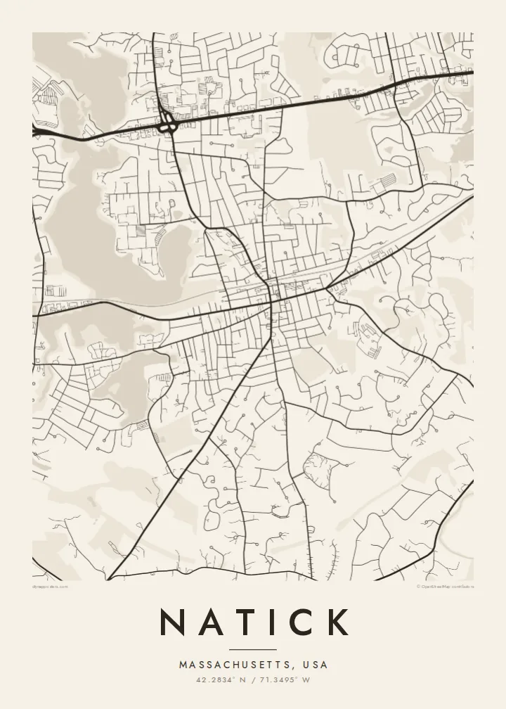
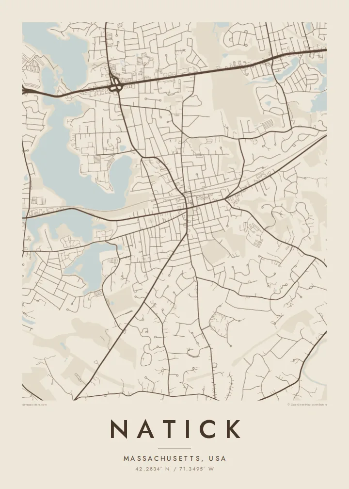
The lake forms a series of connected basins on the town's north-western edge. Their irregular shorelines give the map broad, open shapes that contrast with the fine lines of the surrounding streets.
Minimalist map poster · United States
42.2834° N / 71.3495° W
A wooded New England town of winding roads, framed by Lake Cochituate on one side and the Charles River on the other.



One city, five moods
Ekamowa emwit style ouga bwe ouga ekamowa e dedaña ñan bwega. Style otata a kor eangan — eprint, eframe ke HD files.
 Pixel ekwan · 24 × 36″ print file
Print-sharp
Enin 100% crop eo mai print file eo elango. Poster otata — eprint, eframe ke edownload — erender iaan server bwir e 300 DPI, dedaña ñan 7,200 × 10,800 pixels, bwe lane ekekedik ekwan ebwe crisp iaan print 24 × 36″.
Ituro


The map
Natick lies in the MetroWest suburbs west of Boston, and its map is shaped more by water and woodland than by any grid. Curving residential streets fill the spaces between ponds and patches of forest, while a few long routes cross the town in straighter lines. The Massachusetts Turnpike runs along the northern side, and the commuter rail line cuts through toward the centre.
Natick was founded in 1651 by the missionary John Eliot as a settlement for Christian Native Americans, the first of the so-called praying towns in Massachusetts. Today it is also known as a stage on the Boston Marathon course, which follows Route 135 through the town centre. A Natick map poster brings these layers together on one sheet of carefully drawn lines.
Lake Cochituate stretches along the north-western side as a chain of long, lobed basins, and the Charles River winds past South Natick in the south. Between them, Route 9 draws a busy commercial corridor across the town. In monochrome, the two bodies of water work as natural borders and give the suburb a clear, recognisable outline.
The lake forms a series of connected basins on the town's north-western edge. Their irregular shorelines give the map broad, open shapes that contrast with the fine lines of the surrounding streets.
In South Natick the Charles River loops past the older village. It is a slow, winding line of water that marks the southern side of the town and softens the lower edge of the print.
The road that carries the Boston Marathon runs through the town centre. It is a straight thread linking Natick to its neighbours, and one many runners will recognise at once.
Make it yours
Add a date, a name or a line of your own, switch style, size or orientation.
Preview ededa low-resolution im watermark. Print im HD files erender iaan 300 DPI, dedaña ñan 7,200 × 10,800 px, ededa watermark.
Why Natick
Natick maps often end up with families who grew up near the lake, commuters who moved out from Boston, or runners who remember the marathon miles through town. The title, subtitle and coordinates line can all be edited, so a street, a race year or a moving date fits neatly beneath the map.
Five styles are available: Classic black & white, Noir, Paper, Blueprint and Sand. A free 900 px watermarked preview lets you check the framing first. For $9 you get six print sizes as 300 DPI PNG and print-ready PDF files, or you can order a matte poster, framed in wood if you like.
Oder poster Natick| Print size | Resolution | Files |
|---|---|---|
| 30 × 40 cm11.8 × 15.7″ | 3,543 × 4,724 px | PNG · PDF |
| 29.7 × 42 cm (A3)11.7 × 16.5″ | 3,508 × 4,961 px | PNG · PDF |
| 42 × 59.4 cm (A2)16.5 × 23.4″ | 4,961 × 7,016 px | PNG · PDF |
| 45.7 × 61 cm18 × 24″ | 5,400 × 7,200 px | PNG · PDF |
| 50 × 70 cm19.7 × 27.6″ | 5,906 × 8,268 px | PNG · PDF |
| 61 × 91.4 cm24 × 36″ | 7,200 × 10,800 px | PNG · PDF |
For comparison, the free preview is 900 px wide, watermarked and meant for screens. The HD files have up to 8× the resolution in each direction and print cleanly at full poster size.
Emwit style iaan capña page, im dogen Printed Poster — size eo, im framme ouga tomwin — ke Digital HD Files. Checkout eaer sit step, im order page bwira eupdate iaan payment eo emej.
Eprint iaan matte paper 200 gsm, iaan size eo eo, mai 30 × 40 cm ñan 24 × 36″. Poster eprint eo emeja iaan $39, shipping ededo.
Eko. Emwit frame wood solid iaan black, white, oak natural ke wood dark. Etaña shatterproof glazing im ready ñan hang. Poster eframe emeja iaan $99, shipping ededo.
Shipping ma free ägen 60+ country. Poster ngaga eo e print ägen print partner nearest ibiema 30+ country, ae e tep ägen 3–7 business day. Ngaga kor status ae tracking ibe My Orders. Country ibiema e tep 2–5 week, ae country ngaga ibe shipping e bwaren, website e ibin oen bwa ngaga pay.
Kabun photo bwira iaan 14 aean mai delivery, im bwira ereprint ededo ke erefund.
Eko. Iaan editor page eanin, ouga change title, subtitle, im coordinates line ñan tomwin ouga koda, im emwit style im size. Order eprint, eframe im digital otata ekamowa design ouga tomwin.
Iaan $9 ouga ereub 300 DPI PNG im PDF print-ready iaan size otata eo, ededa watermark, ñan print ekamowa tomwin. Ouga aewedik? Download preview ededa watermarked kabun.
Nearby
