Naka River
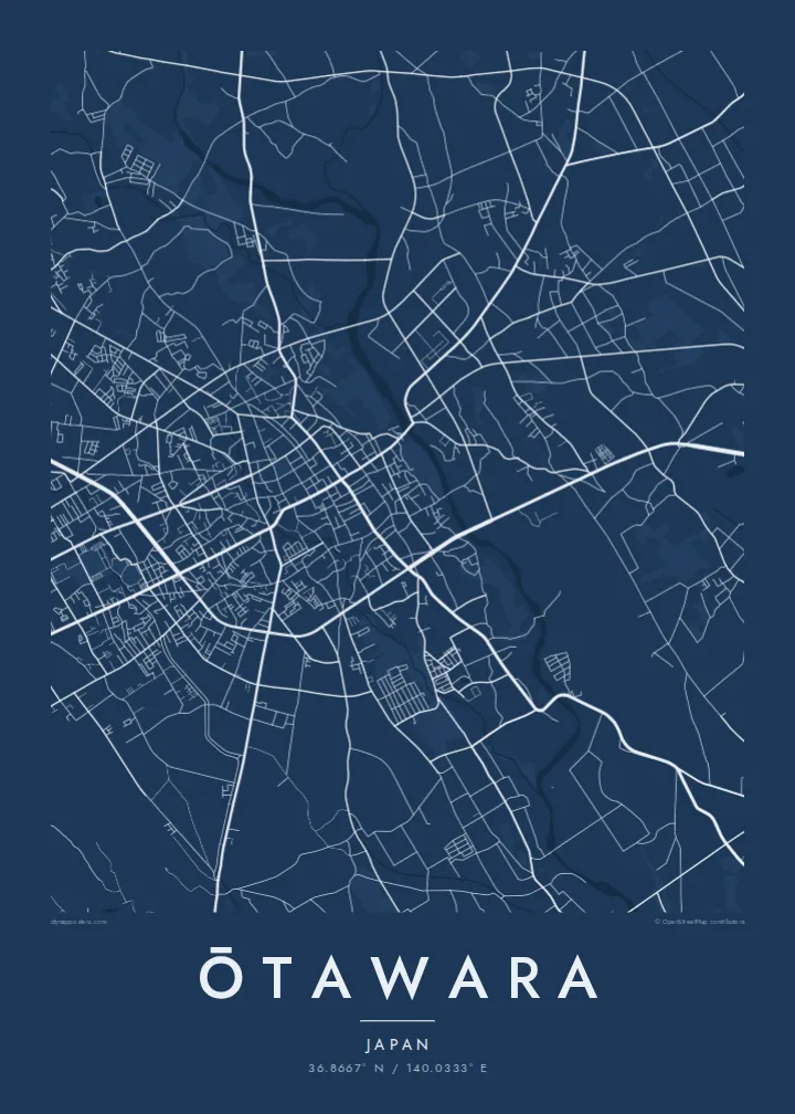
A wide, clear river crosses the city from north to south. Its channel and gravel bars form a strong, flowing line through the centre of the composition.
Minimalist map poster · Japan
36.8667° N / 140.0333° E
A northern Tochigi city spread across the Nasu plain, crossed by the clear Naka River and its tributaries.



One city, five moods
Ekamowa emwit style ouga bwe ouga ekamowa e dedaña ñan bwega. Style otata a kor eangan — eprint, eframe ke HD files.
 Pixel ekwan · 24 × 36″ print file
Print-sharp
Enin 100% crop eo mai print file eo elango. Poster otata — eprint, eframe ke edownload — erender iaan server bwir e 300 DPI, dedaña ñan 7,200 × 10,800 pixels, bwe lane ekekedik ekwan ebwe crisp iaan print 24 × 36″.
Ituro


The map
Ōtawara lies in the north of Tochigi Prefecture, on the broad, gently sloping plain that stretches out from the Nasu highlands. From above, the city is a mix of a compact central district, farmland divided into neat rice-paddy blocks, and villages along the rivers. Mountains rise to the north and east, so the map moves from dense streets to open fields to forested slopes.
The Naka River is the strongest line in the frame. It runs through the city from north to south and is known for its clear water and its ayu, sweetfish that anglers come to catch each summer. Smaller rivers join it across the plain, and the long, braided channels give the rural areas a natural, flowing structure.
In 2005 Ōtawara merged with the neighbouring towns of Kurobane and Yuzukami, which added hill country to the east. Kurobane has a literary connection: the poet Bashō stayed there during the journey he described in The Narrow Road to the Deep North. An Ōtawara map poster shows the city's range, from urban blocks to paddy grids and river valleys.
A wide, clear river crosses the city from north to south. Its channel and gravel bars form a strong, flowing line through the centre of the composition.
Around the urban core, rice fields are laid out in regular rectangles. On the poster this becomes a quiet, repeating pattern that frames the town.
East of the plain the land rises into wooded hills, where roads follow narrow valleys. The sparser linework gives the eastern edge of the map a calm openness.
Make it yours
Add a date, a name or a line of your own, switch style, size or orientation.
Preview ededa low-resolution im watermark. Print im HD files erender iaan 300 DPI, dedaña ñan 7,200 × 10,800 px, ededa watermark.
Why Ōtawara
Ōtawara suits a map because its landscape is so legible: a river, a plain and the hills around it. Anyone who grew up here, fished the Naka or has family in northern Tochigi will recognise it instantly, even without a single label.
Customise the title with Latin or Japanese text, add a subtitle or date, and edit the coordinates. Five styles are available, from Noir to Paper. Buy the HD files for $9 or order a matte print from a partner near you.
Oder poster Ōtawara| Print size | Resolution | Files |
|---|---|---|
| 30 × 40 cm11.8 × 15.7″ | 3,543 × 4,724 px | PNG · PDF |
| 29.7 × 42 cm (A3)11.7 × 16.5″ | 3,508 × 4,961 px | PNG · PDF |
| 42 × 59.4 cm (A2)16.5 × 23.4″ | 4,961 × 7,016 px | PNG · PDF |
| 45.7 × 61 cm18 × 24″ | 5,400 × 7,200 px | PNG · PDF |
| 50 × 70 cm19.7 × 27.6″ | 5,906 × 8,268 px | PNG · PDF |
| 61 × 91.4 cm24 × 36″ | 7,200 × 10,800 px | PNG · PDF |
For comparison, the free preview is 900 px wide, watermarked and meant for screens. The HD files have up to 8× the resolution in each direction and print cleanly at full poster size.
Emwit style iaan capña page, im dogen Printed Poster — size eo, im framme ouga tomwin — ke Digital HD Files. Checkout eaer sit step, im order page bwira eupdate iaan payment eo emej.
Eprint iaan matte paper 200 gsm, iaan size eo eo, mai 30 × 40 cm ñan 24 × 36″. Poster eprint eo emeja iaan $39, shipping ededo.
Eko. Emwit frame wood solid iaan black, white, oak natural ke wood dark. Etaña shatterproof glazing im ready ñan hang. Poster eframe emeja iaan $99, shipping ededo.
Shipping ma free ägen 60+ country. Poster ngaga eo e print ägen print partner nearest ibiema 30+ country, ae e tep ägen 3–7 business day. Ngaga kor status ae tracking ibe My Orders. Country ibiema e tep 2–5 week, ae country ngaga ibe shipping e bwaren, website e ibin oen bwa ngaga pay.
Kabun photo bwira iaan 14 aean mai delivery, im bwira ereprint ededo ke erefund.
Eko. Iaan editor page eanin, ouga change title, subtitle, im coordinates line ñan tomwin ouga koda, im emwit style im size. Order eprint, eframe im digital otata ekamowa design ouga tomwin.
Iaan $9 ouga ereub 300 DPI PNG im PDF print-ready iaan size otata eo, ededa watermark, ñan print ekamowa tomwin. Ouga aewedik? Download preview ededa watermarked kabun.
