Crescent outline
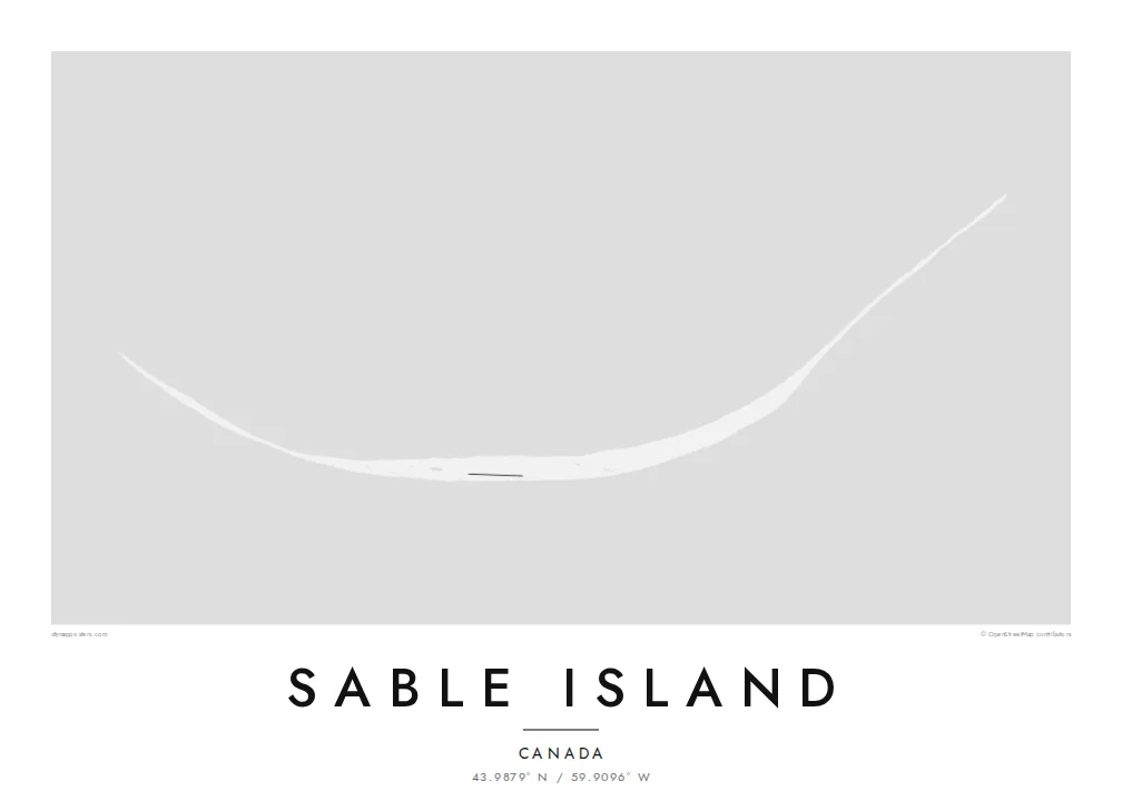
The island curves in a long, shallow arc, so its entire shape can be read at a glance, with generous open water above and below it.
Minimalist map poster · Canada
43.9879° N / 59.9096° W
A slender crescent of sand far out in the North Atlantic, bowed gently and alone on the open sea


One city, five moods
Ekamowa emwit style ouga bwe ouga ekamowa e dedaña ñan bwega. Style otata a kor eangan — eprint, eframe ke HD files.
 Pixel ekwan · 24 × 36″ print file
Print-sharp
Enin 100% crop eo mai print file eo elango. Poster otata — eprint, eframe ke edownload — erender iaan server bwir e 300 DPI, dedaña ñan 7,200 × 10,800 pixels, bwe lane ekekedik ekwan ebwe crisp iaan print 24 × 36″.
Ituro


The map
Sable Island lies in the North Atlantic about 300 kilometres southeast of Halifax, a narrow crescent of dunes and grassland standing alone on the continental shelf. It is long and very thin, curved gently along its length, with a shallow lake in its interior and wide beaches running along both its northern and southern sides.
The island is known for its free-roaming horses, which have lived here for generations without human management, and for the grey seals that breed on its beaches. The shifting sandbars around it caused so many wrecks that it earned the name Graveyard of the Atlantic. Since 2013 it has been protected as Sable Island National Park Reserve.
A Sable Island map poster is almost pure line: one curved sliver of land with very little built on it and nothing around it but water. That simplicity makes it one of the most graphic island maps possible. On a large print, the crescent becomes a single quiet arc across the paper, and the empty sea does the rest.
The island curves in a long, shallow arc, so its entire shape can be read at a glance, with generous open water above and below it.
A shallow lake sits among the dunes near the middle of the island, adding a small, soft shape within the slender strip of land.
Nothing else appears in the frame. The emptiness around Sable makes the island feel even more remote and gives the poster a strong, minimal balance.
Make it yours
Add a date, a name or a line of your own, switch style, size or orientation.
Preview ededa low-resolution im watermark. Print im HD files erender iaan 300 DPI, dedaña ñan 7,200 × 10,800 px, ededa watermark.
Why Sable Island
Sable Island appeals to people who love wild horses, shipwreck history or the Nova Scotia coast, and to anyone who likes a map that looks almost like a drawing. Few people ever visit, which makes it an unusual and thoughtful thing to hang.
Choose Classic black & white, Noir, Paper, Blueprint or Sand, and personalise the title, subtitle and coordinates line, for example with a meaningful date. Files arrive as a 300 DPI PNG and print-ready PDF for $9, or you can order a matte print shipped from a nearby partner.
Oder poster Sable Island| Print size | Resolution | Files |
|---|---|---|
| 30 × 40 cm11.8 × 15.7″ | 3,543 × 4,724 px | PNG · PDF |
| 29.7 × 42 cm (A3)11.7 × 16.5″ | 3,508 × 4,961 px | PNG · PDF |
| 42 × 59.4 cm (A2)16.5 × 23.4″ | 4,961 × 7,016 px | PNG · PDF |
| 45.7 × 61 cm18 × 24″ | 5,400 × 7,200 px | PNG · PDF |
| 50 × 70 cm19.7 × 27.6″ | 5,906 × 8,268 px | PNG · PDF |
| 61 × 91.4 cm24 × 36″ | 7,200 × 10,800 px | PNG · PDF |
For comparison, the free preview is 900 px wide, watermarked and meant for screens. The HD files have up to 8× the resolution in each direction and print cleanly at full poster size.
Emwit style iaan capña page, im dogen Printed Poster — size eo, im framme ouga tomwin — ke Digital HD Files. Checkout eaer sit step, im order page bwira eupdate iaan payment eo emej.
Eprint iaan matte paper 200 gsm, iaan size eo eo, mai 30 × 40 cm ñan 24 × 36″. Poster eprint eo emeja iaan $39, shipping ededo.
Eko. Emwit frame wood solid iaan black, white, oak natural ke wood dark. Etaña shatterproof glazing im ready ñan hang. Poster eframe emeja iaan $99, shipping ededo.
Shipping ma free ägen 60+ country. Poster ngaga eo e print ägen print partner nearest ibiema 30+ country, ae e tep ägen 3–7 business day. Ngaga kor status ae tracking ibe My Orders. Country ibiema e tep 2–5 week, ae country ngaga ibe shipping e bwaren, website e ibin oen bwa ngaga pay.
Kabun photo bwira iaan 14 aean mai delivery, im bwira ereprint ededo ke erefund.
Eko. Iaan editor page eanin, ouga change title, subtitle, im coordinates line ñan tomwin ouga koda, im emwit style im size. Order eprint, eframe im digital otata ekamowa design ouga tomwin.
Iaan $9 ouga ereub 300 DPI PNG im PDF print-ready iaan size otata eo, ededa watermark, ñan print ekamowa tomwin. Ouga aewedik? Download preview ededa watermarked kabun.
