Shimanto River
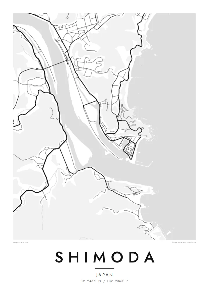
The river's wide, slow bends are the strongest shape on the map, a pale band cutting through the dark mass of the surrounding valley and hills.
Minimalist map poster · Japan
32.9458° N / 132.9863° E
A riverside district on Shikoku's southwest, where the broad Shimanto meanders toward the Pacific between wooded ridges and small rice plains.


One city, five moods
Ekamowa emwit style ouga bwe ouga ekamowa e dedaña ñan bwega. Style otata a kor eangan — eprint, eframe ke HD files.
 Pixel ekwan · 24 × 36″ print file
Print-sharp
Enin 100% crop eo mai print file eo elango. Poster otata — eprint, eframe ke edownload — erender iaan server bwir e 300 DPI, dedaña ñan 7,200 × 10,800 pixels, bwe lane ekekedik ekwan ebwe crisp iaan print 24 × 36″.
Ituro


The map
Shimoda sits in the southwestern corner of Kochi Prefecture on the island of Shikoku, close to where the Shimanto River runs out toward the Pacific. From above, the pattern is simple: a wide ribbon of water, a thin strip of flat land beside it, and steep green ridges pressing in on almost every side, leaving little room for anything like a grid.
The Shimanto is often called the last clear stream in Japan, and it is well known for its low submersible bridges, built without railings so that floods can pass over them. On a map the river dominates everything. The roads follow its banks, the settlements cluster where the valley widens, and the coastline to the south breaks into coves and headlands.
A Shimoda map poster turns this into a composition of curves rather than blocks. The river's sweeping bends carry most of the weight, fine lines of lanes and paths trace the edges of the fields, and the blank hillsides give the drawing a quiet, open feel. It is a map for people who know how this part of Kochi is shaped by water.
The river's wide, slow bends are the strongest shape on the map, a pale band cutting through the dark mass of the surrounding valley and hills.
To the south, the river mouth opens onto the ocean, and the shoreline turns ragged, with small bays and rocky points marking where Shikoku meets open water.
Houses and roads gather on the narrow flat ground beside the river, forming loose clusters instead of a planned street grid and leaving the steep slopes almost empty.
Make it yours
Add a date, a name or a line of your own, switch style, size or orientation.
Preview ededa low-resolution im watermark. Print im HD files erender iaan 300 DPI, dedaña ñan 7,200 × 10,800 px, ededa watermark.
Why Shimoda
Some people hang Shimoda because they grew up along the Shimanto, and others because they once travelled Shikoku's quiet southwest and remember the river more than any single building. The map keeps the shape of that valley in one clean frame.
Add a title, a date or a line of coordinates, then pick one of five styles. Blueprint suits the river, while Paper or Sand soften the hills. The $9 HD download covers six print sizes, each as a 300 DPI PNG and a print-ready PDF.
Oder poster Shimoda| Print size | Resolution | Files |
|---|---|---|
| 30 × 40 cm11.8 × 15.7″ | 3,543 × 4,724 px | PNG · PDF |
| 29.7 × 42 cm (A3)11.7 × 16.5″ | 3,508 × 4,961 px | PNG · PDF |
| 42 × 59.4 cm (A2)16.5 × 23.4″ | 4,961 × 7,016 px | PNG · PDF |
| 45.7 × 61 cm18 × 24″ | 5,400 × 7,200 px | PNG · PDF |
| 50 × 70 cm19.7 × 27.6″ | 5,906 × 8,268 px | PNG · PDF |
| 61 × 91.4 cm24 × 36″ | 7,200 × 10,800 px | PNG · PDF |
For comparison, the free preview is 900 px wide, watermarked and meant for screens. The HD files have up to 8× the resolution in each direction and print cleanly at full poster size.
Emwit style iaan capña page, im dogen Printed Poster — size eo, im framme ouga tomwin — ke Digital HD Files. Checkout eaer sit step, im order page bwira eupdate iaan payment eo emej.
Eprint iaan matte paper 200 gsm, iaan size eo eo, mai 30 × 40 cm ñan 24 × 36″. Poster eprint eo emeja iaan $39, shipping ededo.
Eko. Emwit frame wood solid iaan black, white, oak natural ke wood dark. Etaña shatterproof glazing im ready ñan hang. Poster eframe emeja iaan $99, shipping ededo.
Shipping ma free ägen 60+ country. Poster ngaga eo e print ägen print partner nearest ibiema 30+ country, ae e tep ägen 3–7 business day. Ngaga kor status ae tracking ibe My Orders. Country ibiema e tep 2–5 week, ae country ngaga ibe shipping e bwaren, website e ibin oen bwa ngaga pay.
Kabun photo bwira iaan 14 aean mai delivery, im bwira ereprint ededo ke erefund.
Eko. Iaan editor page eanin, ouga change title, subtitle, im coordinates line ñan tomwin ouga koda, im emwit style im size. Order eprint, eframe im digital otata ekamowa design ouga tomwin.
Iaan $9 ouga ereub 300 DPI PNG im PDF print-ready iaan size otata eo, ededa watermark, ñan print ekamowa tomwin. Ouga aewedik? Download preview ededa watermarked kabun.
