Chongchon estuary
The lower Chongchon spreads wide as it approaches the Yellow Sea, with sandbanks and tidal ground giving the river an irregular, layered outline on the poster.
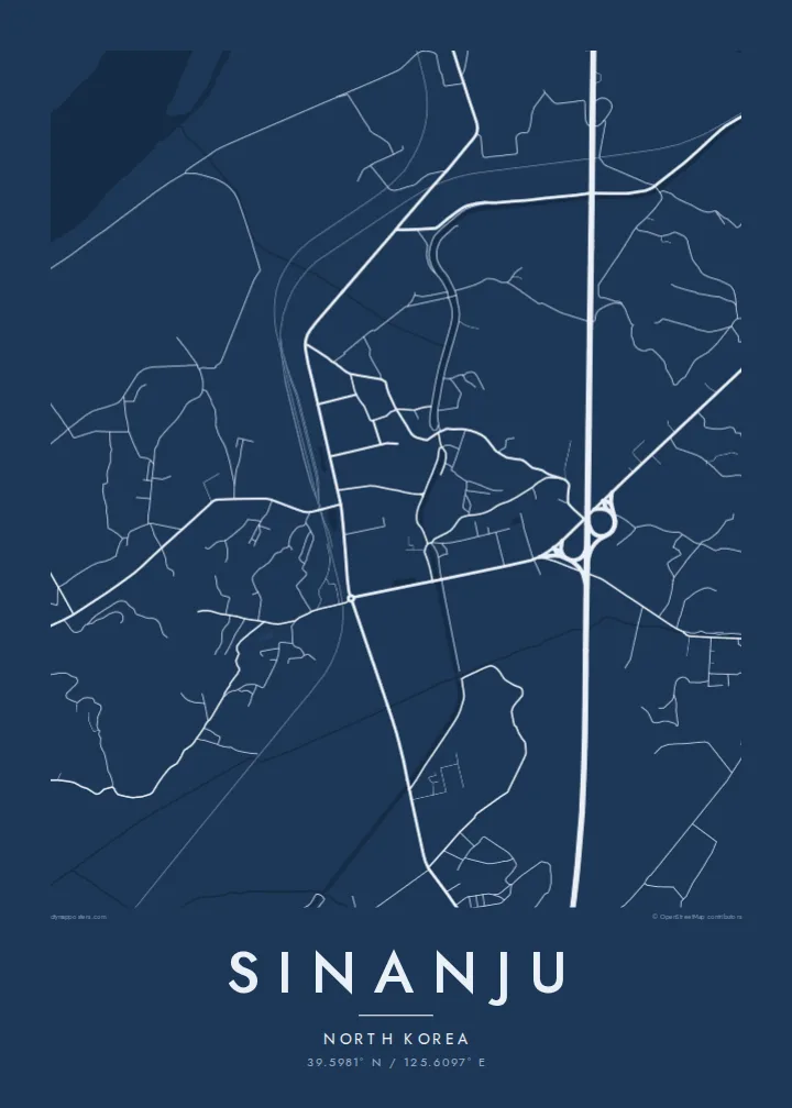
Minimalist map poster · North Korea
39.5981° N / 125.6097° E
A river town on the lower Chongchon, where rail and road bridges cross just before the estuary opens to the Yellow Sea.



One city, five moods
Ekamowa emwit style ouga bwe ouga ekamowa e dedaña ñan bwega. Style otata a kor eangan — eprint, eframe ke HD files.
 Pixel ekwan · 24 × 36″ print file
Print-sharp
Enin 100% crop eo mai print file eo elango. Poster otata — eprint, eframe ke edownload — erender iaan server bwir e 300 DPI, dedaña ñan 7,200 × 10,800 pixels, bwe lane ekekedik ekwan ebwe crisp iaan print 24 × 36″.
Ituro


The map
Sinanju sits on the lower Chongchon River in South Pyongan Province, close to where the river widens into its estuary and meets the Yellow Sea. On the map the river dominates: a broad band of water and tidal flats curving past the town, with low farmland and scattered settlements spreading across the flat ground on either bank.
The town has long been a crossing point. The main railway between Pyongyang and the northwest border runs through here, and its bridges over the Chongchon form some of the strongest straight lines in the whole frame. Roads converge on the same crossing, giving Sinanju a clear role as a knot in the regional transport network.
Because of that position, the lower Chongchon saw heavy fighting during the Korean War. A Sinanju map poster shows the geography behind that history in plain lines: the wide river, the bridges, the grid of fields and embankments, and the coastline beginning to open out toward the sea.
The lower Chongchon spreads wide as it approaches the Yellow Sea, with sandbanks and tidal ground giving the river an irregular, layered outline on the poster.
Rail and road bridges span the river near the town, straight lines cutting across the water that mark Sinanju's long-standing importance as a crossing point.
Flat farmland, embankments and field divisions surround the town, creating a finely ruled background that contrasts with the broad curves of the river.
Make it yours
Add a date, a name or a line of your own, switch style, size or orientation.
Preview ededa low-resolution im watermark. Print im HD files erender iaan 300 DPI, dedaña ñan 7,200 × 10,800 px, ededa watermark.
Why Sinanju
This is a map for people with a family connection to the region, historians of the Korean War, or collectors of rarely mapped places. The strong line of the river and its crossings makes a composition that is both graphic and quietly thought-provoking.
The title, subtitle and coordinates line can be edited, so you can add a family name, a date or a short note. Choose from five styles, Classic black & white, Noir, Paper, Blueprint and Sand, as $9 HD files or a printed poster with an optional wooden frame.
Oder poster Sinanju| Print size | Resolution | Files |
|---|---|---|
| 30 × 40 cm11.8 × 15.7″ | 3,543 × 4,724 px | PNG · PDF |
| 29.7 × 42 cm (A3)11.7 × 16.5″ | 3,508 × 4,961 px | PNG · PDF |
| 42 × 59.4 cm (A2)16.5 × 23.4″ | 4,961 × 7,016 px | PNG · PDF |
| 45.7 × 61 cm18 × 24″ | 5,400 × 7,200 px | PNG · PDF |
| 50 × 70 cm19.7 × 27.6″ | 5,906 × 8,268 px | PNG · PDF |
| 61 × 91.4 cm24 × 36″ | 7,200 × 10,800 px | PNG · PDF |
For comparison, the free preview is 900 px wide, watermarked and meant for screens. The HD files have up to 8× the resolution in each direction and print cleanly at full poster size.
Emwit style iaan capña page, im dogen Printed Poster — size eo, im framme ouga tomwin — ke Digital HD Files. Checkout eaer sit step, im order page bwira eupdate iaan payment eo emej.
Eprint iaan matte paper 200 gsm, iaan size eo eo, mai 30 × 40 cm ñan 24 × 36″. Poster eprint eo emeja iaan $39, shipping ededo.
Eko. Emwit frame wood solid iaan black, white, oak natural ke wood dark. Etaña shatterproof glazing im ready ñan hang. Poster eframe emeja iaan $99, shipping ededo.
Shipping ma free ägen 60+ country. Poster ngaga eo e print ägen print partner nearest ibiema 30+ country, ae e tep ägen 3–7 business day. Ngaga kor status ae tracking ibe My Orders. Country ibiema e tep 2–5 week, ae country ngaga ibe shipping e bwaren, website e ibin oen bwa ngaga pay.
Kabun photo bwira iaan 14 aean mai delivery, im bwira ereprint ededo ke erefund.
Eko. Iaan editor page eanin, ouga change title, subtitle, im coordinates line ñan tomwin ouga koda, im emwit style im size. Order eprint, eframe im digital otata ekamowa design ouga tomwin.
Iaan $9 ouga ereub 300 DPI PNG im PDF print-ready iaan size otata eo, ededa watermark, ñan print ekamowa tomwin. Ouga aewedik? Download preview ededa watermarked kabun.
