Route de l'Espoir
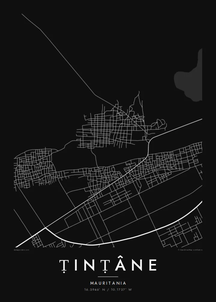
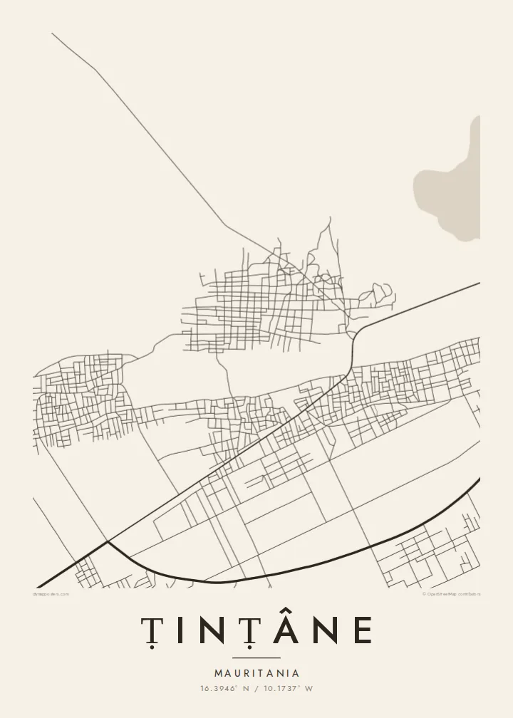
The national highway crosses the town in a long, straight line, the dominant axis on the poster and the main link to Kiffa, Ayoun el Atrouss and the capital.
Minimalist map poster · Mauritania
16.3946° N / 10.1737° W
A Sahel town in southern Mauritania, its sandy streets set out along the long national highway crossing the Hodh.



One city, five moods
Ekamowa emwit style ouga bwe ouga ekamowa e dedaña ñan bwega. Style otata a kor eangan — eprint, eframe ke HD files.
 Pixel ekwan · 24 × 36″ print file
Print-sharp
Enin 100% crop eo mai print file eo elango. Poster otata — eprint, eframe ke edownload — erender iaan server bwir e 300 DPI, dedaña ñan 7,200 × 10,800 pixels, bwe lane ekekedik ekwan ebwe crisp iaan print 24 × 36″.
Ituro


The map
Ṭinṭâne lies in the Hodh El Gharbi region of southern Mauritania, on the Route de l'Espoir, the long highway that links Nouakchott with the east of the country. From above, the town reads as a loose grid of sandy streets and walled compounds spread along and back from the road, set in a wide landscape of dunes, scrub and seasonal watercourses.
The land here is flat to gently undulating, and in the rainy season low ground can hold water for weeks. That relationship with water has shaped the town's recent history: in 2007 heavy rains and flooding destroyed a large part of Ṭinṭâne, which then had to be rebuilt. On a map, the town is best read alongside the low ground and drainage lines around it.
Like other towns along the highway, it is a meeting point for travellers and for herders and farmers from the surrounding area. A Ṭinṭâne map poster reduces its setting to clean lines: the straight road, the gridded compounds, and the soft, open ground of the Sahel stretching away in every direction.
The national highway crosses the town in a long, straight line, the dominant axis on the poster and the main link to Kiffa, Ayoun el Atrouss and the capital.
Streets form a loose, open grid between walled family compounds, a pattern typical of Sahelian towns that looks strikingly graphic in black and white.
Shallow depressions and seasonal watercourses around the town fill after heavy rain, shaping where people build and adding soft, irregular forms to the map.
Make it yours
Add a date, a name or a line of your own, switch style, size or orientation.
Preview ededa low-resolution im watermark. Print im HD files erender iaan 300 DPI, dedaña ñan 7,200 × 10,800 px, ededa watermark.
Why Ṭinṭâne
For Mauritanians from Ṭinṭâne and the Hodh, living in Nouakchott or abroad, this map is a way to keep home in sight. Its spare composition of a road, a grid and open land has a quiet, almost abstract beauty on the wall.
The title, subtitle and coordinates can be personalised with a family name, a date or a short dedication. Choose one of five styles, Classic black & white, Noir, Paper, Blueprint or Sand, as a $9 set of HD files or as a printed matte poster.
Oder poster Ṭinṭâne| Print size | Resolution | Files |
|---|---|---|
| 30 × 40 cm11.8 × 15.7″ | 3,543 × 4,724 px | PNG · PDF |
| 29.7 × 42 cm (A3)11.7 × 16.5″ | 3,508 × 4,961 px | PNG · PDF |
| 42 × 59.4 cm (A2)16.5 × 23.4″ | 4,961 × 7,016 px | PNG · PDF |
| 45.7 × 61 cm18 × 24″ | 5,400 × 7,200 px | PNG · PDF |
| 50 × 70 cm19.7 × 27.6″ | 5,906 × 8,268 px | PNG · PDF |
| 61 × 91.4 cm24 × 36″ | 7,200 × 10,800 px | PNG · PDF |
For comparison, the free preview is 900 px wide, watermarked and meant for screens. The HD files have up to 8× the resolution in each direction and print cleanly at full poster size.
Emwit style iaan capña page, im dogen Printed Poster — size eo, im framme ouga tomwin — ke Digital HD Files. Checkout eaer sit step, im order page bwira eupdate iaan payment eo emej.
Eprint iaan matte paper 200 gsm, iaan size eo eo, mai 30 × 40 cm ñan 24 × 36″. Poster eprint eo emeja iaan $39, shipping ededo.
Eko. Emwit frame wood solid iaan black, white, oak natural ke wood dark. Etaña shatterproof glazing im ready ñan hang. Poster eframe emeja iaan $99, shipping ededo.
Shipping ma free ägen 60+ country. Poster ngaga eo e print ägen print partner nearest ibiema 30+ country, ae e tep ägen 3–7 business day. Ngaga kor status ae tracking ibe My Orders. Country ibiema e tep 2–5 week, ae country ngaga ibe shipping e bwaren, website e ibin oen bwa ngaga pay.
Kabun photo bwira iaan 14 aean mai delivery, im bwira ereprint ededo ke erefund.
Eko. Iaan editor page eanin, ouga change title, subtitle, im coordinates line ñan tomwin ouga koda, im emwit style im size. Order eprint, eframe im digital otata ekamowa design ouga tomwin.
Iaan $9 ouga ereub 300 DPI PNG im PDF print-ready iaan size otata eo, ededa watermark, ñan print ekamowa tomwin. Ouga aewedik? Download preview ededa watermarked kabun.
