Kansas River bend
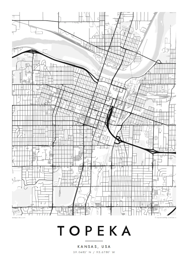
The river forms the northern boundary of the older city. Its wide, slow curves are the only real break in the otherwise regular street pattern, and it frames the downtown blocks on the map.
Minimalist map poster · United States
39.0483° N / 95.6780° W
A prairie capital laid out on a tidy grid, with the Kansas River curving along its northern edge


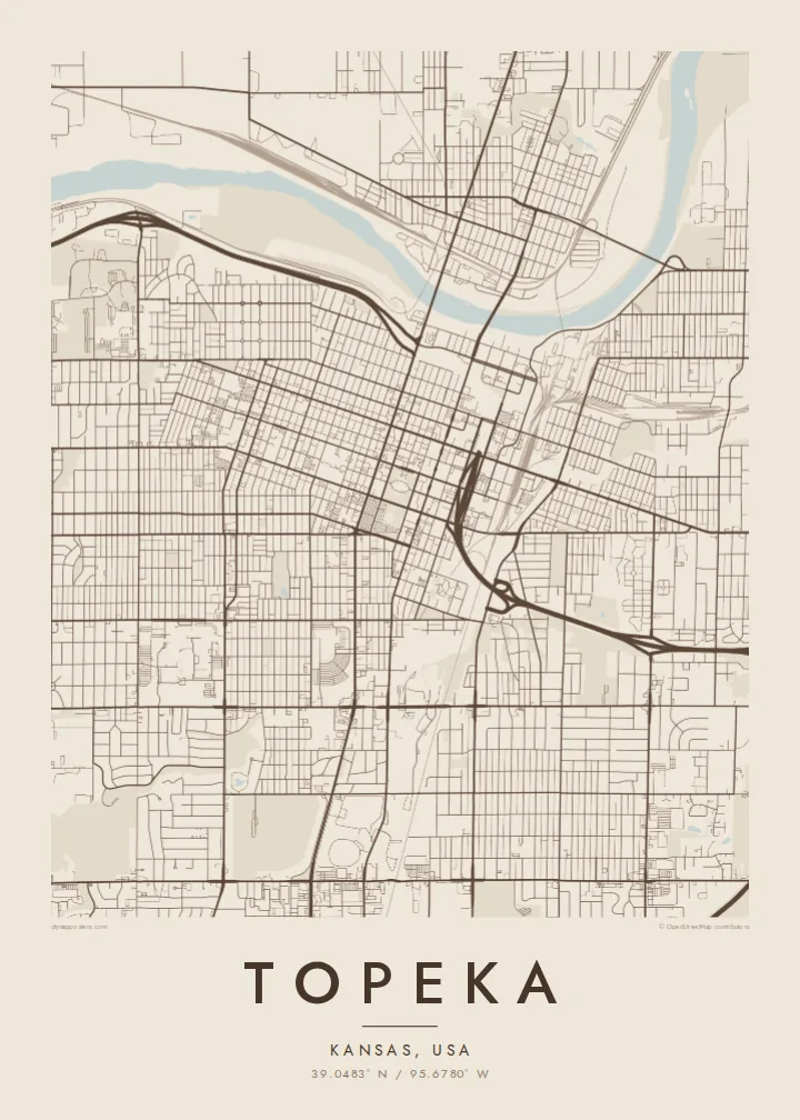
One city, five moods
Ekamowa emwit style ouga bwe ouga ekamowa e dedaña ñan bwega. Style otata a kor eangan — eprint, eframe ke HD files.
 Pixel ekwan · 24 × 36″ print file
Print-sharp
Enin 100% crop eo mai print file eo elango. Poster otata — eprint, eframe ke edownload — erender iaan server bwir e 300 DPI, dedaña ñan 7,200 × 10,800 pixels, bwe lane ekekedik ekwan ebwe crisp iaan print 24 × 36″.
Ituro


The map
Seen from above, Topeka is a city of right angles. Numbered and named streets run in a steady grid south of the Kansas River, which bends lazily along the top of the map. Downtown sits close to the water, and the blocks spread out south and west into quieter residential streets. Interstate 70 cuts across the whole pattern and loops around the centre before heading out across the plains.
Topeka is the capital of Kansas, and the domed State Capitol stands at the heart of the downtown grid. The city is also known for Brown v. Board of Education, the 1954 Supreme Court case that began with local families. The former Monroe Elementary School is now a national historical park, marked on the map as a small block among ordinary streets.
A Topeka map poster shows how a planned Midwestern capital meets its river. The north bank looks looser and more rural, and the south side is denser and more regular. Washburn University's campus makes a clear rectangle to the southwest. To the southeast, Lake Shawnee shows up as an irregular shape of open water, a contrast to the straight lines around it.
The river forms the northern boundary of the older city. Its wide, slow curves are the only real break in the otherwise regular street pattern, and it frames the downtown blocks on the map.
The State Capitol occupies its own green square in the middle of downtown. Streets on all four sides line up with it, so the building works as a quiet anchor for the grid.
In the southeast, a reservoir surrounded by parkland adds a patch of irregular shoreline. It is the largest body of open water inside the city's footprint and is easy to pick out in any style.
Make it yours
Add a date, a name or a line of your own, switch style, size or orientation.
Preview ededa low-resolution im watermark. Print im HD files erender iaan 300 DPI, dedaña ñan 7,200 × 10,800 px, ededa watermark.
Why Topeka
People who grew up in Topeka, studied at Washburn or worked in state government often want the city's plain, orderly grid on the wall. It is an understated print that still shows the river, the Capitol and the neighbourhoods clearly.
You can personalise the title, subtitle and coordinates line, for example with a family name or a year you moved. Choose from five styles: Classic black & white, Noir, Paper, Blueprint and Sand. The HD file costs $9, or you can order a matte print, framed if you like.
Oder poster Topeka| Print size | Resolution | Files |
|---|---|---|
| 30 × 40 cm (11.8 × 15.7″) | 3,543 × 4,724 px | PNG · PDF |
| 29.7 × 42 cm (A3, 11.7 × 16.5″) | 3,508 × 4,961 px | PNG · PDF |
| 42 × 59.4 cm (A2, 16.5 × 23.4″) | 4,961 × 7,016 px | PNG · PDF |
| 45.7 × 61 cm (18 × 24″) | 5,400 × 7,200 px | PNG · PDF |
| 50 × 70 cm (19.7 × 27.6″) | 5,906 × 8,268 px | PNG · PDF |
| 61 × 91.4 cm (24 × 36″) | 7,200 × 10,800 px | PNG · PDF |
For comparison, the free preview is 900 px wide, watermarked and meant for screens. The HD files have up to 8× the resolution in each direction and print cleanly at full poster size.
Emwit style iaan capña page, im dogen Printed Poster — size eo, im framme ouga tomwin — ke Digital HD Files. Checkout eaer sit step, im order page bwira eupdate iaan payment eo emej.
Eprint iaan matte paper 200 gsm, iaan size eo eo, mai 30 × 40 cm ñan 24 × 36″. Poster eprint eo emeja iaan $39, shipping ededo.
Eko. Emwit frame wood solid iaan black, white, oak natural ke wood dark. Etaña shatterproof glazing im ready ñan hang. Poster eframe emeja iaan $99, shipping ededo.
Eaeoen e ngaaba ngeni ouwa age ngaabe. Ngaeo poster e ibiyaneo ibon e print partner eg ibom ngaen ingi ngae 30+ eben, e naeo e yan ngaae e 3–7 aon wan ewa. Kom ngaa e eain ingi tracking ibon My Orders. Tauweo ebe 2–5 wik, ingi ibon ngaen ibun e ngaeo ngaeigie, e saet e sooe nuwe kom e pae.
Kabun photo bwira iaan 14 aean mai delivery, im bwira ereprint ededo ke erefund.
Eko. Iaan editor page eanin, ouga change title, subtitle, im coordinates line ñan tomwin ouga koda, im emwit style im size. Order eprint, eframe im digital otata ekamowa design ouga tomwin.
Iaan $9 ouga ereub 300 DPI PNG im PDF print-ready iaan size otata eo, ededa watermark, ñan print ekamowa tomwin. Ouga aewedik? Download preview ededa watermarked kabun.
