Irrigation grid
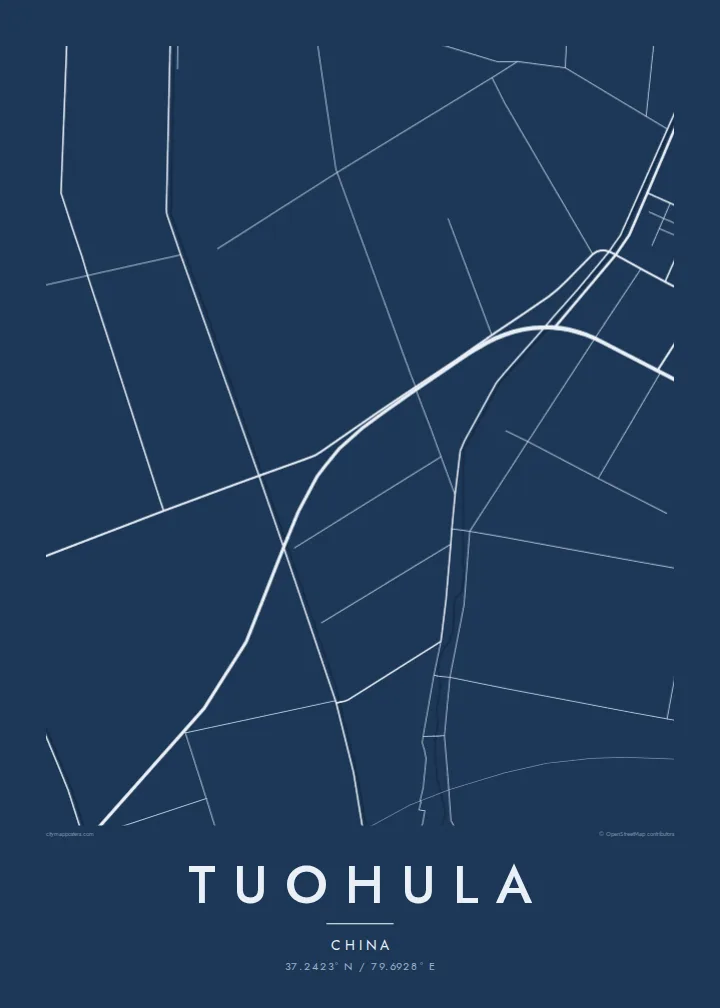
Canals and field roads divide the oasis into long, regular strips, a pattern shaped by water distribution that reads on the poster as a finely ruled geometric surface.
Minimalist map poster · China
37.2423° N / 79.6928° E
An oasis settlement on the southern rim of the Taklamakan, drawn in irrigation channels, tree-lined roads and long field strips.



One city, five moods
Ekamowa emwit style ouga bwe ouga ekamowa e dedaña ñan bwega. Style otata a kor eangan — eprint, eframe ke HD files.
 Pixel ekwan · 24 × 36″ print file
Print-sharp
Enin 100% crop eo mai print file eo elango. Poster otata — eprint, eframe ke edownload — erender iaan server bwir e 300 DPI, dedaña ñan 7,200 × 10,800 pixels, bwe lane ekekedik ekwan ebwe crisp iaan print 24 × 36″.
Ituro


The map
Tuohula lies in the Hotan area of southern Xinjiang, within the band of oases along the northern foot of the Kunlun Mountains, at the edge of the Taklamakan Desert. Life here depends on meltwater rivers coming down from the mountains, and that dependence is written clearly on any map of the place.
Within the oasis, roads, canals and field boundaries form a closely ruled pattern of long rectangles, typically lined with rows of trees that act as windbreaks. Houses string along the roads rather than gathering into one dense centre. Beyond the last irrigated plots the lines stop abruptly, and the map turns to open desert with almost no markings.
A Tuohula map poster is a study in contrast between cultivated order and empty ground. It suits anyone interested in the oases of the Tarim Basin, where settlements have long depended on careful water management. The result is an unusually graphic print in which the edge of the green zone becomes the main subject.
Canals and field roads divide the oasis into long, regular strips, a pattern shaped by water distribution that reads on the poster as a finely ruled geometric surface.
Homes line the roads in continuous ribbons instead of forming a compact town, so the built-up area shows as linear strokes running through the fields.
Where irrigation ends, the map falls almost silent. The sharp boundary between farmed land and the Taklamakan is the most striking line in the composition.
Make it yours
Add a date, a name or a line of your own, switch style, size or orientation.
Preview ededa low-resolution im watermark. Print im HD files erender iaan 300 DPI, dedaña ñan 7,200 × 10,800 px, ededa watermark.
Why Tuohula
For people from the Hotan region, the pattern of fields and channels around their village is deeply familiar. For others, the map is a striking abstract image of a community holding its ground at the edge of one of the world's great deserts.
Personalise the title, subtitle and coordinates, and pick one of five styles. Sand and Paper suit the desert setting. Digital files cost $9 and cover six print sizes, and printed posters on matte paper ship from partners in more than 30 countries.
Oder poster Tuohula| Print size | Resolution | Files |
|---|---|---|
| 30 × 40 cm11.8 × 15.7″ | 3,543 × 4,724 px | PNG · PDF |
| 29.7 × 42 cm (A3)11.7 × 16.5″ | 3,508 × 4,961 px | PNG · PDF |
| 42 × 59.4 cm (A2)16.5 × 23.4″ | 4,961 × 7,016 px | PNG · PDF |
| 45.7 × 61 cm18 × 24″ | 5,400 × 7,200 px | PNG · PDF |
| 50 × 70 cm19.7 × 27.6″ | 5,906 × 8,268 px | PNG · PDF |
| 61 × 91.4 cm24 × 36″ | 7,200 × 10,800 px | PNG · PDF |
For comparison, the free preview is 900 px wide, watermarked and meant for screens. The HD files have up to 8× the resolution in each direction and print cleanly at full poster size.
Emwit style iaan capña page, im dogen Printed Poster — size eo, im framme ouga tomwin — ke Digital HD Files. Checkout eaer sit step, im order page bwira eupdate iaan payment eo emej.
Eprint iaan matte paper 200 gsm, iaan size eo eo, mai 30 × 40 cm ñan 24 × 36″. Poster eprint eo emeja iaan $39, shipping ededo.
Eko. Emwit frame wood solid iaan black, white, oak natural ke wood dark. Etaña shatterproof glazing im ready ñan hang. Poster eframe emeja iaan $99, shipping ededo.
Shipping ma free ägen 60+ country. Poster ngaga eo e print ägen print partner nearest ibiema 30+ country, ae e tep ägen 3–7 business day. Ngaga kor status ae tracking ibe My Orders. Country ibiema e tep 2–5 week, ae country ngaga ibe shipping e bwaren, website e ibin oen bwa ngaga pay.
Kabun photo bwira iaan 14 aean mai delivery, im bwira ereprint ededo ke erefund.
Eko. Iaan editor page eanin, ouga change title, subtitle, im coordinates line ñan tomwin ouga koda, im emwit style im size. Order eprint, eframe im digital otata ekamowa design ouga tomwin.
Iaan $9 ouga ereub 300 DPI PNG im PDF print-ready iaan size otata eo, ededa watermark, ñan print ekamowa tomwin. Ouga aewedik? Download preview ededa watermarked kabun.
