Jaffa Road
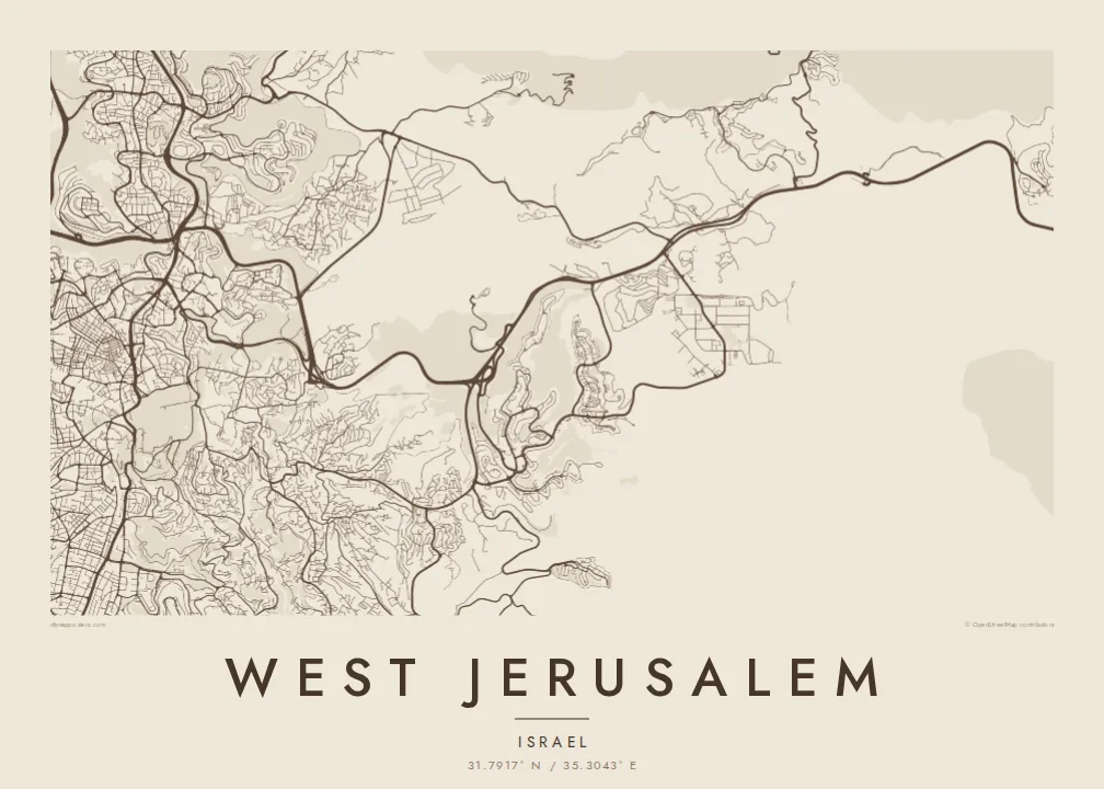
The long historic road is the clearest line on the map. It links the Old City area with the western neighbourhoods and carries the light rail for much of its length.
Minimalist map poster · Israel
31.7917° N / 35.3043° E
Neighbourhoods spread across ridges and valleys west of the Old City, tied together by Jaffa Road and the light rail.


One city, five moods
Ekamowa emwit style ouga bwe ouga ekamowa e dedaña ñan bwega. Style otata a kor eangan — eprint, eframe ke HD files.
 Pixel ekwan · 24 × 36″ print file
Print-sharp
Enin 100% crop eo mai print file eo elango. Poster otata — eprint, eframe ke edownload — erender iaan server bwir e 300 DPI, dedaña ñan 7,200 × 10,800 pixels, bwe lane ekekedik ekwan ebwe crisp iaan print 24 × 36″.
Ituro


The map
West Jerusalem covers the parts of the city that grew up outside the Old City walls to the west, mostly from the late nineteenth century onward. Its layout follows the terrain. Neighbourhoods occupy ridges and slopes, while the valleys remain as parks, roads or open ground. The result on a map is an irregular patchwork rather than a single grid.
Jaffa Road is the main spine, running from near the Old City towards the western entrance of the city, and the light rail follows much of its route. Mahane Yehuda market lies along it, with the small lanes of Nachlaot beside it. Further south, planned garden suburbs such as Rehavia have more regular street patterns, and the Valley of the Cross forms a green gap.
Major institutions stand here too, among them the Knesset and the Israel Museum, set on hilltops above that valley. On the western edge, Ein Karem sits in its own hollow among terraced slopes. A West Jerusalem map poster brings these varied neighbourhoods together and shows how the landscape, more than any plan, shaped this side of the city.
The long historic road is the clearest line on the map. It links the Old City area with the western neighbourhoods and carries the light rail for much of its length.
A broad green valley opens between the neighbourhoods, with the Monastery of the Cross near its floor and major institutions set on the ridges above.
Beside the market, a cluster of small, winding streets forms one of the densest parts of the map, in contrast with the broader roads around it.
Make it yours
Add a date, a name or a line of your own, switch style, size or orientation.
Preview ededa low-resolution im watermark. Print im HD files erender iaan 300 DPI, dedaña ñan 7,200 × 10,800 px, ededa watermark.
Why West Jerusalem
People frame West Jerusalem to remember a neighbourhood they lived in, a year of study or family roots in the city. The hilly terrain gives the streets a flowing, organic quality that works well on a large wall.
Personalise the title, subtitle and coordinates line, perhaps with a neighbourhood name or a date, and choose Classic black & white, Noir, Paper, Blueprint or Sand. The HD files come without a watermark, as 300 DPI PNGs and print-ready PDFs.
Oder poster West Jerusalem| Print size | Resolution | Files |
|---|---|---|
| 30 × 40 cm11.8 × 15.7″ | 3,543 × 4,724 px | PNG · PDF |
| 29.7 × 42 cm (A3)11.7 × 16.5″ | 3,508 × 4,961 px | PNG · PDF |
| 42 × 59.4 cm (A2)16.5 × 23.4″ | 4,961 × 7,016 px | PNG · PDF |
| 45.7 × 61 cm18 × 24″ | 5,400 × 7,200 px | PNG · PDF |
| 50 × 70 cm19.7 × 27.6″ | 5,906 × 8,268 px | PNG · PDF |
| 61 × 91.4 cm24 × 36″ | 7,200 × 10,800 px | PNG · PDF |
For comparison, the free preview is 900 px wide, watermarked and meant for screens. The HD files have up to 8× the resolution in each direction and print cleanly at full poster size.
Emwit style iaan capña page, im dogen Printed Poster — size eo, im framme ouga tomwin — ke Digital HD Files. Checkout eaer sit step, im order page bwira eupdate iaan payment eo emej.
Eprint iaan matte paper 200 gsm, iaan size eo eo, mai 30 × 40 cm ñan 24 × 36″. Poster eprint eo emeja iaan $39, shipping ededo.
Eko. Emwit frame wood solid iaan black, white, oak natural ke wood dark. Etaña shatterproof glazing im ready ñan hang. Poster eframe emeja iaan $99, shipping ededo.
Shipping ma free ägen 60+ country. Poster ngaga eo e print ägen print partner nearest ibiema 30+ country, ae e tep ägen 3–7 business day. Ngaga kor status ae tracking ibe My Orders. Country ibiema e tep 2–5 week, ae country ngaga ibe shipping e bwaren, website e ibin oen bwa ngaga pay.
Kabun photo bwira iaan 14 aean mai delivery, im bwira ereprint ededo ke erefund.
Eko. Iaan editor page eanin, ouga change title, subtitle, im coordinates line ñan tomwin ouga koda, im emwit style im size. Order eprint, eframe im digital otata ekamowa design ouga tomwin.
Iaan $9 ouga ereub 300 DPI PNG im PDF print-ready iaan size otata eo, ededa watermark, ñan print ekamowa tomwin. Ouga aewedik? Download preview ededa watermarked kabun.
