Hill of Difficulty
The steep track from the landing up to the village is the island's essential route, drawn on the map as a short, sharply climbing line from the shore.
Fakatino mape mukamuka · Pitcairn Islands
25.0660° S / 130.1015° W
The only settlement on Pitcairn, a scatter of homes and dirt tracks on green slopes high above Bounty Bay.




Taha e taone, lima e onoonoaga
Tapaki e taha puhala ke kitia ai ki luga he puipui. Kua tatai e totogi he tau puhala oti — pete he lolomi, poloka, po ke faila HD.
 Tau pikselo mooli · faila lolomi 24 × 36″
Maama mitaki ke lolomi
Ko e 100% e fahi mooli mai he faila lolomi. Ko e tau poster oti — pete kua lolomi, poloka, po ke utu hifo — kua taute ke he ha mautolu a tau tokoluga (server) ke he 300 DPI, hokotia ke he 7,200 × 10,800 piksela, ke maeke ai e tau ala ikiiki tote ke maaliali fakamitaki he lolomi 24 × 36″.
He Pā


Ko e mape
Adamstown is the capital and only village of the Pitcairn Islands, a British Overseas Territory in the South Pacific and one of the least populated jurisdictions in the world. The island was settled in 1790 by mutineers from HMS Bounty and the Tahitians who travelled with them, and many of today's islanders are their descendants. The village is named after John Adams, the last surviving mutineer.
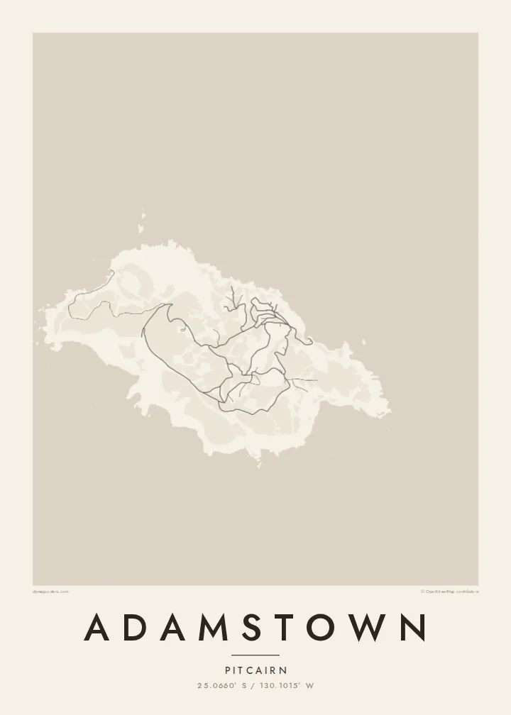
On a map, Adamstown is not a grid but a loose arrangement of houses and public buildings along a network of unpaved tracks on the island's northern slopes. A steep road known as the Hill of Difficulty climbs from the landing at Bounty Bay to the village, and a few further tracks wander out across the rest of the island's small, rugged surface.
Pitcairn is volcanic and only a few square kilometres in area, with cliffs on almost every side and no harbour for large ships. An Adamstown map poster reflects that intimacy of scale: a handful of lines on a hillside and the long, rocky coast of an island where every track eventually leads back to the sea.
The steep track from the landing up to the village is the island's essential route, drawn on the map as a short, sharply climbing line from the shore.
A small cove on the northeast coast serves as the island's landing place, a modest indentation in a coastline otherwise defined by cliffs and rock.
Unpaved roads and paths spread loosely across the slopes around Adamstown, linking homes, public buildings and outlying plots in an informal, organic web.
Taute ke ha hau
Lafi e aho, taha higoa po ke taha kupu haau, hiki e fakatino, lahi po ke tuaga.
Ko e kitiaaga nakai totogi kua tote e maaliali mo e fakamailoga vai. Ko e tau lolomi mo e tau faila HD kua taute ke he 300 DPI, hokotia ke he 7,200 × 10,800 px, nakai fai fakamailoga vai.
Ko e ha Adamstown
Adamstown is a map for people fascinated by the Bounty story, for descendants of the island families, and for those who collect the world's most remote places. Its few, almost hand-drawn lines and generous coastline make a thoughtful piece for a study or library wall.
Add a title, a subtitle or a date of your choosing, and a coordinates line, then choose Classic black & white, Noir, Paper, Blueprint or Sand. The Paper style gives it the feel of an old chart. Download for $9, or order a matte print with an optional wooden frame.
Talaage e poster Adamstown| Lahi he lolomi | Maama | Tau faila |
|---|---|---|
| 30 × 40 cm11.8 × 15.7″ | 3,543 × 4,724 px | PNG · PDF |
| 29.7 × 42 cm (A3)11.7 × 16.5″ | 3,508 × 4,961 px | PNG · PDF |
| 42 × 59.4 cm (A2)16.5 × 23.4″ | 4,961 × 7,016 px | PNG · PDF |
| 45.7 × 61 cm18 × 24″ | 5,400 × 7,200 px | PNG · PDF |
| 50 × 70 cm19.7 × 27.6″ | 5,906 × 8,268 px | PNG · PDF |
| 61 × 91.4 cm24 × 36″ | 7,200 × 10,800 px | PNG · PDF |
Ke fakatatai, ko e fakatino noa kua 900 px e laulahi, fai fakamailoga mo e mo e tau mata komipiuta ni. Ko e tau faila HD kua ato hoko ke he 8× e maama ke he tau faahi takitaha mo e lolomi mitaki he lahi katoa he fakatino.
Fifili e taha puhala i luga he kupega, ti fifili e Poster Lolomi — e lahi mo e, kaeke ke manako ai koe, taha poloka — po ke Tau Faila HD Fakaeletonika. Ko e fakaotiaga totogi ko e taha gahua ni, ti ko e kupega he hau a talaaga ka fakafou fakahaga i mua he fakaotiaga e totogi.
Kua lolomi ai ke he pepa mitaki 200 gsm matte he taha he tau lahi ono, mai he 30 × 40 cm ke hoko ke he 24 × 36″. Kamata e tau poster lolomi mai he $39, kua putoia ai e utaaga.
E. Fifili e poloka akau malolō ke he lanu uli, tea, akau oki mooli, po ke akau pouli. Kua fakalataha mo e sioga malolō nakai malepe ti kua mautali ke tautau. Kamata e tau poster poloka mai he $99, kua putoia ai e utaaga.
Nakai totogi e fakafano ke he motu 60+. Ko e fakatino taha kua lolomi he fenoga lolomi ha mautolu kua tata mo e tau motu 30+, kua hoko mai he tau aho gahua 3–7. Maeke ia koe ke kikite e tuaga mo e fakamuitua he lalo he Haku Tau Fakatonu. Ke he falu motu kua 2–5 e tau tapu, ti ka nakai fakafano a mautolu ki ai, to fakaha he api tupe ia ki mua he totogi.
Fakafano mai e taha ata ki a mautolu he loto he 14 e tau aho tali mai he hokoaga, ti to lolomi foki e mautolu nakai totogi po ke liu atu e totogi ki a koe.
E. He editor i luga he kupega nei, hikihiki e matakupu, e matakupu lalo mo e laini coordinates ke he taha mena kua manako a koe ki ai, ti fifili e puhala mo e lahi. Ko e tau talaaga lolomi, poloka mo e fakaeletonika oti kua fakaaoga tonu e hau a fakatino.
Ma e $9 ka moua e koe e tau faila PNG 300 DPI mo e PDF kua mautali ke lolomi he tau lahi ono oti, nakai fai fakamailoga vai, ke lolomi i fe mena. Nakai maopoopo agaia? Utu hifo fakamua e kitiaaga nakai totogi ne fai fakamailoga vai.
Tata mai
