Haulover Creek
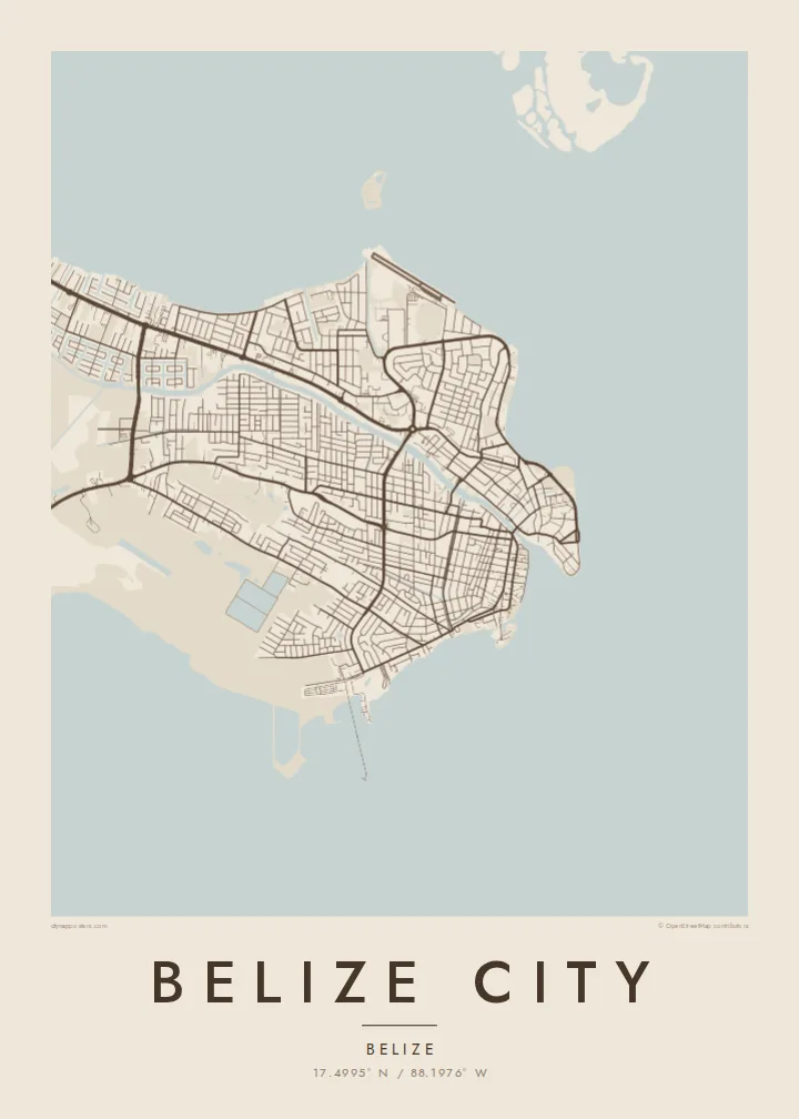
The creek winds through the centre and empties into the sea. It splits the city into its two historic halves and gives the map a clear central axis.
Fakatino mape mukamuka · Belize
17.4995° N / 88.1976° W
A low, sea-level city on the Caribbean, split by Haulover Creek and edged by mangrove and open water.


Taha e taone, lima e onoonoaga
Tapaki e taha puhala ke kitia ai ki luga he puipui. Kua tatai e totogi he tau puhala oti — pete he lolomi, poloka, po ke faila HD.
 Tau pikselo mooli · faila lolomi 24 × 36″
Maama mitaki ke lolomi
Ko e 100% e fahi mooli mai he faila lolomi. Ko e tau poster oti — pete kua lolomi, poloka, po ke utu hifo — kua taute ke he ha mautolu a tau tokoluga (server) ke he 300 DPI, hokotia ke he 7,200 × 10,800 piksela, ke maeke ai e tau ala ikiiki tote ke maaliali fakamitaki he lolomi 24 × 36″.
He Pā


Ko e mape
Belize City sits on a flat, low-lying stretch of the Caribbean coast, at the mouth of Haulover Creek, a branch of the Belize River. It is the country's largest city. It was the capital until 1970, when the government moved inland to Belmopan after Hurricane Hattie devastated the coast in 1961. On a map, the creek divides the city into a Northside and a Southside.
The oldest streets cluster near the mouth of the creek, where a narrow grid of lanes runs along the waterfront. Canals once drained much of the low ground, and some still cut through the neighbourhoods. Newer districts spread west and north toward mangrove and marsh. The coastline curves around the city in a smooth line, and open sea fills a large part of the composition.
The Swing Bridge over Haulover Creek, opened in the 1920s and turned by hand, is one of the city's best-known sights. Offshore lies the Belize Barrier Reef, outside the frame of a city map but part of how people think of the place. A Belize City map poster gives equal weight to the water, the creek and the tight old streets.
The creek winds through the centre and empties into the sea. It splits the city into its two historic halves and gives the map a clear central axis.
At the mouth of the creek, the hand-operated bridge links Northside and Southside. On the print it is a short span that marks the traditional heart of the city.
The sea wraps the eastern side of the city in a long, smooth edge. In darker styles such as Noir, the open water becomes a striking block of space.
Taute ke ha hau
Lafi e aho, taha higoa po ke taha kupu haau, hiki e fakatino, lahi po ke tuaga.
Ko e kitiaaga nakai totogi kua tote e maaliali mo e fakamailoga vai. Ko e tau lolomi mo e tau faila HD kua taute ke he 300 DPI, hokotia ke he 7,200 × 10,800 px, nakai fai fakamailoga vai.
Ko e ha Belize City
Belize City is where many journeys to the country begin, and many Belizeans abroad still call it home. A map of its creek, bridge and waterfront suits anyone who grew up on the Southside or passed through on the way to the cayes.
Add a title and subtitle, such as a neighbourhood, a wedding date or a year of travel, and change the coordinates line. Choose Classic black & white, Noir, Paper, Blueprint or Sand, as HD digital files or a printed poster shipped from a nearby partner.
Talaage e poster Belize City| Lahi he lolomi | Maama | Tau faila |
|---|---|---|
| 30 × 40 cm11.8 × 15.7″ | 3,543 × 4,724 px | PNG · PDF |
| 29.7 × 42 cm (A3)11.7 × 16.5″ | 3,508 × 4,961 px | PNG · PDF |
| 42 × 59.4 cm (A2)16.5 × 23.4″ | 4,961 × 7,016 px | PNG · PDF |
| 45.7 × 61 cm18 × 24″ | 5,400 × 7,200 px | PNG · PDF |
| 50 × 70 cm19.7 × 27.6″ | 5,906 × 8,268 px | PNG · PDF |
| 61 × 91.4 cm24 × 36″ | 7,200 × 10,800 px | PNG · PDF |
Ke fakatatai, ko e fakatino noa kua 900 px e laulahi, fai fakamailoga mo e mo e tau mata komipiuta ni. Ko e tau faila HD kua ato hoko ke he 8× e maama ke he tau faahi takitaha mo e lolomi mitaki he lahi katoa he fakatino.
Fifili e taha puhala i luga he kupega, ti fifili e Poster Lolomi — e lahi mo e, kaeke ke manako ai koe, taha poloka — po ke Tau Faila HD Fakaeletonika. Ko e fakaotiaga totogi ko e taha gahua ni, ti ko e kupega he hau a talaaga ka fakafou fakahaga i mua he fakaotiaga e totogi.
Kua lolomi ai ke he pepa mitaki 200 gsm matte he taha he tau lahi ono, mai he 30 × 40 cm ke hoko ke he 24 × 36″. Kamata e tau poster lolomi mai he $39, kua putoia ai e utaaga.
E. Fifili e poloka akau malolō ke he lanu uli, tea, akau oki mooli, po ke akau pouli. Kua fakalataha mo e sioga malolō nakai malepe ti kua mautali ke tautau. Kamata e tau poster poloka mai he $99, kua putoia ai e utaaga.
Nakai totogi e fakafano ke he motu 60+. Ko e fakatino taha kua lolomi he fenoga lolomi ha mautolu kua tata mo e tau motu 30+, kua hoko mai he tau aho gahua 3–7. Maeke ia koe ke kikite e tuaga mo e fakamuitua he lalo he Haku Tau Fakatonu. Ke he falu motu kua 2–5 e tau tapu, ti ka nakai fakafano a mautolu ki ai, to fakaha he api tupe ia ki mua he totogi.
Fakafano mai e taha ata ki a mautolu he loto he 14 e tau aho tali mai he hokoaga, ti to lolomi foki e mautolu nakai totogi po ke liu atu e totogi ki a koe.
E. He editor i luga he kupega nei, hikihiki e matakupu, e matakupu lalo mo e laini coordinates ke he taha mena kua manako a koe ki ai, ti fifili e puhala mo e lahi. Ko e tau talaaga lolomi, poloka mo e fakaeletonika oti kua fakaaoga tonu e hau a fakatino.
Ma e $9 ka moua e koe e tau faila PNG 300 DPI mo e PDF kua mautali ke lolomi he tau lahi ono oti, nakai fai fakamailoga vai, ke lolomi i fe mena. Nakai maopoopo agaia? Utu hifo fakamua e kitiaaga nakai totogi ne fai fakamailoga vai.
