The Düzce plain
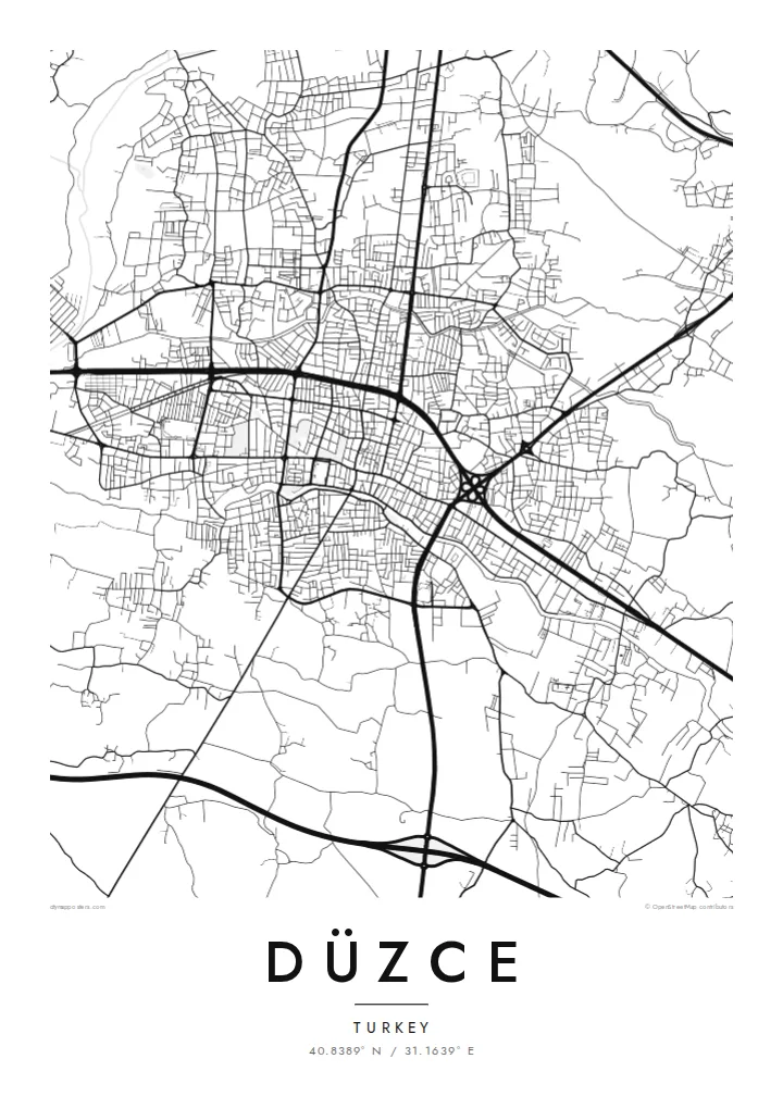
A wide, nearly flat basin of farmland and orchards surrounds the city. On the map it appears as a calm field of small parcels and rural lanes, framing the urban centre from every side.
Fakatino mape mukamuka · Türkiye
40.8389° N / 31.1639° E
A compact city on a broad, flat plain ringed by forested mountains, crossed by the main highway between Istanbul and Ankara.


Taha e taone, lima e onoonoaga
Tapaki e taha puhala ke kitia ai ki luga he puipui. Kua tatai e totogi he tau puhala oti — pete he lolomi, poloka, po ke faila HD.
 Tau pikselo mooli · faila lolomi 24 × 36″
Maama mitaki ke lolomi
Ko e 100% e fahi mooli mai he faila lolomi. Ko e tau poster oti — pete kua lolomi, poloka, po ke utu hifo — kua taute ke he ha mautolu a tau tokoluga (server) ke he 300 DPI, hokotia ke he 7,200 × 10,800 piksela, ke maeke ai e tau ala ikiiki tote ke maaliali fakamitaki he lolomi 24 × 36″.
He Pā


Ko e mape
Düzce occupies the centre of a wide, level basin in north-western Turkey, a short distance inland from the Black Sea coast. From above, the city is a dense cluster of streets surrounded by an even patchwork of fields and hazelnut orchards, with wooded ridges closing in on every side. The flatness of the plain gives the map an unusual clarity, with roads radiating outward in long straight lines.
The city is inseparable from the earthquake of November 1999, which caused heavy damage and led to much of Düzce being rebuilt; the same year it became the capital of a new province. Today the O-4 motorway and the older D-100 highway run across the plain, carrying traffic between Istanbul and Ankara, and the university campus sits at the edge of town.
A Düzce map poster shows how a rebuilt city settled back into its landscape: newer blocks and wide avenues around an older core, the motorway sweeping along the plain, and streams draining the basin. In black and white, the contrast between the tight urban centre and the surrounding open land is particularly striking.
A wide, nearly flat basin of farmland and orchards surrounds the city. On the map it appears as a calm field of small parcels and rural lanes, framing the urban centre from every side.
The O-4 motorway and the D-100 highway cross the plain, drawn as long, confident lines. They are the reason Düzce has long been a stopping point between Turkey's two largest cities.
South-west of the city lies Efteni Lake, a shallow wetland known for its birdlife. It shows up on the map as an irregular pale shape set within the agricultural plain.
Taute ke ha hau
Lafi e aho, taha higoa po ke taha kupu haau, hiki e fakatino, lahi po ke tuaga.
Ko e kitiaaga nakai totogi kua tote e maaliali mo e fakamailoga vai. Ko e tau lolomi mo e tau faila HD kua taute ke he 300 DPI, hokotia ke he 7,200 × 10,800 px, nakai fai fakamailoga vai.
Ko e ha Düzce
Düzce carries a story of loss and recovery, and many residents mark their connection to it through the rebuilt city itself. A map is a quiet way to honour that, whether it hangs in a family home in the province or in a flat far from the Black Sea region.
Each poster can be personalised with a title, subtitle and coordinates line, perhaps a neighbourhood name or a meaningful date. Five styles are available: Classic black & white, Noir, Paper, Blueprint and Sand, each giving the plain and the surrounding hills a different mood.
Talaage e poster Düzce| Lahi he lolomi | Maama | Tau faila |
|---|---|---|
| 30 × 40 cm11.8 × 15.7″ | 3,543 × 4,724 px | PNG · PDF |
| 29.7 × 42 cm (A3)11.7 × 16.5″ | 3,508 × 4,961 px | PNG · PDF |
| 42 × 59.4 cm (A2)16.5 × 23.4″ | 4,961 × 7,016 px | PNG · PDF |
| 45.7 × 61 cm18 × 24″ | 5,400 × 7,200 px | PNG · PDF |
| 50 × 70 cm19.7 × 27.6″ | 5,906 × 8,268 px | PNG · PDF |
| 61 × 91.4 cm24 × 36″ | 7,200 × 10,800 px | PNG · PDF |
Ke fakatatai, ko e fakatino noa kua 900 px e laulahi, fai fakamailoga mo e mo e tau mata komipiuta ni. Ko e tau faila HD kua ato hoko ke he 8× e maama ke he tau faahi takitaha mo e lolomi mitaki he lahi katoa he fakatino.
Fifili e taha puhala i luga he kupega, ti fifili e Poster Lolomi — e lahi mo e, kaeke ke manako ai koe, taha poloka — po ke Tau Faila HD Fakaeletonika. Ko e fakaotiaga totogi ko e taha gahua ni, ti ko e kupega he hau a talaaga ka fakafou fakahaga i mua he fakaotiaga e totogi.
Kua lolomi ai ke he pepa mitaki 200 gsm matte he taha he tau lahi ono, mai he 30 × 40 cm ke hoko ke he 24 × 36″. Kamata e tau poster lolomi mai he $39, kua putoia ai e utaaga.
E. Fifili e poloka akau malolō ke he lanu uli, tea, akau oki mooli, po ke akau pouli. Kua fakalataha mo e sioga malolō nakai malepe ti kua mautali ke tautau. Kamata e tau poster poloka mai he $99, kua putoia ai e utaaga.
Nakai totogi e fakafano ke he motu 60+. Ko e fakatino taha kua lolomi he fenoga lolomi ha mautolu kua tata mo e tau motu 30+, kua hoko mai he tau aho gahua 3–7. Maeke ia koe ke kikite e tuaga mo e fakamuitua he lalo he Haku Tau Fakatonu. Ke he falu motu kua 2–5 e tau tapu, ti ka nakai fakafano a mautolu ki ai, to fakaha he api tupe ia ki mua he totogi.
Fakafano mai e taha ata ki a mautolu he loto he 14 e tau aho tali mai he hokoaga, ti to lolomi foki e mautolu nakai totogi po ke liu atu e totogi ki a koe.
E. He editor i luga he kupega nei, hikihiki e matakupu, e matakupu lalo mo e laini coordinates ke he taha mena kua manako a koe ki ai, ti fifili e puhala mo e lahi. Ko e tau talaaga lolomi, poloka mo e fakaeletonika oti kua fakaaoga tonu e hau a fakatino.
Ma e $9 ka moua e koe e tau faila PNG 300 DPI mo e PDF kua mautali ke lolomi he tau lahi ono oti, nakai fai fakamailoga vai, ke lolomi i fe mena. Nakai maopoopo agaia? Utu hifo fakamua e kitiaaga nakai totogi ne fai fakamailoga vai.
Tata mai
