Medan Merdeka
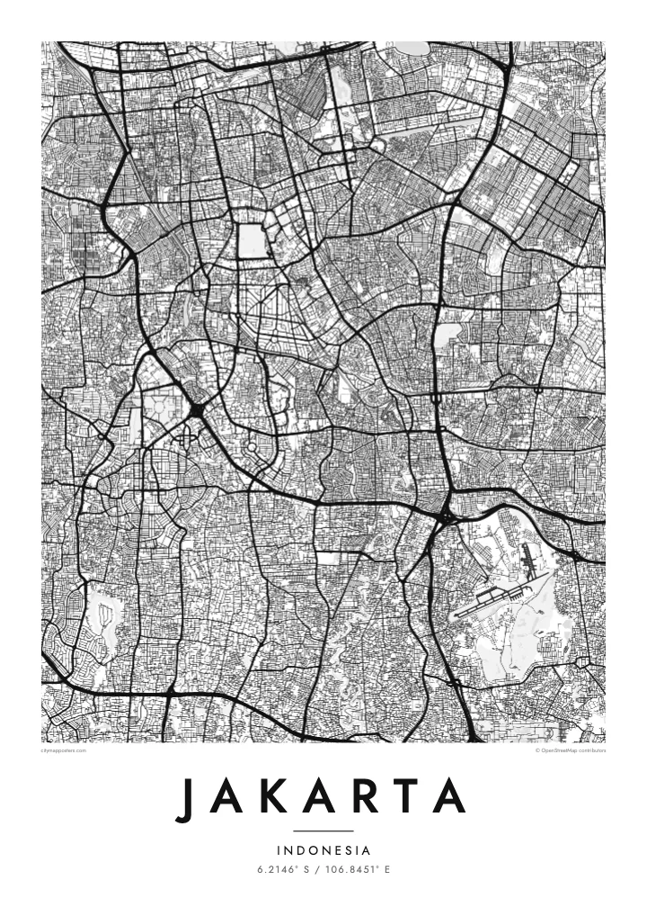
One of the largest city squares in the world, a near-square open field with the National Monument at its centre. On the map it forms a strong, blank anchor in the middle of the city.
Fakatino mape mukamuka · Indonesia
6.2146° S / 106.8451° E
A flat coastal capital on Java's north shore, crossed by rivers and flood canals, with the old Batavia harbour at its edge.


Taha e taone, lima e onoonoaga
Tapaki e taha puhala ke kitia ai ki luga he puipui. Kua tatai e totogi he tau puhala oti — pete he lolomi, poloka, po ke faila HD.
 Tau pikselo mooli · faila lolomi 24 × 36″
Maama mitaki ke lolomi
Ko e 100% e fahi mooli mai he faila lolomi. Ko e tau poster oti — pete kua lolomi, poloka, po ke utu hifo — kua taute ke he ha mautolu a tau tokoluga (server) ke he 300 DPI, hokotia ke he 7,200 × 10,800 piksela, ke maeke ai e tau ala ikiiki tote ke maaliali fakamitaki he lolomi 24 × 36″.
He Pā


Ko e mape
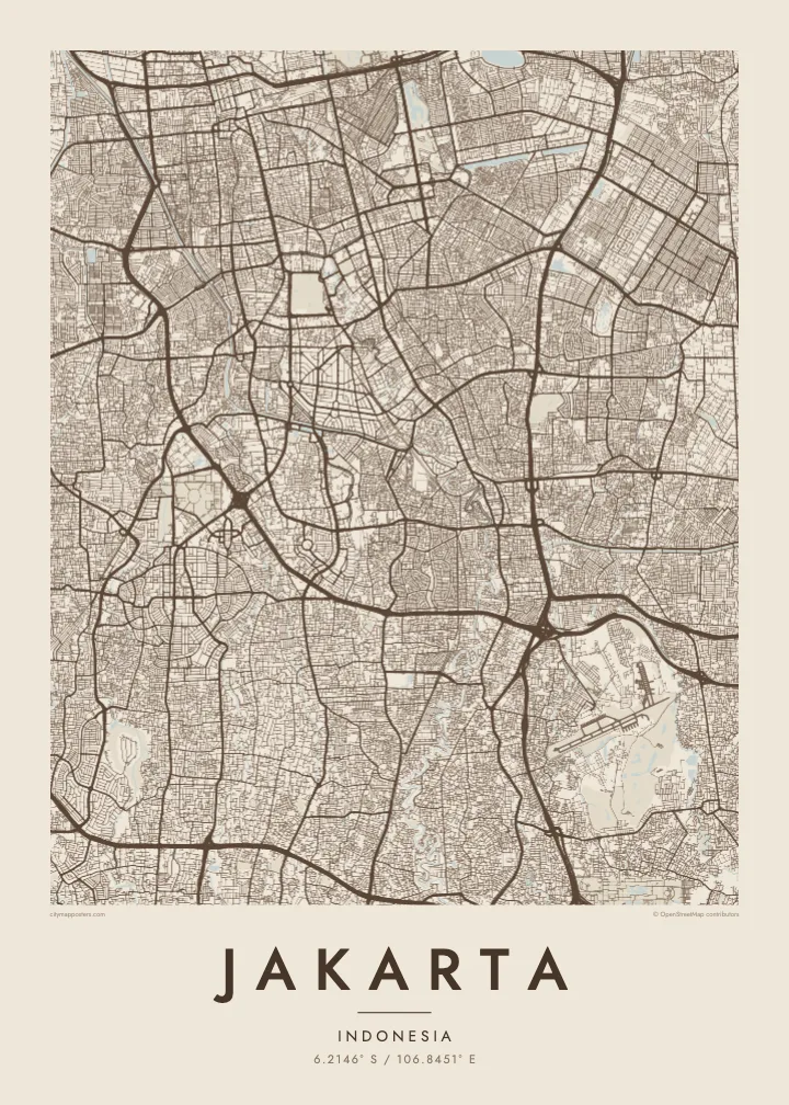
Jakarta spreads across a low, flat plain on the northern coast of Java, facing Jakarta Bay. Because the land is so level, water shapes much of the map. The Ciliwung and several other rivers flow north through the city to the sea, and two large flood canals, the West and East Banjir Kanal, cut across it to carry water past the centre.
The oldest part of the city is Kota Tua in the north, once the Dutch colonial settlement of Batavia. Its canals and warehouses sit beside Sunda Kelapa, the old harbour where wooden schooners still load cargo. To the south, the planned centre spreads around Medan Merdeka, a vast square with the National Monument at its middle, surrounded by ministries and wide avenues.
Beyond the centre, Jakarta becomes an enormous metropolitan region of toll roads and suburban grids. Parts of the north coast are subsiding, one reason the government decided to develop a new capital, Nusantara, in East Kalimantan. A Jakarta map poster records the city as it is now, from the bay and old port to the long avenues of Thamrin and Sudirman.
One of the largest city squares in the world, a near-square open field with the National Monument at its centre. On the map it forms a strong, blank anchor in the middle of the city.
Two long flood canals that bend around the core, the western one dating from the Dutch period and the eastern completed much later. Their clean curves stand apart from the winding natural rivers.
The old port at the mouth of the Ciliwung, with narrow basins and quays beside Kota Tua. It marks the point where the city began, on the shore of Jakarta Bay.
Taute ke ha hau
Lafi e aho, taha higoa po ke taha kupu haau, hiki e fakatino, lahi po ke tuaga.
Ko e kitiaaga nakai totogi kua tote e maaliali mo e fakamailoga vai. Ko e tau lolomi mo e tau faila HD kua taute ke he 300 DPI, hokotia ke he 7,200 × 10,800 px, nakai fai fakamailoga vai.
Ko e ha Jakarta
Jakarta is a city many people pass through for work and many more call home, often in one particular kampung or district. A map shows how that corner connects to the bay, the canals and the centre, which is rarely obvious from street level.
Write a title, add a date or subtitle, and adjust the coordinates line, then choose one of five styles. Classic black & white keeps the dense grid legible; Blueprint suits the canals. The $9 download includes a 300 DPI PNG and a print-ready PDF for each size.
Talaage e poster Jakarta| Lahi he lolomi | Maama | Tau faila |
|---|---|---|
| 30 × 40 cm11.8 × 15.7″ | 3,543 × 4,724 px | PNG · PDF |
| 29.7 × 42 cm (A3)11.7 × 16.5″ | 3,508 × 4,961 px | PNG · PDF |
| 42 × 59.4 cm (A2)16.5 × 23.4″ | 4,961 × 7,016 px | PNG · PDF |
| 45.7 × 61 cm18 × 24″ | 5,400 × 7,200 px | PNG · PDF |
| 50 × 70 cm19.7 × 27.6″ | 5,906 × 8,268 px | PNG · PDF |
| 61 × 91.4 cm24 × 36″ | 7,200 × 10,800 px | PNG · PDF |
Ke fakatatai, ko e fakatino noa kua 900 px e laulahi, fai fakamailoga mo e mo e tau mata komipiuta ni. Ko e tau faila HD kua ato hoko ke he 8× e maama ke he tau faahi takitaha mo e lolomi mitaki he lahi katoa he fakatino.
Fifili e taha puhala i luga he kupega, ti fifili e Poster Lolomi — e lahi mo e, kaeke ke manako ai koe, taha poloka — po ke Tau Faila HD Fakaeletonika. Ko e fakaotiaga totogi ko e taha gahua ni, ti ko e kupega he hau a talaaga ka fakafou fakahaga i mua he fakaotiaga e totogi.
Kua lolomi ai ke he pepa mitaki 200 gsm matte he taha he tau lahi ono, mai he 30 × 40 cm ke hoko ke he 24 × 36″. Kamata e tau poster lolomi mai he $39, kua putoia ai e utaaga.
E. Fifili e poloka akau malolō ke he lanu uli, tea, akau oki mooli, po ke akau pouli. Kua fakalataha mo e sioga malolō nakai malepe ti kua mautali ke tautau. Kamata e tau poster poloka mai he $99, kua putoia ai e utaaga.
Nakai totogi e fakafano ke he motu 60+. Ko e fakatino taha kua lolomi he fenoga lolomi ha mautolu kua tata mo e tau motu 30+, kua hoko mai he tau aho gahua 3–7. Maeke ia koe ke kikite e tuaga mo e fakamuitua he lalo he Haku Tau Fakatonu. Ke he falu motu kua 2–5 e tau tapu, ti ka nakai fakafano a mautolu ki ai, to fakaha he api tupe ia ki mua he totogi.
Fakafano mai e taha ata ki a mautolu he loto he 14 e tau aho tali mai he hokoaga, ti to lolomi foki e mautolu nakai totogi po ke liu atu e totogi ki a koe.
E. He editor i luga he kupega nei, hikihiki e matakupu, e matakupu lalo mo e laini coordinates ke he taha mena kua manako a koe ki ai, ti fifili e puhala mo e lahi. Ko e tau talaaga lolomi, poloka mo e fakaeletonika oti kua fakaaoga tonu e hau a fakatino.
Ma e $9 ka moua e koe e tau faila PNG 300 DPI mo e PDF kua mautali ke lolomi he tau lahi ono oti, nakai fai fakamailoga vai, ke lolomi i fe mena. Nakai maopoopo agaia? Utu hifo fakamua e kitiaaga nakai totogi ne fai fakamailoga vai.
Tata mai
