East coast centre
Lakatoro and Norsup, on the east coast, form the island's main hub. Their streets and roads are the densest part of the map, set against the surrounding forest.
Fakatino mape mukamuka · Vanuatu
16.2342° S / 167.4944° E
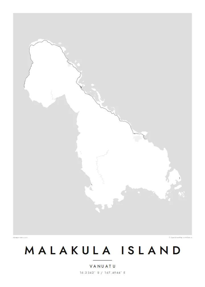
Vanuatu's second-largest island, an irregular landmass of forested hills with small island groups scattered off its coasts.
Taha e taone, lima e onoonoaga
Tapaki e taha puhala ke kitia ai ki luga he puipui. Kua tatai e totogi he tau puhala oti — pete he lolomi, poloka, po ke faila HD.
 Tau pikselo mooli · faila lolomi 24 × 36″
Maama mitaki ke lolomi
Ko e 100% e fahi mooli mai he faila lolomi. Ko e tau poster oti — pete kua lolomi, poloka, po ke utu hifo — kua taute ke he ha mautolu a tau tokoluga (server) ke he 300 DPI, hokotia ke he 7,200 × 10,800 piksela, ke maeke ai e tau ala ikiiki tote ke maaliali fakamitaki he lolomi 24 × 36″.
He Pā


Ko e mape
Malakula, also spelled Malekula, is the second-largest island in Vanuatu, in the South Pacific. Its outline is irregular, with a broad main body, a coastline cut by bays and headlands, and small islands and island groups scattered close offshore. The Maskelyne Islands lie off the southeastern tip. The interior is hilly and forested, and it is crossed by only a few roads.
The island is known for its remarkable cultural and linguistic diversity. A large number of distinct languages are spoken on Malakula, a notable concentration even by the standards of Vanuatu. It is also associated with the Big Nambas and Small Nambas, well-known cultural groups. The provincial centre, Lakatoro, and the nearby airstrip at Norsup lie on the east coast.
A Malakula Island map poster balances coastline and open ground. A road runs along parts of the coast, linking villages, and the east coast holds the densest clusters. The rest of the interior remains largely empty, where the forested hills rise. Offshore, the small islands add a lively scatter of shapes around the main body of the island.
Lakatoro and Norsup, on the east coast, form the island's main hub. Their streets and roads are the densest part of the map, set against the surrounding forest.
Small islands, including the Maskelyne group near the southeastern tip, lie close to Malakula's coast. They add a scatter of small shapes around the main outline.
The hilly interior has very few roads. On the map it leaves a broad open area inside the coastline, underlining how much of the island is rugged and wild.
Taute ke ha hau
Lafi e aho, taha higoa po ke taha kupu haau, hiki e fakatino, lahi po ke tuaga.
Ko e kitiaaga nakai totogi kua tote e maaliali mo e fakamailoga vai. Ko e tau lolomi mo e tau faila HD kua taute ke he 300 DPI, hokotia ke he 7,200 × 10,800 px, nakai fai fakamailoga vai.
Ko e ha Malakula Island
Malakula means a great deal to its many communities and to those who have lived, taught or travelled there. Its irregular outline and scattered offshore islands make a distinctive print, well suited to someone whose connection to Vanuatu runs deep.
Add your own title and subtitle, such as a village or a year, and edit the coordinates line. Pick from Classic black & white, Noir, Paper, Blueprint and Sand. Get the $9 HD files in six print sizes, or order a printed poster shipped from partners in more than 30 countries.
Talaage e poster Malakula Island| Lahi he lolomi | Maama | Tau faila |
|---|---|---|
| 30 × 40 cm11.8 × 15.7″ | 3,543 × 4,724 px | PNG · PDF |
| 29.7 × 42 cm (A3)11.7 × 16.5″ | 3,508 × 4,961 px | PNG · PDF |
| 42 × 59.4 cm (A2)16.5 × 23.4″ | 4,961 × 7,016 px | PNG · PDF |
| 45.7 × 61 cm18 × 24″ | 5,400 × 7,200 px | PNG · PDF |
| 50 × 70 cm19.7 × 27.6″ | 5,906 × 8,268 px | PNG · PDF |
| 61 × 91.4 cm24 × 36″ | 7,200 × 10,800 px | PNG · PDF |
Ke fakatatai, ko e fakatino noa kua 900 px e laulahi, fai fakamailoga mo e mo e tau mata komipiuta ni. Ko e tau faila HD kua ato hoko ke he 8× e maama ke he tau faahi takitaha mo e lolomi mitaki he lahi katoa he fakatino.
Fifili e taha puhala i luga he kupega, ti fifili e Poster Lolomi — e lahi mo e, kaeke ke manako ai koe, taha poloka — po ke Tau Faila HD Fakaeletonika. Ko e fakaotiaga totogi ko e taha gahua ni, ti ko e kupega he hau a talaaga ka fakafou fakahaga i mua he fakaotiaga e totogi.
Kua lolomi ai ke he pepa mitaki 200 gsm matte he taha he tau lahi ono, mai he 30 × 40 cm ke hoko ke he 24 × 36″. Kamata e tau poster lolomi mai he $39, kua putoia ai e utaaga.
E. Fifili e poloka akau malolō ke he lanu uli, tea, akau oki mooli, po ke akau pouli. Kua fakalataha mo e sioga malolō nakai malepe ti kua mautali ke tautau. Kamata e tau poster poloka mai he $99, kua putoia ai e utaaga.
Nakai totogi e fakafano ke he motu 60+. Ko e fakatino taha kua lolomi he fenoga lolomi ha mautolu kua tata mo e tau motu 30+, kua hoko mai he tau aho gahua 3–7. Maeke ia koe ke kikite e tuaga mo e fakamuitua he lalo he Haku Tau Fakatonu. Ke he falu motu kua 2–5 e tau tapu, ti ka nakai fakafano a mautolu ki ai, to fakaha he api tupe ia ki mua he totogi.
Fakafano mai e taha ata ki a mautolu he loto he 14 e tau aho tali mai he hokoaga, ti to lolomi foki e mautolu nakai totogi po ke liu atu e totogi ki a koe.
E. He editor i luga he kupega nei, hikihiki e matakupu, e matakupu lalo mo e laini coordinates ke he taha mena kua manako a koe ki ai, ti fifili e puhala mo e lahi. Ko e tau talaaga lolomi, poloka mo e fakaeletonika oti kua fakaaoga tonu e hau a fakatino.
Ma e $9 ka moua e koe e tau faila PNG 300 DPI mo e PDF kua mautali ke lolomi he tau lahi ono oti, nakai fai fakamailoga vai, ke lolomi i fe mena. Nakai maopoopo agaia? Utu hifo fakamua e kitiaaga nakai totogi ne fai fakamailoga vai.
Tata mai
