Niger River border
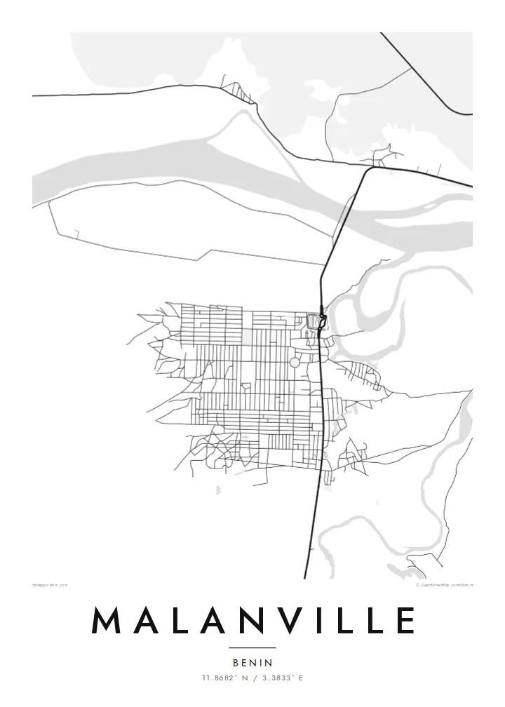
The broad Niger runs along the northern edge of the town and marks the international boundary. Its braided channels and sandbanks give the top of the print texture and movement.
Fakatino mape mukamuka · Benin
11.8682° N / 3.3833° E
Benin's northern gateway on the Niger River, a market town facing the neighbouring country across the water


Taha e taone, lima e onoonoaga
Tapaki e taha puhala ke kitia ai ki luga he puipui. Kua tatai e totogi he tau puhala oti — pete he lolomi, poloka, po ke faila HD.
 Tau pikselo mooli · faila lolomi 24 × 36″
Maama mitaki ke lolomi
Ko e 100% e fahi mooli mai he faila lolomi. Ko e tau poster oti — pete kua lolomi, poloka, po ke utu hifo — kua taute ke he ha mautolu a tau tokoluga (server) ke he 300 DPI, hokotia ke he 7,200 × 10,800 piksela, ke maeke ai e tau ala ikiiki tote ke maaliali fakamitaki he lolomi 24 × 36″.
He Pā


Ko e mape
Malanville is at the northern tip of Benin, where the Niger River forms the border with the Republic of Niger. From above, the river is the dominant feature: a wide channel with sandbanks and side branches. A bridge carries the main road north across it. The town spreads along the southern bank in a loose grid, and flat, cultivated floodplain fills the space between streets and water.
The town is best known for its large regional market, which draws traders from Benin, Niger, Nigeria and further afield. It also sits on the main road corridor linking the Gulf of Guinea coast with the Sahel. The Malanville map poster shows that meeting point clearly: a river, a bridge and a road that ties two countries together.
Around the town, the floodplain is worked for rice and other crops. On a clean monochrome map it shows as open ground crossed by channels. To the west lies the wider Niger valley, and protected parkland is not far away. The print leaves out everything except structure: a town set between the river and the long road south.
The broad Niger runs along the northern edge of the town and marks the international boundary. Its braided channels and sandbanks give the top of the print texture and movement.
The road bridge over the Niger connects Malanville with the town of Gaya on the opposite bank. It is a short, decisive line that joins two countries.
The streets form a loose, practical grid around the market district. It is the densest part of the map, where regional trade gathers every week.
Taute ke ha hau
Lafi e aho, taha higoa po ke taha kupu haau, hiki e fakatino, lahi po ke tuaga.
Ko e kitiaaga nakai totogi kua tote e maaliali mo e fakamailoga vai. Ko e tau lolomi mo e tau faila HD kua taute ke he 300 DPI, hokotia ke he 7,200 × 10,800 px, nakai fai fakamailoga vai.
Ko e ha Malanville
For anyone who has crossed the Niger here, traded at the market or grown up in Alibori, this map records a place defined by movement and exchange. The river-and-bridge composition works well in a living room or an office.
Personalise the title, subtitle and coordinates line with a name or date that matters to you. Choose one of five styles: Classic black & white, Noir, Paper, Blueprint or Sand. Printed posters on matte paper ship from partners in more than 30 countries.
Talaage e poster Malanville| Lahi he lolomi | Maama | Tau faila |
|---|---|---|
| 30 × 40 cm11.8 × 15.7″ | 3,543 × 4,724 px | PNG · PDF |
| 29.7 × 42 cm (A3)11.7 × 16.5″ | 3,508 × 4,961 px | PNG · PDF |
| 42 × 59.4 cm (A2)16.5 × 23.4″ | 4,961 × 7,016 px | PNG · PDF |
| 45.7 × 61 cm18 × 24″ | 5,400 × 7,200 px | PNG · PDF |
| 50 × 70 cm19.7 × 27.6″ | 5,906 × 8,268 px | PNG · PDF |
| 61 × 91.4 cm24 × 36″ | 7,200 × 10,800 px | PNG · PDF |
Ke fakatatai, ko e fakatino noa kua 900 px e laulahi, fai fakamailoga mo e mo e tau mata komipiuta ni. Ko e tau faila HD kua ato hoko ke he 8× e maama ke he tau faahi takitaha mo e lolomi mitaki he lahi katoa he fakatino.
Fifili e taha puhala i luga he kupega, ti fifili e Poster Lolomi — e lahi mo e, kaeke ke manako ai koe, taha poloka — po ke Tau Faila HD Fakaeletonika. Ko e fakaotiaga totogi ko e taha gahua ni, ti ko e kupega he hau a talaaga ka fakafou fakahaga i mua he fakaotiaga e totogi.
Kua lolomi ai ke he pepa mitaki 200 gsm matte he taha he tau lahi ono, mai he 30 × 40 cm ke hoko ke he 24 × 36″. Kamata e tau poster lolomi mai he $39, kua putoia ai e utaaga.
E. Fifili e poloka akau malolō ke he lanu uli, tea, akau oki mooli, po ke akau pouli. Kua fakalataha mo e sioga malolō nakai malepe ti kua mautali ke tautau. Kamata e tau poster poloka mai he $99, kua putoia ai e utaaga.
Nakai totogi e fakafano ke he motu 60+. Ko e fakatino taha kua lolomi he fenoga lolomi ha mautolu kua tata mo e tau motu 30+, kua hoko mai he tau aho gahua 3–7. Maeke ia koe ke kikite e tuaga mo e fakamuitua he lalo he Haku Tau Fakatonu. Ke he falu motu kua 2–5 e tau tapu, ti ka nakai fakafano a mautolu ki ai, to fakaha he api tupe ia ki mua he totogi.
Fakafano mai e taha ata ki a mautolu he loto he 14 e tau aho tali mai he hokoaga, ti to lolomi foki e mautolu nakai totogi po ke liu atu e totogi ki a koe.
E. He editor i luga he kupega nei, hikihiki e matakupu, e matakupu lalo mo e laini coordinates ke he taha mena kua manako a koe ki ai, ti fifili e puhala mo e lahi. Ko e tau talaaga lolomi, poloka mo e fakaeletonika oti kua fakaaoga tonu e hau a fakatino.
Ma e $9 ka moua e koe e tau faila PNG 300 DPI mo e PDF kua mautali ke lolomi he tau lahi ono oti, nakai fai fakamailoga vai, ke lolomi i fe mena. Nakai maopoopo agaia? Utu hifo fakamua e kitiaaga nakai totogi ne fai fakamailoga vai.
Tata mai
