The river bend
The Minnesota River swings through a wide turn at Mankato. This single curve is the dominant line of the map, with the city on one bank and North Mankato on the other.
Fakatino mape mukamuka · United States
44.1591° N / 94.0092° W
A river town on the sharp bend of the Minnesota River, with a flat downtown below the bluffs and a university campus on the high ground.


Taha e taone, lima e onoonoaga
Tapaki e taha puhala ke kitia ai ki luga he puipui. Kua tatai e totogi he tau puhala oti — pete he lolomi, poloka, po ke faila HD.
 Tau pikselo mooli · faila lolomi 24 × 36″
Maama mitaki ke lolomi
Ko e 100% e fahi mooli mai he faila lolomi. Ko e tau poster oti — pete kua lolomi, poloka, po ke utu hifo — kua taute ke he ha mautolu a tau tokoluga (server) ke he 300 DPI, hokotia ke he 7,200 × 10,800 piksela, ke maeke ai e tau ala ikiiki tote ke maaliali fakamitaki he lolomi 24 × 36″.
He Pā


Ko e mape
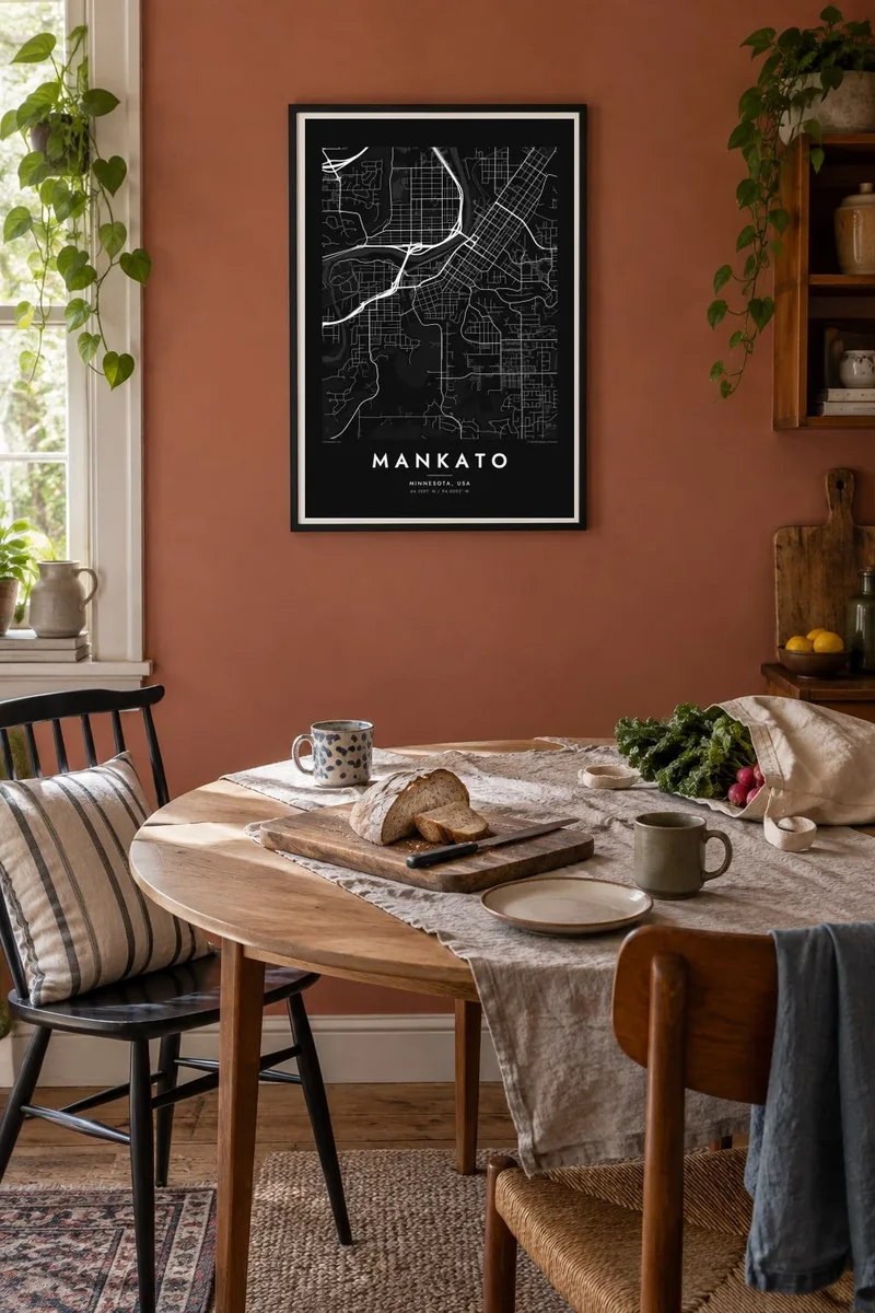
Mankato sits at the southern tip of the great bend where the Minnesota River turns from southeast to northeast, close to where the Blue Earth River flows in from the south. From above, the older city fills the flat ground beside the water, and newer neighbourhoods climb onto the high ground to the east and south. North Mankato faces it across the river, so the two read as one settlement split by water.
Downtown is a grid aligned with the riverbank and hemmed in by levees and rail lines, with several bridges linking it to North Mankato. Up on the bluff, Minnesota State University, Mankato spreads across a broad campus of curving drives and parking fields, a very different texture from the blocks below. Beyond the city, long straight section roads mark out the surrounding prairie farmland.
A Mankato map poster puts the river at the centre. A strong curve cuts across the frame, the downtown grid presses against its bank, and the bluff line marks the point where the street pattern suddenly changes. It shows clearly how landform shapes a Midwestern town, and in black and white the bend takes on an almost calligraphic quality.
The Minnesota River swings through a wide turn at Mankato. This single curve is the dominant line of the map, with the city on one bank and North Mankato on the other.
The Blue Earth River comes in from the south and joins the Minnesota near the city. Its channel adds a second, winding line of water and floodplain to the composition.
Minnesota State University occupies the upland above the valley. Its looping drives and open grounds contrast with the rectangular downtown blocks along the river below.
Taute ke ha hau
Lafi e aho, taha higoa po ke taha kupu haau, hiki e fakatino, lahi po ke tuaga.
Ko e kitiaaga nakai totogi kua tote e maaliali mo e fakamailoga vai. Ko e tau lolomi mo e tau faila HD kua taute ke he 300 DPI, hokotia ke he 7,200 × 10,800 px, nakai fai fakamailoga vai.
Ko e ha Mankato
For students, alumni and families who grew up along the Minnesota River, Mankato's map carries a lot of memory: the drive down the bluff, the bridges, the view across to North Mankato. As a poster it is simple and graphic, and it is easy to place.
The title, subtitle and coordinates line can be changed to mark a graduation year, a first home or a family name. There are five styles to choose from, including Blueprint for a technical look and Sand for a warmer tone. Order it as a $9 set of HD files or as a matte print, framed if you like.
Talaage e poster Mankato| Lahi he lolomi | Maama | Tau faila |
|---|---|---|
| 30 × 40 cm11.8 × 15.7″ | 3,543 × 4,724 px | PNG · PDF |
| 29.7 × 42 cm (A3)11.7 × 16.5″ | 3,508 × 4,961 px | PNG · PDF |
| 42 × 59.4 cm (A2)16.5 × 23.4″ | 4,961 × 7,016 px | PNG · PDF |
| 45.7 × 61 cm18 × 24″ | 5,400 × 7,200 px | PNG · PDF |
| 50 × 70 cm19.7 × 27.6″ | 5,906 × 8,268 px | PNG · PDF |
| 61 × 91.4 cm24 × 36″ | 7,200 × 10,800 px | PNG · PDF |
Ke fakatatai, ko e fakatino noa kua 900 px e laulahi, fai fakamailoga mo e mo e tau mata komipiuta ni. Ko e tau faila HD kua ato hoko ke he 8× e maama ke he tau faahi takitaha mo e lolomi mitaki he lahi katoa he fakatino.
Fifili e taha puhala i luga he kupega, ti fifili e Poster Lolomi — e lahi mo e, kaeke ke manako ai koe, taha poloka — po ke Tau Faila HD Fakaeletonika. Ko e fakaotiaga totogi ko e taha gahua ni, ti ko e kupega he hau a talaaga ka fakafou fakahaga i mua he fakaotiaga e totogi.
Kua lolomi ai ke he pepa mitaki 200 gsm matte he taha he tau lahi ono, mai he 30 × 40 cm ke hoko ke he 24 × 36″. Kamata e tau poster lolomi mai he $39, kua putoia ai e utaaga.
E. Fifili e poloka akau malolō ke he lanu uli, tea, akau oki mooli, po ke akau pouli. Kua fakalataha mo e sioga malolō nakai malepe ti kua mautali ke tautau. Kamata e tau poster poloka mai he $99, kua putoia ai e utaaga.
Nakai totogi e fakafano ke he motu 60+. Ko e fakatino taha kua lolomi he fenoga lolomi ha mautolu kua tata mo e tau motu 30+, kua hoko mai he tau aho gahua 3–7. Maeke ia koe ke kikite e tuaga mo e fakamuitua he lalo he Haku Tau Fakatonu. Ke he falu motu kua 2–5 e tau tapu, ti ka nakai fakafano a mautolu ki ai, to fakaha he api tupe ia ki mua he totogi.
Fakafano mai e taha ata ki a mautolu he loto he 14 e tau aho tali mai he hokoaga, ti to lolomi foki e mautolu nakai totogi po ke liu atu e totogi ki a koe.
E. He editor i luga he kupega nei, hikihiki e matakupu, e matakupu lalo mo e laini coordinates ke he taha mena kua manako a koe ki ai, ti fifili e puhala mo e lahi. Ko e tau talaaga lolomi, poloka mo e fakaeletonika oti kua fakaaoga tonu e hau a fakatino.
Ma e $9 ka moua e koe e tau faila PNG 300 DPI mo e PDF kua mautali ke lolomi he tau lahi ono oti, nakai fai fakamailoga vai, ke lolomi i fe mena. Nakai maopoopo agaia? Utu hifo fakamua e kitiaaga nakai totogi ne fai fakamailoga vai.
