Marine Drive
A long promenade and road tracing the curve of Back Bay from Nariman Point toward Malabar Hill. From above it forms one of the cleanest arcs on any city map.
Fakatino mape mukamuka · India
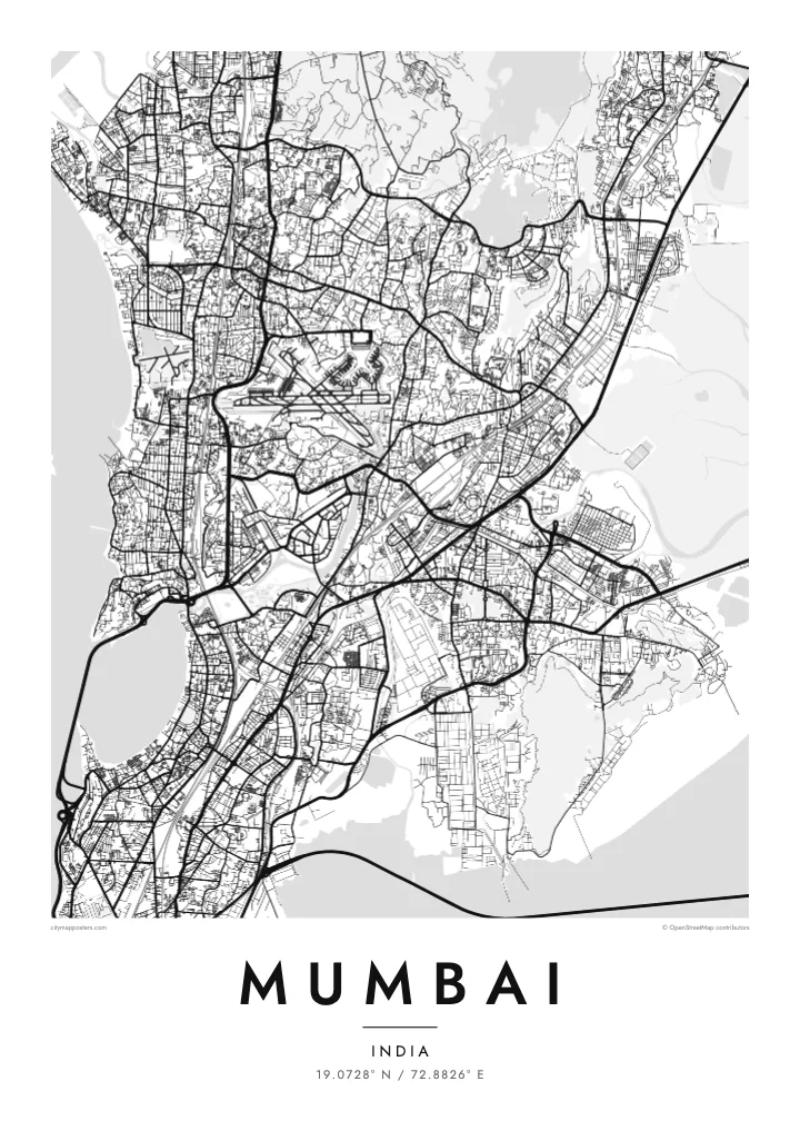
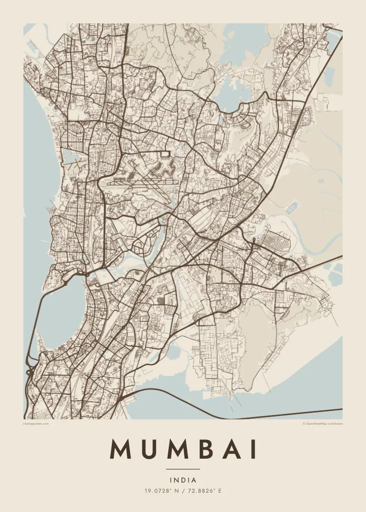
19.0728° N / 72.8826° E
A long peninsula of joined islands, curving around Back Bay and reaching south toward Colaba between sea and harbour


Taha e taone, lima e onoonoaga
Tapaki e taha puhala ke kitia ai ki luga he puipui. Kua tatai e totogi he tau puhala oti — pete he lolomi, poloka, po ke faila HD.
 Tau pikselo mooli · faila lolomi 24 × 36″
Maama mitaki ke lolomi
Ko e 100% e fahi mooli mai he faila lolomi. Ko e tau poster oti — pete kua lolomi, poloka, po ke utu hifo — kua taute ke he ha mautolu a tau tokoluga (server) ke he 300 DPI, hokotia ke he 7,200 × 10,800 piksela, ke maeke ai e tau ala ikiiki tote ke maaliali fakamitaki he lolomi 24 × 36″.
He Pā


Ko e mape
Mumbai occupies a narrow peninsula facing the Arabian Sea, created largely in the eighteenth and nineteenth centuries by joining seven islands through land reclamation. The resulting outline tapers south toward Colaba, with Back Bay curving along the west and the sheltered harbour on the east. To the north the city widens across Salsette Island, bounded by creeks and the forested hills of Sanjay Gandhi National Park.
The southern tip holds the densest layer of history, with the Fort district, the Oval Maidan and the station at Chhatrapati Shivaji Terminus. Marine Drive traces the arc of Back Bay, and further north the Bandra–Worli Sea Link swings out over the water on a long cable-stayed span. Between them, the Mithi River and Mahim Creek cut in from the west.
Chhatrapati Shivaji Terminus is a UNESCO World Heritage Site, and in 2018 the Victorian Gothic and Art Deco ensembles around the Oval Maidan were added as well. Mumbai is India’s financial capital and home to the Hindi film industry. A Mumbai map poster shows the coastline that made it possible: a deep, protected harbour on one side and the open sea on the other.
A long promenade and road tracing the curve of Back Bay from Nariman Point toward Malabar Hill. From above it forms one of the cleanest arcs on any city map.
A cable-stayed bridge that leaves the shore and crosses Mahim Bay on a gentle curve, linking the western suburbs with the island city to the south.
A large forested area in the northern suburbs, enclosed by the city on almost every side. It appears as a broad open space breaking the dense street network of the north.
Taute ke ha hau
Lafi e aho, taha higoa po ke taha kupu haau, hiki e fakatino, lahi po ke tuaga.
Ko e kitiaaga nakai totogi kua tote e maaliali mo e fakamailoga vai. Ko e tau lolomi mo e tau faila HD kua taute ke he 300 DPI, hokotia ke he 7,200 × 10,800 px, nakai fai fakamailoga vai.
Ko e ha Mumbai
Mumbai belongs to people who have lived its commute, its monsoon and its seafront, and to those who carry it with them after moving abroad. The long outline of the peninsula makes a distinctive vertical composition, well suited to taller frames.
Use the title and subtitle for a neighbourhood, a family name or the date you first arrived, and edit the coordinates line. Choose Classic black & white, Noir, Paper, Blueprint or Sand, and order HD files for $9 or a printed matte poster.
Talaage e poster Mumbai| Lahi he lolomi | Maama | Tau faila |
|---|---|---|
| 30 × 40 cm11.8 × 15.7″ | 3,543 × 4,724 px | PNG · PDF |
| 29.7 × 42 cm (A3)11.7 × 16.5″ | 3,508 × 4,961 px | PNG · PDF |
| 42 × 59.4 cm (A2)16.5 × 23.4″ | 4,961 × 7,016 px | PNG · PDF |
| 45.7 × 61 cm18 × 24″ | 5,400 × 7,200 px | PNG · PDF |
| 50 × 70 cm19.7 × 27.6″ | 5,906 × 8,268 px | PNG · PDF |
| 61 × 91.4 cm24 × 36″ | 7,200 × 10,800 px | PNG · PDF |
Ke fakatatai, ko e fakatino noa kua 900 px e laulahi, fai fakamailoga mo e mo e tau mata komipiuta ni. Ko e tau faila HD kua ato hoko ke he 8× e maama ke he tau faahi takitaha mo e lolomi mitaki he lahi katoa he fakatino.
Fifili e taha puhala i luga he kupega, ti fifili e Poster Lolomi — e lahi mo e, kaeke ke manako ai koe, taha poloka — po ke Tau Faila HD Fakaeletonika. Ko e fakaotiaga totogi ko e taha gahua ni, ti ko e kupega he hau a talaaga ka fakafou fakahaga i mua he fakaotiaga e totogi.
Kua lolomi ai ke he pepa mitaki 200 gsm matte he taha he tau lahi ono, mai he 30 × 40 cm ke hoko ke he 24 × 36″. Kamata e tau poster lolomi mai he $39, kua putoia ai e utaaga.
E. Fifili e poloka akau malolō ke he lanu uli, tea, akau oki mooli, po ke akau pouli. Kua fakalataha mo e sioga malolō nakai malepe ti kua mautali ke tautau. Kamata e tau poster poloka mai he $99, kua putoia ai e utaaga.
Nakai totogi e fakafano ke he motu 60+. Ko e fakatino taha kua lolomi he fenoga lolomi ha mautolu kua tata mo e tau motu 30+, kua hoko mai he tau aho gahua 3–7. Maeke ia koe ke kikite e tuaga mo e fakamuitua he lalo he Haku Tau Fakatonu. Ke he falu motu kua 2–5 e tau tapu, ti ka nakai fakafano a mautolu ki ai, to fakaha he api tupe ia ki mua he totogi.
Fakafano mai e taha ata ki a mautolu he loto he 14 e tau aho tali mai he hokoaga, ti to lolomi foki e mautolu nakai totogi po ke liu atu e totogi ki a koe.
E. He editor i luga he kupega nei, hikihiki e matakupu, e matakupu lalo mo e laini coordinates ke he taha mena kua manako a koe ki ai, ti fifili e puhala mo e lahi. Ko e tau talaaga lolomi, poloka mo e fakaeletonika oti kua fakaaoga tonu e hau a fakatino.
Ma e $9 ka moua e koe e tau faila PNG 300 DPI mo e PDF kua mautali ke lolomi he tau lahi ono oti, nakai fai fakamailoga vai, ke lolomi i fe mena. Nakai maopoopo agaia? Utu hifo fakamua e kitiaaga nakai totogi ne fai fakamailoga vai.
Tata mai
