Ocean Boulevard
The beachfront road runs for miles beside the sand, a single steady line separating hotels and houses from the open Atlantic.
Fakatino mape mukamuka · United States
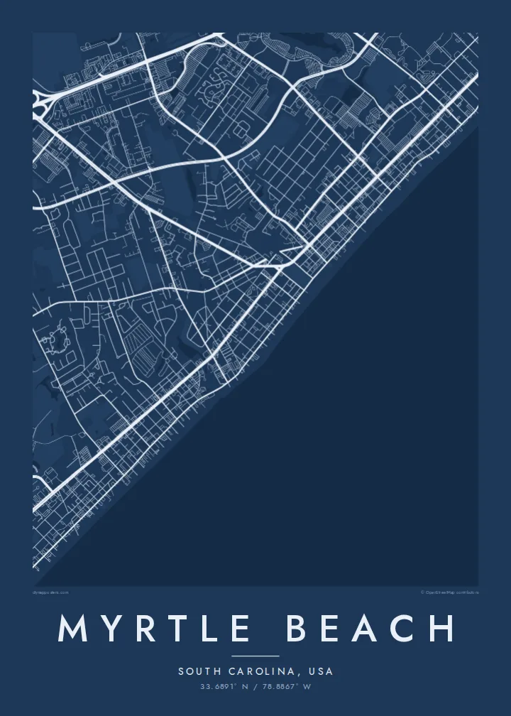
33.6891° N / 78.8867° W
A long ribbon of streets running parallel to the Atlantic, pinned between the ocean beach and the Intracoastal Waterway.



Taha e taone, lima e onoonoaga
Tapaki e taha puhala ke kitia ai ki luga he puipui. Kua tatai e totogi he tau puhala oti — pete he lolomi, poloka, po ke faila HD.
 Tau pikselo mooli · faila lolomi 24 × 36″
Maama mitaki ke lolomi
Ko e 100% e fahi mooli mai he faila lolomi. Ko e tau poster oti — pete kua lolomi, poloka, po ke utu hifo — kua taute ke he ha mautolu a tau tokoluga (server) ke he 300 DPI, hokotia ke he 7,200 × 10,800 piksela, ke maeke ai e tau ala ikiiki tote ke maaliali fakamitaki he lolomi 24 × 36″.
He Pā


Ko e mape
Myrtle Beach is the centre of the Grand Strand, the long run of beaches along the South Carolina coast, and its map is essentially linear. Ocean Boulevard tracks the sand, Kings Highway follows a little inland, and a looser grid of numbered avenues runs between them, so the whole city reads as a stretched band aligned with the shore.
Behind the town, the Atlantic Intracoastal Waterway cuts a narrow channel through marsh and woodland, closing the city off on its landward side. Golf courses fill much of the inland ground with curving fairways and ponds, and the grounds of the former Air Force base in the south now hold neighbourhoods, a park and the airport, each with its own distinct street pattern.
Visitors come for the beach, the boardwalk and the SkyWheel on the oceanfront, but the map reveals the structure beneath the resort. A Myrtle Beach map poster shows the discipline of a coastal city built in parallel lines, with the unbroken Atlantic edge running the full length of the frame.
The beachfront road runs for miles beside the sand, a single steady line separating hotels and houses from the open Atlantic.
A narrow man-made channel curves along the city's inland side, giving the map a second waterline and a clear boundary behind the resort.
Courses spread across the inland areas, their fairways, ponds and looping cart paths adding organic shapes among the straight residential streets.
Taute ke ha hau
Lafi e aho, taha higoa po ke taha kupu haau, hiki e fakatino, lahi po ke tuaga.
Ko e kitiaaga nakai totogi kua tote e maaliali mo e fakamailoga vai. Ko e tau lolomi mo e tau faila HD kua taute ke he 300 DPI, hokotia ke he 7,200 × 10,800 px, nakai fai fakamailoga vai.
Ko e ha Myrtle Beach
Family beach trips, honeymoons and retirements all lead to Myrtle Beach, and many visitors return year after year. A map of the coast is a calmer souvenir than a snapshot, and it sits easily in a beach house, a hallway or a home far inland.
Add your own title and subtitle, such as a family name and the summer you first came, and adjust the coordinates line. Sand is a natural fit for a beach town, though Classic black & white, Noir, Paper and Blueprint are all available.
Talaage e poster Myrtle Beach| Lahi he lolomi | Maama | Tau faila |
|---|---|---|
| 30 × 40 cm11.8 × 15.7″ | 3,543 × 4,724 px | PNG · PDF |
| 29.7 × 42 cm (A3)11.7 × 16.5″ | 3,508 × 4,961 px | PNG · PDF |
| 42 × 59.4 cm (A2)16.5 × 23.4″ | 4,961 × 7,016 px | PNG · PDF |
| 45.7 × 61 cm18 × 24″ | 5,400 × 7,200 px | PNG · PDF |
| 50 × 70 cm19.7 × 27.6″ | 5,906 × 8,268 px | PNG · PDF |
| 61 × 91.4 cm24 × 36″ | 7,200 × 10,800 px | PNG · PDF |
Ke fakatatai, ko e fakatino noa kua 900 px e laulahi, fai fakamailoga mo e mo e tau mata komipiuta ni. Ko e tau faila HD kua ato hoko ke he 8× e maama ke he tau faahi takitaha mo e lolomi mitaki he lahi katoa he fakatino.
Fifili e taha puhala i luga he kupega, ti fifili e Poster Lolomi — e lahi mo e, kaeke ke manako ai koe, taha poloka — po ke Tau Faila HD Fakaeletonika. Ko e fakaotiaga totogi ko e taha gahua ni, ti ko e kupega he hau a talaaga ka fakafou fakahaga i mua he fakaotiaga e totogi.
Kua lolomi ai ke he pepa mitaki 200 gsm matte he taha he tau lahi ono, mai he 30 × 40 cm ke hoko ke he 24 × 36″. Kamata e tau poster lolomi mai he $39, kua putoia ai e utaaga.
E. Fifili e poloka akau malolō ke he lanu uli, tea, akau oki mooli, po ke akau pouli. Kua fakalataha mo e sioga malolō nakai malepe ti kua mautali ke tautau. Kamata e tau poster poloka mai he $99, kua putoia ai e utaaga.
Nakai totogi e fakafano ke he motu 60+. Ko e fakatino taha kua lolomi he fenoga lolomi ha mautolu kua tata mo e tau motu 30+, kua hoko mai he tau aho gahua 3–7. Maeke ia koe ke kikite e tuaga mo e fakamuitua he lalo he Haku Tau Fakatonu. Ke he falu motu kua 2–5 e tau tapu, ti ka nakai fakafano a mautolu ki ai, to fakaha he api tupe ia ki mua he totogi.
Fakafano mai e taha ata ki a mautolu he loto he 14 e tau aho tali mai he hokoaga, ti to lolomi foki e mautolu nakai totogi po ke liu atu e totogi ki a koe.
E. He editor i luga he kupega nei, hikihiki e matakupu, e matakupu lalo mo e laini coordinates ke he taha mena kua manako a koe ki ai, ti fifili e puhala mo e lahi. Ko e tau talaaga lolomi, poloka mo e fakaeletonika oti kua fakaaoga tonu e hau a fakatino.
Ma e $9 ka moua e koe e tau faila PNG 300 DPI mo e PDF kua mautali ke lolomi he tau lahi ono oti, nakai fai fakamailoga vai, ke lolomi i fe mena. Nakai maopoopo agaia? Utu hifo fakamua e kitiaaga nakai totogi ne fai fakamailoga vai.
