The Vakhsh gorge
The Vakhsh River narrows as it passes the town, and roads and buildings squeeze into the limited flat ground beside it, giving the map a strong diagonal axis.
Fakatino mape mukamuka · Tajikistan
38.3892° N / 69.3227° E
A mountain town on the Vakhsh River, where a narrow gorge ends in one of the tallest dams ever built


Taha e taone, lima e onoonoaga
Tapaki e taha puhala ke kitia ai ki luga he puipui. Kua tatai e totogi he tau puhala oti — pete he lolomi, poloka, po ke faila HD.
 Tau pikselo mooli · faila lolomi 24 × 36″
Maama mitaki ke lolomi
Ko e 100% e fahi mooli mai he faila lolomi. Ko e tau poster oti — pete kua lolomi, poloka, po ke utu hifo — kua taute ke he ha mautolu a tau tokoluga (server) ke he 300 DPI, hokotia ke he 7,200 × 10,800 piksela, ke maeke ai e tau ala ikiiki tote ke maaliali fakamitaki he lolomi 24 × 36″.
He Pā


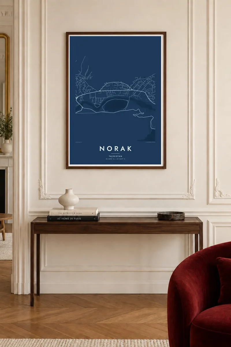
Ko e mape
Norak sits where the Vakhsh River cuts through the ranges of southern Tajikistan. From above, the town appears as a compact grid of Soviet-era blocks on a shelf of flat ground, closed in by steep ridges. The river runs along its edge in a tight, braided line, and the terrain contour lines stack close together almost everywhere around it.
The town grew up around the Nurek hydroelectric project, started in the 1960s. Its rock-fill dam, about 300 metres high, has long been listed among the tallest in the world. Upstream, the reservoir winds through the mountains as a long, branching body of water, which on a map looks more like a river valley filled to the brim than a lake.
A Norak map poster sets planned streets against wild terrain. The orderly housing districts, the road along the gorge and the pale shape of the reservoir give the print a clear structure, and the mountains supply the texture. It works well for anyone with a link to Tajikistan, to engineering, or to places shaped by one very large piece of infrastructure.
The Vakhsh River narrows as it passes the town, and roads and buildings squeeze into the limited flat ground beside it, giving the map a strong diagonal axis.
Above the dam, the Nurek reservoir fills a winding mountain valley, producing a long, irregular shape with side arms that reach into the surrounding ridges.
The residential districts were laid out for dam builders and their families, so the streets form regular blocks that contrast sharply with the folded landscape around them.
Taute ke ha hau
Lafi e aho, taha higoa po ke taha kupu haau, hiki e fakatino, lahi po ke tuaga.
Ko e kitiaaga nakai totogi kua tote e maaliali mo e fakamailoga vai. Ko e tau lolomi mo e tau faila HD kua taute ke he 300 DPI, hokotia ke he 7,200 × 10,800 px, nakai fai fakamailoga vai.
Ko e ha Norak
For people who worked on the dam, grew up in the town or have family there, Norak is more than a name on a list of engineering records. A map of its streets and the river keeps that connection at the scale of daily life.
You can add a title, a subtitle such as a family name or a year, and the coordinates line, then pick Classic black & white, Noir, Paper, Blueprint or Sand. Blueprint fits the engineering story particularly well.
Talaage e poster Norak| Lahi he lolomi | Maama | Tau faila |
|---|---|---|
| 30 × 40 cm11.8 × 15.7″ | 3,543 × 4,724 px | PNG · PDF |
| 29.7 × 42 cm (A3)11.7 × 16.5″ | 3,508 × 4,961 px | PNG · PDF |
| 42 × 59.4 cm (A2)16.5 × 23.4″ | 4,961 × 7,016 px | PNG · PDF |
| 45.7 × 61 cm18 × 24″ | 5,400 × 7,200 px | PNG · PDF |
| 50 × 70 cm19.7 × 27.6″ | 5,906 × 8,268 px | PNG · PDF |
| 61 × 91.4 cm24 × 36″ | 7,200 × 10,800 px | PNG · PDF |
Ke fakatatai, ko e fakatino noa kua 900 px e laulahi, fai fakamailoga mo e mo e tau mata komipiuta ni. Ko e tau faila HD kua ato hoko ke he 8× e maama ke he tau faahi takitaha mo e lolomi mitaki he lahi katoa he fakatino.
Fifili e taha puhala i luga he kupega, ti fifili e Poster Lolomi — e lahi mo e, kaeke ke manako ai koe, taha poloka — po ke Tau Faila HD Fakaeletonika. Ko e fakaotiaga totogi ko e taha gahua ni, ti ko e kupega he hau a talaaga ka fakafou fakahaga i mua he fakaotiaga e totogi.
Kua lolomi ai ke he pepa mitaki 200 gsm matte he taha he tau lahi ono, mai he 30 × 40 cm ke hoko ke he 24 × 36″. Kamata e tau poster lolomi mai he $39, kua putoia ai e utaaga.
E. Fifili e poloka akau malolō ke he lanu uli, tea, akau oki mooli, po ke akau pouli. Kua fakalataha mo e sioga malolō nakai malepe ti kua mautali ke tautau. Kamata e tau poster poloka mai he $99, kua putoia ai e utaaga.
Nakai totogi e fakafano ke he motu 60+. Ko e fakatino taha kua lolomi he fenoga lolomi ha mautolu kua tata mo e tau motu 30+, kua hoko mai he tau aho gahua 3–7. Maeke ia koe ke kikite e tuaga mo e fakamuitua he lalo he Haku Tau Fakatonu. Ke he falu motu kua 2–5 e tau tapu, ti ka nakai fakafano a mautolu ki ai, to fakaha he api tupe ia ki mua he totogi.
Fakafano mai e taha ata ki a mautolu he loto he 14 e tau aho tali mai he hokoaga, ti to lolomi foki e mautolu nakai totogi po ke liu atu e totogi ki a koe.
E. He editor i luga he kupega nei, hikihiki e matakupu, e matakupu lalo mo e laini coordinates ke he taha mena kua manako a koe ki ai, ti fifili e puhala mo e lahi. Ko e tau talaaga lolomi, poloka mo e fakaeletonika oti kua fakaaoga tonu e hau a fakatino.
Ma e $9 ka moua e koe e tau faila PNG 300 DPI mo e PDF kua mautali ke lolomi he tau lahi ono oti, nakai fai fakamailoga vai, ke lolomi i fe mena. Nakai maopoopo agaia? Utu hifo fakamua e kitiaaga nakai totogi ne fai fakamailoga vai.
Tata mai
