Gulf of Aden shore
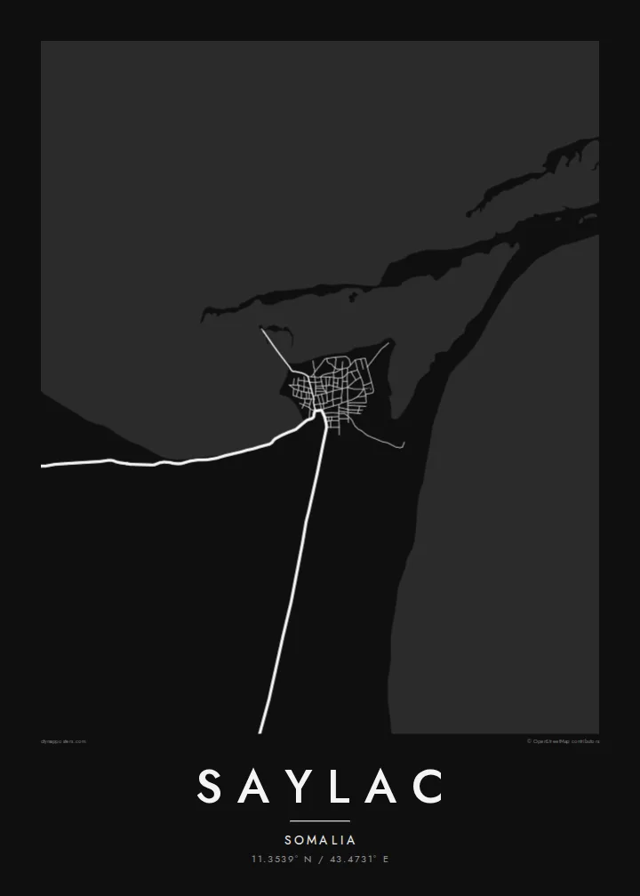
The coastline runs low and uneven along the town's edge, with shallows and inlets that turn the boundary between land and water into a fine, irregular line on the print.
Fakatino mape mukamuka · Somalia
11.3539° N / 43.4731° E
An old port on the Gulf of Aden, low and compact, with a flat shoreline and scattered islands offshore.



Taha e taone, lima e onoonoaga
Tapaki e taha puhala ke kitia ai ki luga he puipui. Kua tatai e totogi he tau puhala oti — pete he lolomi, poloka, po ke faila HD.
 Tau pikselo mooli · faila lolomi 24 × 36″
Maama mitaki ke lolomi
Ko e 100% e fahi mooli mai he faila lolomi. Ko e tau poster oti — pete kua lolomi, poloka, po ke utu hifo — kua taute ke he ha mautolu a tau tokoluga (server) ke he 300 DPI, hokotia ke he 7,200 × 10,800 piksela, ke maeke ai e tau ala ikiiki tote ke maaliali fakamitaki he lolomi 24 × 36″.
He Pā


Ko e mape
Saylac, also known as Zeila, stands in the Awdal region on the north-western coast of Somalia, close to the border with Djibouti. It is one of the oldest ports on the Horn of Africa, recorded for centuries as a trading town that linked the interior with Arabia and the wider Indian Ocean. Today it is a small settlement, and its map is dominated by the meeting of sand and sea.
From above the town is a tight cluster of low buildings on a flat stretch of coast, with sandy tracks running inland across a dry plain. The shoreline is shallow and irregular, and a group of small islands lies offshore. Among the older structures is a mosque traditionally described as having two prayer niches, one facing Jerusalem and one facing Mecca.
A Saylac map poster is a portrait of a place where geography explains history: a piece of coast near the mouth of the Red Sea trade routes. The white space of water and desert frames the settlement, and the scattered islands add small points of interest across the sheet. It suits anyone with roots in the region or an interest in old trading ports.
The coastline runs low and uneven along the town's edge, with shallows and inlets that turn the boundary between land and water into a fine, irregular line on the print.
Several small islands sit off the coast, appearing as isolated shapes in open water and giving the seaward half of the map a light, scattered rhythm.
The settlement is small and dense, its lanes packed close together near the water, reflecting a long history as a harbour town rather than a planned modern layout.
Taute ke ha hau
Lafi e aho, taha higoa po ke taha kupu haau, hiki e fakatino, lahi po ke tuaga.
Ko e kitiaaga nakai totogi kua tote e maaliali mo e fakamailoga vai. Ko e tau lolomi mo e tau faila HD kua taute ke he 300 DPI, hokotia ke he 7,200 × 10,800 px, nakai fai fakamailoga vai.
Ko e ha Saylac
Saylac speaks to people from the Awdal region and the Somali diaspora, and to readers of Horn of Africa history who know the name Zeila from old travel accounts. The map turns a remote coastal town into a clear, quiet image of shore, sand and street.
Personalise the title, subtitle and coordinates line, perhaps with the name Zeila or a family date, and choose Classic black & white, Noir, Paper, Blueprint or Sand. Digital HD files are $9 with six print sizes included, and printed posters ship from partners in more than 30 countries.
Talaage e poster Saylac| Lahi he lolomi | Maama | Tau faila |
|---|---|---|
| 30 × 40 cm11.8 × 15.7″ | 3,543 × 4,724 px | PNG · PDF |
| 29.7 × 42 cm (A3)11.7 × 16.5″ | 3,508 × 4,961 px | PNG · PDF |
| 42 × 59.4 cm (A2)16.5 × 23.4″ | 4,961 × 7,016 px | PNG · PDF |
| 45.7 × 61 cm18 × 24″ | 5,400 × 7,200 px | PNG · PDF |
| 50 × 70 cm19.7 × 27.6″ | 5,906 × 8,268 px | PNG · PDF |
| 61 × 91.4 cm24 × 36″ | 7,200 × 10,800 px | PNG · PDF |
Ke fakatatai, ko e fakatino noa kua 900 px e laulahi, fai fakamailoga mo e mo e tau mata komipiuta ni. Ko e tau faila HD kua ato hoko ke he 8× e maama ke he tau faahi takitaha mo e lolomi mitaki he lahi katoa he fakatino.
Fifili e taha puhala i luga he kupega, ti fifili e Poster Lolomi — e lahi mo e, kaeke ke manako ai koe, taha poloka — po ke Tau Faila HD Fakaeletonika. Ko e fakaotiaga totogi ko e taha gahua ni, ti ko e kupega he hau a talaaga ka fakafou fakahaga i mua he fakaotiaga e totogi.
Kua lolomi ai ke he pepa mitaki 200 gsm matte he taha he tau lahi ono, mai he 30 × 40 cm ke hoko ke he 24 × 36″. Kamata e tau poster lolomi mai he $39, kua putoia ai e utaaga.
E. Fifili e poloka akau malolō ke he lanu uli, tea, akau oki mooli, po ke akau pouli. Kua fakalataha mo e sioga malolō nakai malepe ti kua mautali ke tautau. Kamata e tau poster poloka mai he $99, kua putoia ai e utaaga.
Nakai totogi e fakafano ke he motu 60+. Ko e fakatino taha kua lolomi he fenoga lolomi ha mautolu kua tata mo e tau motu 30+, kua hoko mai he tau aho gahua 3–7. Maeke ia koe ke kikite e tuaga mo e fakamuitua he lalo he Haku Tau Fakatonu. Ke he falu motu kua 2–5 e tau tapu, ti ka nakai fakafano a mautolu ki ai, to fakaha he api tupe ia ki mua he totogi.
Fakafano mai e taha ata ki a mautolu he loto he 14 e tau aho tali mai he hokoaga, ti to lolomi foki e mautolu nakai totogi po ke liu atu e totogi ki a koe.
E. He editor i luga he kupega nei, hikihiki e matakupu, e matakupu lalo mo e laini coordinates ke he taha mena kua manako a koe ki ai, ti fifili e puhala mo e lahi. Ko e tau talaaga lolomi, poloka mo e fakaeletonika oti kua fakaaoga tonu e hau a fakatino.
Ma e $9 ka moua e koe e tau faila PNG 300 DPI mo e PDF kua mautali ke lolomi he tau lahi ono oti, nakai fai fakamailoga vai, ke lolomi i fe mena. Nakai maopoopo agaia? Utu hifo fakamua e kitiaaga nakai totogi ne fai fakamailoga vai.
Tata mai
