St Anthony Channel
A narrow, winding strait joins Šibenik's sheltered bay to the Adriatic. On the map it appears as a slim passage between headlands, with St Nicholas Fortress at its seaward mouth.
Fakatino mape mukamuka · Croatia
43.7343° N / 15.8942° E
A stone old town stepping down a hillside to a sheltered channel, with fortresses on the heights and islands scattered offshore


Taha e taone, lima e onoonoaga
Tapaki e taha puhala ke kitia ai ki luga he puipui. Kua tatai e totogi he tau puhala oti — pete he lolomi, poloka, po ke faila HD.
 Tau pikselo mooli · faila lolomi 24 × 36″
Maama mitaki ke lolomi
Ko e 100% e fahi mooli mai he faila lolomi. Ko e tau poster oti — pete kua lolomi, poloka, po ke utu hifo — kua taute ke he ha mautolu a tau tokoluga (server) ke he 300 DPI, hokotia ke he 7,200 × 10,800 piksela, ke maeke ai e tau ala ikiiki tote ke maaliali fakamitaki he lolomi 24 × 36″.
He Pā


Ko e mape
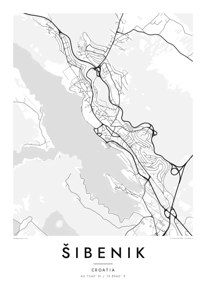
Šibenik sits on the Dalmatian coast where the Krka river reaches the Adriatic through a long, narrow bay. From above, the town is a tight cluster of lanes climbing a slope to the water's edge. Streets run along the contours in short terraces and are linked by stairways, so the old core looks less like a grid and more like a fingerprint pressed into the hillside.
Two of its best-known buildings are on the UNESCO World Heritage list. The Cathedral of St James, built entirely of stone, stands near the waterfront. St Nicholas Fortress guards the entrance to the St Anthony Channel, the narrow strait that links the bay to the open sea. On the map, that channel is a thin thread of water cutting between two headlands.
A Šibenik map poster keeps these contrasts in view: the dense medieval centre, newer districts spreading along the shore, the inland reach of the Krka estuary and the islands of the archipelago beyond. In black and white, the coastline does most of the work, giving an outline that is hard to confuse with any other Adriatic town.
A narrow, winding strait joins Šibenik's sheltered bay to the Adriatic. On the map it appears as a slim passage between headlands, with St Nicholas Fortress at its seaward mouth.
Lanes follow the slope in stepped rows and are linked by stairways rather than straight avenues, so the historic centre prints as a dense, curving mesh of fine lines above the harbour.
Inland from the town, the Krka river widens into a long estuary that winds north towards the national park. It carries the water shapes of the map well beyond the city streets.
Taute ke ha hau
Lafi e aho, taha higoa po ke taha kupu haau, hiki e fakatino, lahi po ke tuaga.
Ko e kitiaaga nakai totogi kua tote e maaliali mo e fakamailoga vai. Ko e tau lolomi mo e tau faila HD kua taute ke he 300 DPI, hokotia ke he 7,200 × 10,800 px, nakai fai fakamailoga vai.
Ko e ha Šibenik
People who have sailed through the channel, climbed the fortress stairs or spent a summer on the nearby islands often want a reminder that isn't a photograph. The street pattern alone is enough to bring back the place: a steep old town, a quiet bay and the sea just beyond.
You can add your own title, a subtitle such as a year or a family name, and the coordinates line. Choose from five styles: Classic black & white, Noir, Paper, Blueprint or Sand. Buy it as a $9 HD download or order it printed on matte paper, with a wooden frame if you like.
Talaage e poster Šibenik| Lahi he lolomi | Maama | Tau faila |
|---|---|---|
| 30 × 40 cm11.8 × 15.7″ | 3,543 × 4,724 px | PNG · PDF |
| 29.7 × 42 cm (A3)11.7 × 16.5″ | 3,508 × 4,961 px | PNG · PDF |
| 42 × 59.4 cm (A2)16.5 × 23.4″ | 4,961 × 7,016 px | PNG · PDF |
| 45.7 × 61 cm18 × 24″ | 5,400 × 7,200 px | PNG · PDF |
| 50 × 70 cm19.7 × 27.6″ | 5,906 × 8,268 px | PNG · PDF |
| 61 × 91.4 cm24 × 36″ | 7,200 × 10,800 px | PNG · PDF |
Ke fakatatai, ko e fakatino noa kua 900 px e laulahi, fai fakamailoga mo e mo e tau mata komipiuta ni. Ko e tau faila HD kua ato hoko ke he 8× e maama ke he tau faahi takitaha mo e lolomi mitaki he lahi katoa he fakatino.
Fifili e taha puhala i luga he kupega, ti fifili e Poster Lolomi — e lahi mo e, kaeke ke manako ai koe, taha poloka — po ke Tau Faila HD Fakaeletonika. Ko e fakaotiaga totogi ko e taha gahua ni, ti ko e kupega he hau a talaaga ka fakafou fakahaga i mua he fakaotiaga e totogi.
Kua lolomi ai ke he pepa mitaki 200 gsm matte he taha he tau lahi ono, mai he 30 × 40 cm ke hoko ke he 24 × 36″. Kamata e tau poster lolomi mai he $39, kua putoia ai e utaaga.
E. Fifili e poloka akau malolō ke he lanu uli, tea, akau oki mooli, po ke akau pouli. Kua fakalataha mo e sioga malolō nakai malepe ti kua mautali ke tautau. Kamata e tau poster poloka mai he $99, kua putoia ai e utaaga.
Nakai totogi e fakafano ke he motu 60+. Ko e fakatino taha kua lolomi he fenoga lolomi ha mautolu kua tata mo e tau motu 30+, kua hoko mai he tau aho gahua 3–7. Maeke ia koe ke kikite e tuaga mo e fakamuitua he lalo he Haku Tau Fakatonu. Ke he falu motu kua 2–5 e tau tapu, ti ka nakai fakafano a mautolu ki ai, to fakaha he api tupe ia ki mua he totogi.
Fakafano mai e taha ata ki a mautolu he loto he 14 e tau aho tali mai he hokoaga, ti to lolomi foki e mautolu nakai totogi po ke liu atu e totogi ki a koe.
E. He editor i luga he kupega nei, hikihiki e matakupu, e matakupu lalo mo e laini coordinates ke he taha mena kua manako a koe ki ai, ti fifili e puhala mo e lahi. Ko e tau talaaga lolomi, poloka mo e fakaeletonika oti kua fakaaoga tonu e hau a fakatino.
Ma e $9 ka moua e koe e tau faila PNG 300 DPI mo e PDF kua mautali ke lolomi he tau lahi ono oti, nakai fai fakamailoga vai, ke lolomi i fe mena. Nakai maopoopo agaia? Utu hifo fakamua e kitiaaga nakai totogi ne fai fakamailoga vai.
Tata mai
