Chongchon estuary
The lower Chongchon spreads wide as it approaches the Yellow Sea, with sandbanks and tidal ground giving the river an irregular, layered outline on the poster.
Fakatino mape mukamuka · North Korea
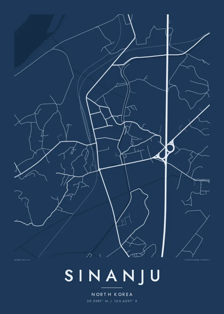
39.5981° N / 125.6097° E
A river town on the lower Chongchon, where rail and road bridges cross just before the estuary opens to the Yellow Sea.



Taha e taone, lima e onoonoaga
Tapaki e taha puhala ke kitia ai ki luga he puipui. Kua tatai e totogi he tau puhala oti — pete he lolomi, poloka, po ke faila HD.
 Tau pikselo mooli · faila lolomi 24 × 36″
Maama mitaki ke lolomi
Ko e 100% e fahi mooli mai he faila lolomi. Ko e tau poster oti — pete kua lolomi, poloka, po ke utu hifo — kua taute ke he ha mautolu a tau tokoluga (server) ke he 300 DPI, hokotia ke he 7,200 × 10,800 piksela, ke maeke ai e tau ala ikiiki tote ke maaliali fakamitaki he lolomi 24 × 36″.
He Pā



Ko e mape
Sinanju sits on the lower Chongchon River in South Pyongan Province, close to where the river widens into its estuary and meets the Yellow Sea. On the map the river dominates: a broad band of water and tidal flats curving past the town, with low farmland and scattered settlements spreading across the flat ground on either bank.
The town has long been a crossing point. The main railway between Pyongyang and the northwest border runs through here, and its bridges over the Chongchon form some of the strongest straight lines in the whole frame. Roads converge on the same crossing, giving Sinanju a clear role as a knot in the regional transport network.
Because of that position, the lower Chongchon saw heavy fighting during the Korean War. A Sinanju map poster shows the geography behind that history in plain lines: the wide river, the bridges, the grid of fields and embankments, and the coastline beginning to open out toward the sea.
The lower Chongchon spreads wide as it approaches the Yellow Sea, with sandbanks and tidal ground giving the river an irregular, layered outline on the poster.
Rail and road bridges span the river near the town, straight lines cutting across the water that mark Sinanju's long-standing importance as a crossing point.
Flat farmland, embankments and field divisions surround the town, creating a finely ruled background that contrasts with the broad curves of the river.
Taute ke ha hau
Lafi e aho, taha higoa po ke taha kupu haau, hiki e fakatino, lahi po ke tuaga.
Ko e kitiaaga nakai totogi kua tote e maaliali mo e fakamailoga vai. Ko e tau lolomi mo e tau faila HD kua taute ke he 300 DPI, hokotia ke he 7,200 × 10,800 px, nakai fai fakamailoga vai.
Ko e ha Sinanju
This is a map for people with a family connection to the region, historians of the Korean War, or collectors of rarely mapped places. The strong line of the river and its crossings makes a composition that is both graphic and quietly thought-provoking.
The title, subtitle and coordinates line can be edited, so you can add a family name, a date or a short note. Choose from five styles, Classic black & white, Noir, Paper, Blueprint and Sand, as $9 HD files or a printed poster with an optional wooden frame.
Talaage e poster Sinanju| Lahi he lolomi | Maama | Tau faila |
|---|---|---|
| 30 × 40 cm11.8 × 15.7″ | 3,543 × 4,724 px | PNG · PDF |
| 29.7 × 42 cm (A3)11.7 × 16.5″ | 3,508 × 4,961 px | PNG · PDF |
| 42 × 59.4 cm (A2)16.5 × 23.4″ | 4,961 × 7,016 px | PNG · PDF |
| 45.7 × 61 cm18 × 24″ | 5,400 × 7,200 px | PNG · PDF |
| 50 × 70 cm19.7 × 27.6″ | 5,906 × 8,268 px | PNG · PDF |
| 61 × 91.4 cm24 × 36″ | 7,200 × 10,800 px | PNG · PDF |
Ke fakatatai, ko e fakatino noa kua 900 px e laulahi, fai fakamailoga mo e mo e tau mata komipiuta ni. Ko e tau faila HD kua ato hoko ke he 8× e maama ke he tau faahi takitaha mo e lolomi mitaki he lahi katoa he fakatino.
Fifili e taha puhala i luga he kupega, ti fifili e Poster Lolomi — e lahi mo e, kaeke ke manako ai koe, taha poloka — po ke Tau Faila HD Fakaeletonika. Ko e fakaotiaga totogi ko e taha gahua ni, ti ko e kupega he hau a talaaga ka fakafou fakahaga i mua he fakaotiaga e totogi.
Kua lolomi ai ke he pepa mitaki 200 gsm matte he taha he tau lahi ono, mai he 30 × 40 cm ke hoko ke he 24 × 36″. Kamata e tau poster lolomi mai he $39, kua putoia ai e utaaga.
E. Fifili e poloka akau malolō ke he lanu uli, tea, akau oki mooli, po ke akau pouli. Kua fakalataha mo e sioga malolō nakai malepe ti kua mautali ke tautau. Kamata e tau poster poloka mai he $99, kua putoia ai e utaaga.
Nakai totogi e fakafano ke he motu 60+. Ko e fakatino taha kua lolomi he fenoga lolomi ha mautolu kua tata mo e tau motu 30+, kua hoko mai he tau aho gahua 3–7. Maeke ia koe ke kikite e tuaga mo e fakamuitua he lalo he Haku Tau Fakatonu. Ke he falu motu kua 2–5 e tau tapu, ti ka nakai fakafano a mautolu ki ai, to fakaha he api tupe ia ki mua he totogi.
Fakafano mai e taha ata ki a mautolu he loto he 14 e tau aho tali mai he hokoaga, ti to lolomi foki e mautolu nakai totogi po ke liu atu e totogi ki a koe.
E. He editor i luga he kupega nei, hikihiki e matakupu, e matakupu lalo mo e laini coordinates ke he taha mena kua manako a koe ki ai, ti fifili e puhala mo e lahi. Ko e tau talaaga lolomi, poloka mo e fakaeletonika oti kua fakaaoga tonu e hau a fakatino.
Ma e $9 ka moua e koe e tau faila PNG 300 DPI mo e PDF kua mautali ke lolomi he tau lahi ono oti, nakai fai fakamailoga vai, ke lolomi i fe mena. Nakai maopoopo agaia? Utu hifo fakamua e kitiaaga nakai totogi ne fai fakamailoga vai.
