Island outline
The irregular coastline and the shallow waters around it frame the whole town, turning Tārūt into a self-contained shape on the page.
Fakatino mape mukamuka · Saudi Arabia
26.5733° N / 50.0403° E
An island town in the Gulf, reached by causeway from Qatif, with old lanes around a castle and a shoreline edged by shallows


Taha e taone, lima e onoonoaga
Tapaki e taha puhala ke kitia ai ki luga he puipui. Kua tatai e totogi he tau puhala oti — pete he lolomi, poloka, po ke faila HD.
 Tau pikselo mooli · faila lolomi 24 × 36″
Maama mitaki ke lolomi
Ko e 100% e fahi mooli mai he faila lolomi. Ko e tau poster oti — pete kua lolomi, poloka, po ke utu hifo — kua taute ke he ha mautolu a tau tokoluga (server) ke he 300 DPI, hokotia ke he 7,200 × 10,800 piksela, ke maeke ai e tau ala ikiiki tote ke maaliali fakamitaki he lolomi 24 × 36″.
He Pā
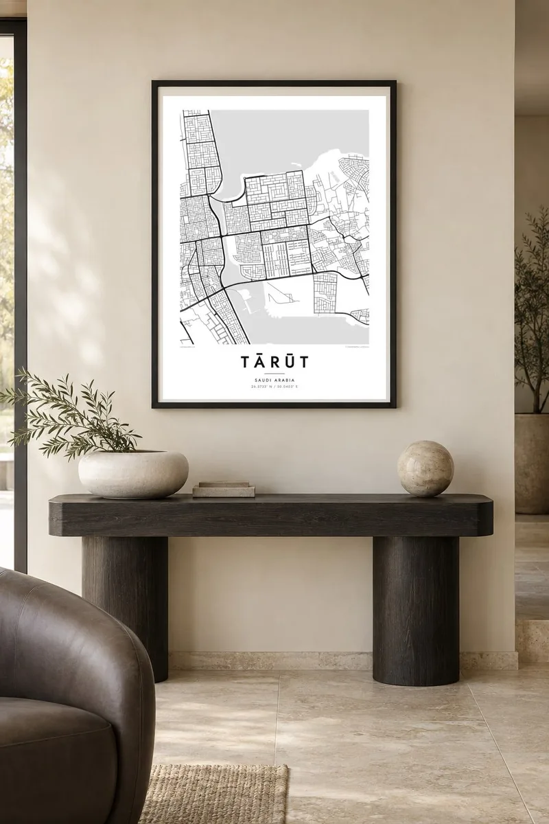


Ko e mape
Tārūt lies on an island just off the coast of Qatif in Saudi Arabia's Eastern Province, and the map makes that setting obvious straight away. Water and tidal flats surround the settlement, and causeways tie it to the mainland. The streets are densest in the historic core. Toward the shore they loosen into newer residential blocks, and in places they give way to former palm groves.
The island is one of the oldest inhabited places in the Arabian Peninsula, with archaeological finds going back thousands of years. At its centre stands Tarut Castle, a fortress on a raised mound above an ancient settlement site. On a map this shows up as a tight knot of irregular lanes. The streets around it grow more regular as the town spreads toward the coast.
A Tārūt map poster frames the island against the surrounding sea, so the coastline becomes the defining shape. The causeway lines give the composition a clear direction, pointing back toward Qatif and the mainland. Inside the outline, the contrast between the winding old quarter and the straighter modern streets gives the print depth without any added decoration.
The irregular coastline and the shallow waters around it frame the whole town, turning Tārūt into a self-contained shape on the page.
Around Tarut Castle the lanes bend and narrow, forming the densest and oldest-looking part of the street pattern.
Straight roads across the water connect the island to Qatif and give the map a strong line reaching toward the mainland.
Taute ke ha hau
Lafi e aho, taha higoa po ke taha kupu haau, hiki e fakatino, lahi po ke tuaga.
Ko e kitiaaga nakai totogi kua tote e maaliali mo e fakamailoga vai. Ko e tau lolomi mo e tau faila HD kua taute ke he 300 DPI, hokotia ke he 7,200 × 10,800 px, nakai fai fakamailoga vai.
Ko e ha Tārūt
Tārūt means a lot to families with deep roots in the Qatif region, and to anyone interested in the long human history of the Gulf coast. An island map makes a quiet, recognisable piece for a majlis, a study or a hallway.
Add your own title and subtitle, perhaps a family name or a year, and adjust the coordinates line. Then choose from Classic black & white, Noir, Paper, Blueprint and Sand. Sand and Paper both suit the coastal setting.
Talaage e poster Tārūt| Lahi he lolomi | Maama | Tau faila |
|---|---|---|
| 30 × 40 cm11.8 × 15.7″ | 3,543 × 4,724 px | PNG · PDF |
| 29.7 × 42 cm (A3)11.7 × 16.5″ | 3,508 × 4,961 px | PNG · PDF |
| 42 × 59.4 cm (A2)16.5 × 23.4″ | 4,961 × 7,016 px | PNG · PDF |
| 45.7 × 61 cm18 × 24″ | 5,400 × 7,200 px | PNG · PDF |
| 50 × 70 cm19.7 × 27.6″ | 5,906 × 8,268 px | PNG · PDF |
| 61 × 91.4 cm24 × 36″ | 7,200 × 10,800 px | PNG · PDF |
Ke fakatatai, ko e fakatino noa kua 900 px e laulahi, fai fakamailoga mo e mo e tau mata komipiuta ni. Ko e tau faila HD kua ato hoko ke he 8× e maama ke he tau faahi takitaha mo e lolomi mitaki he lahi katoa he fakatino.
Fifili e taha puhala i luga he kupega, ti fifili e Poster Lolomi — e lahi mo e, kaeke ke manako ai koe, taha poloka — po ke Tau Faila HD Fakaeletonika. Ko e fakaotiaga totogi ko e taha gahua ni, ti ko e kupega he hau a talaaga ka fakafou fakahaga i mua he fakaotiaga e totogi.
Kua lolomi ai ke he pepa mitaki 200 gsm matte he taha he tau lahi ono, mai he 30 × 40 cm ke hoko ke he 24 × 36″. Kamata e tau poster lolomi mai he $39, kua putoia ai e utaaga.
E. Fifili e poloka akau malolō ke he lanu uli, tea, akau oki mooli, po ke akau pouli. Kua fakalataha mo e sioga malolō nakai malepe ti kua mautali ke tautau. Kamata e tau poster poloka mai he $99, kua putoia ai e utaaga.
Nakai totogi e fakafano ke he motu 60+. Ko e fakatino taha kua lolomi he fenoga lolomi ha mautolu kua tata mo e tau motu 30+, kua hoko mai he tau aho gahua 3–7. Maeke ia koe ke kikite e tuaga mo e fakamuitua he lalo he Haku Tau Fakatonu. Ke he falu motu kua 2–5 e tau tapu, ti ka nakai fakafano a mautolu ki ai, to fakaha he api tupe ia ki mua he totogi.
Fakafano mai e taha ata ki a mautolu he loto he 14 e tau aho tali mai he hokoaga, ti to lolomi foki e mautolu nakai totogi po ke liu atu e totogi ki a koe.
E. He editor i luga he kupega nei, hikihiki e matakupu, e matakupu lalo mo e laini coordinates ke he taha mena kua manako a koe ki ai, ti fifili e puhala mo e lahi. Ko e tau talaaga lolomi, poloka mo e fakaeletonika oti kua fakaaoga tonu e hau a fakatino.
Ma e $9 ka moua e koe e tau faila PNG 300 DPI mo e PDF kua mautali ke lolomi he tau lahi ono oti, nakai fai fakamailoga vai, ke lolomi i fe mena. Nakai maopoopo agaia? Utu hifo fakamua e kitiaaga nakai totogi ne fai fakamailoga vai.
