Canal network
Irrigation canals run through and around the city, drawing long lines across the map that link Urganch to the fields of the oasis and the river that feeds them.
Fakatino mape mukamuka · Uzbekistan
41.5518° N / 60.6314° E
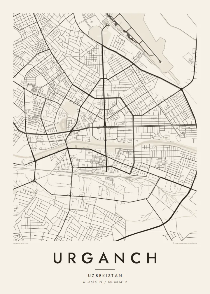
A Soviet-era grid set among irrigated fields and canals in the Khorezm oasis, near the lower reaches of the Amu Darya.




Taha e taone, lima e onoonoaga
Tapaki e taha puhala ke kitia ai ki luga he puipui. Kua tatai e totogi he tau puhala oti — pete he lolomi, poloka, po ke faila HD.
 Tau pikselo mooli · faila lolomi 24 × 36″
Maama mitaki ke lolomi
Ko e 100% e fahi mooli mai he faila lolomi. Ko e tau poster oti — pete kua lolomi, poloka, po ke utu hifo — kua taute ke he ha mautolu a tau tokoluga (server) ke he 300 DPI, hokotia ke he 7,200 × 10,800 piksela, ke maeke ai e tau ala ikiiki tote ke maaliali fakamitaki he lolomi 24 × 36″.
He Pā


Ko e mape
Urganch, often written Urgench, is the administrative centre of Uzbekistan's Xorazm Region, which occupies an oasis on the lower Amu Darya. The modern city was largely laid out in the twentieth century, and from above it reads as a regular grid of wide avenues and broad blocks. Around it, the land is divided by irrigation canals and field boundaries into a fine patchwork that stretches toward the river and the desert beyond.
The city should not be confused with Kunya-Urgench, the ancient Khwarazmian capital that lies across the border in Turkmenistan. Today's Urganch is best known as the gateway to Khiva, whose walled inner town, Itchan Kala, is a UNESCO World Heritage Site about 30 kilometres to the southwest. Cotton has long been the main crop of the surrounding oasis, fed by water drawn from the Amu Darya.
An Urganch map poster shows a city shaped by water in a dry landscape. Canals cut through and around the grid in long, gentle lines, and the fields outside create a texture of their own. Pulled back far enough, the frame can include the river to the north and east, turning the print into a portrait of the oasis rather than just the town.
Irrigation canals run through and around the city, drawing long lines across the map that link Urganch to the fields of the oasis and the river that feeds them.
The centre follows a twentieth-century plan of straight, generous avenues and large rectangular blocks, giving the core a strong geometric structure on the page.
The broad, braided course of the Amu Darya lies a short distance from the city, a pale ribbon that marks the edge of the irrigated Khorezm oasis.
Taute ke ha hau
Lafi e aho, taha higoa po ke taha kupu haau, hiki e fakatino, lahi po ke tuaga.
Ko e kitiaaga nakai totogi kua tote e maaliali mo e fakamailoga vai. Ko e tau lolomi mo e tau faila HD kua taute ke he 300 DPI, hokotia ke he 7,200 × 10,800 px, nakai fai fakamailoga vai.
Ko e ha Urganch
For people from Xorazm, and for travellers who passed through on the way to Khiva, Urganch is a point of arrival and departure. Its map, with canals and fields around a clear grid, makes a thoughtful gift or a reminder of a long journey.
Personalise the title, subtitle and coordinates line, for instance with a family name or the date of a trip, and pick Classic black & white, Noir, Paper, Blueprint or Sand. A free watermarked preview lets you check the layout before buying.
Talaage e poster Urganch| Lahi he lolomi | Maama | Tau faila |
|---|---|---|
| 30 × 40 cm11.8 × 15.7″ | 3,543 × 4,724 px | PNG · PDF |
| 29.7 × 42 cm (A3)11.7 × 16.5″ | 3,508 × 4,961 px | PNG · PDF |
| 42 × 59.4 cm (A2)16.5 × 23.4″ | 4,961 × 7,016 px | PNG · PDF |
| 45.7 × 61 cm18 × 24″ | 5,400 × 7,200 px | PNG · PDF |
| 50 × 70 cm19.7 × 27.6″ | 5,906 × 8,268 px | PNG · PDF |
| 61 × 91.4 cm24 × 36″ | 7,200 × 10,800 px | PNG · PDF |
Ke fakatatai, ko e fakatino noa kua 900 px e laulahi, fai fakamailoga mo e mo e tau mata komipiuta ni. Ko e tau faila HD kua ato hoko ke he 8× e maama ke he tau faahi takitaha mo e lolomi mitaki he lahi katoa he fakatino.
Fifili e taha puhala i luga he kupega, ti fifili e Poster Lolomi — e lahi mo e, kaeke ke manako ai koe, taha poloka — po ke Tau Faila HD Fakaeletonika. Ko e fakaotiaga totogi ko e taha gahua ni, ti ko e kupega he hau a talaaga ka fakafou fakahaga i mua he fakaotiaga e totogi.
Kua lolomi ai ke he pepa mitaki 200 gsm matte he taha he tau lahi ono, mai he 30 × 40 cm ke hoko ke he 24 × 36″. Kamata e tau poster lolomi mai he $39, kua putoia ai e utaaga.
E. Fifili e poloka akau malolō ke he lanu uli, tea, akau oki mooli, po ke akau pouli. Kua fakalataha mo e sioga malolō nakai malepe ti kua mautali ke tautau. Kamata e tau poster poloka mai he $99, kua putoia ai e utaaga.
Nakai totogi e fakafano ke he motu 60+. Ko e fakatino taha kua lolomi he fenoga lolomi ha mautolu kua tata mo e tau motu 30+, kua hoko mai he tau aho gahua 3–7. Maeke ia koe ke kikite e tuaga mo e fakamuitua he lalo he Haku Tau Fakatonu. Ke he falu motu kua 2–5 e tau tapu, ti ka nakai fakafano a mautolu ki ai, to fakaha he api tupe ia ki mua he totogi.
Fakafano mai e taha ata ki a mautolu he loto he 14 e tau aho tali mai he hokoaga, ti to lolomi foki e mautolu nakai totogi po ke liu atu e totogi ki a koe.
E. He editor i luga he kupega nei, hikihiki e matakupu, e matakupu lalo mo e laini coordinates ke he taha mena kua manako a koe ki ai, ti fifili e puhala mo e lahi. Ko e tau talaaga lolomi, poloka mo e fakaeletonika oti kua fakaaoga tonu e hau a fakatino.
Ma e $9 ka moua e koe e tau faila PNG 300 DPI mo e PDF kua mautali ke lolomi he tau lahi ono oti, nakai fai fakamailoga vai, ke lolomi i fe mena. Nakai maopoopo agaia? Utu hifo fakamua e kitiaaga nakai totogi ne fai fakamailoga vai.
Tata mai
