Huangshui valley
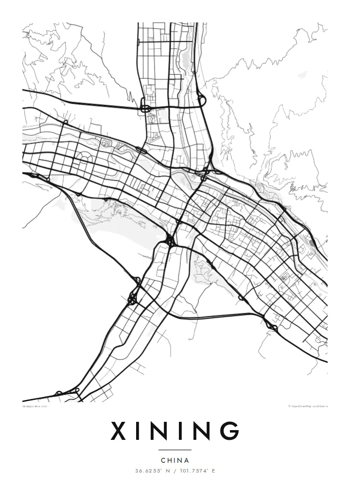
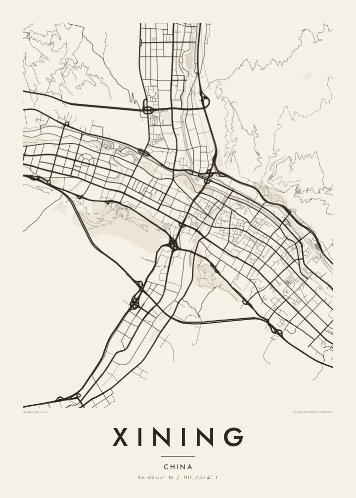
The main river runs east to west through the city, and the densest streets follow its floor in a long, narrow band that defines the whole map.
Fakatino mape mukamuka · China
36.6255° N / 101.7574° E
A high-altitude valley city stretched along the Huangshui River, hemmed in by bare hills at the Tibetan Plateau's edge.



Taha e taone, lima e onoonoaga
Tapaki e taha puhala ke kitia ai ki luga he puipui. Kua tatai e totogi he tau puhala oti — pete he lolomi, poloka, po ke faila HD.
 Tau pikselo mooli · faila lolomi 24 × 36″
Maama mitaki ke lolomi
Ko e 100% e fahi mooli mai he faila lolomi. Ko e tau poster oti — pete kua lolomi, poloka, po ke utu hifo — kua taute ke he ha mautolu a tau tokoluga (server) ke he 300 DPI, hokotia ke he 7,200 × 10,800 piksela, ke maeke ai e tau ala ikiiki tote ke maaliali fakamitaki he lolomi 24 × 36″.
He Pā


Ko e mape
Xining, the capital of Qinghai province, sits at more than 2,200 metres on the northeastern edge of the Tibetan Plateau. The city occupies the valley of the Huangshui River, a tributary of the Yellow River, and several smaller valleys that join it. On a map this gives Xining a stretched, branching shape, with long east–west streets squeezed between steep hills on either side.
Where the valleys meet, the city centre spreads out a little more, forming a denser core of blocks around the old town. The Dongguan Grand Mosque, one of the largest in northwest China, stands in the eastern part of the centre, reflecting the city's large Hui Muslim community. Development follows the valleys outward, while the slopes above remain largely unbuilt.
Xining is the starting point of the Qinghai–Tibet railway toward Lhasa and a common gateway for travellers heading to Qinghai Lake. Nearby, Kumbum Monastery is one of the major centres of Tibetan Buddhism. A Xining map poster shows the city as its valleys have shaped it, a long urban ribbon with hills rising close on every side.
The main river runs east to west through the city, and the densest streets follow its floor in a long, narrow band that defines the whole map.
Side valleys from the north and south join the main one near the centre, giving Xining a cross-like outline with arms of development reaching into the hills.
Steep slopes on either side of the valleys stay mostly empty, leaving wide blank areas on the poster that make the ribbon of streets stand out.
Taute ke ha hau
Lafi e aho, taha higoa po ke taha kupu haau, hiki e fakatino, lahi po ke tuaga.
Ko e kitiaaga nakai totogi kua tote e maaliali mo e fakamailoga vai. Ko e tau lolomi mo e tau faila HD kua taute ke he 300 DPI, hokotia ke he 7,200 × 10,800 px, nakai fai fakamailoga vai.
Ko e ha Xining
Xining is a crossroads of cultures and routes, and for people who lived, worked or travelled there, a map of its valley shape is a distinctive memento. It also appeals to anyone with a connection to Qinghai and the plateau.
Add a title, a subtitle such as a date or a journey, and your own coordinates line. Choose one of five styles, from Classic black & white to Blueprint, then download HD files in six print sizes or order a matte print with an optional wooden frame.
Talaage e poster Xining| Lahi he lolomi | Maama | Tau faila |
|---|---|---|
| 30 × 40 cm11.8 × 15.7″ | 3,543 × 4,724 px | PNG · PDF |
| 29.7 × 42 cm (A3)11.7 × 16.5″ | 3,508 × 4,961 px | PNG · PDF |
| 42 × 59.4 cm (A2)16.5 × 23.4″ | 4,961 × 7,016 px | PNG · PDF |
| 45.7 × 61 cm18 × 24″ | 5,400 × 7,200 px | PNG · PDF |
| 50 × 70 cm19.7 × 27.6″ | 5,906 × 8,268 px | PNG · PDF |
| 61 × 91.4 cm24 × 36″ | 7,200 × 10,800 px | PNG · PDF |
Ke fakatatai, ko e fakatino noa kua 900 px e laulahi, fai fakamailoga mo e mo e tau mata komipiuta ni. Ko e tau faila HD kua ato hoko ke he 8× e maama ke he tau faahi takitaha mo e lolomi mitaki he lahi katoa he fakatino.
Fifili e taha puhala i luga he kupega, ti fifili e Poster Lolomi — e lahi mo e, kaeke ke manako ai koe, taha poloka — po ke Tau Faila HD Fakaeletonika. Ko e fakaotiaga totogi ko e taha gahua ni, ti ko e kupega he hau a talaaga ka fakafou fakahaga i mua he fakaotiaga e totogi.
Kua lolomi ai ke he pepa mitaki 200 gsm matte he taha he tau lahi ono, mai he 30 × 40 cm ke hoko ke he 24 × 36″. Kamata e tau poster lolomi mai he $39, kua putoia ai e utaaga.
E. Fifili e poloka akau malolō ke he lanu uli, tea, akau oki mooli, po ke akau pouli. Kua fakalataha mo e sioga malolō nakai malepe ti kua mautali ke tautau. Kamata e tau poster poloka mai he $99, kua putoia ai e utaaga.
Nakai totogi e fakafano ke he motu 60+. Ko e fakatino taha kua lolomi he fenoga lolomi ha mautolu kua tata mo e tau motu 30+, kua hoko mai he tau aho gahua 3–7. Maeke ia koe ke kikite e tuaga mo e fakamuitua he lalo he Haku Tau Fakatonu. Ke he falu motu kua 2–5 e tau tapu, ti ka nakai fakafano a mautolu ki ai, to fakaha he api tupe ia ki mua he totogi.
Fakafano mai e taha ata ki a mautolu he loto he 14 e tau aho tali mai he hokoaga, ti to lolomi foki e mautolu nakai totogi po ke liu atu e totogi ki a koe.
E. He editor i luga he kupega nei, hikihiki e matakupu, e matakupu lalo mo e laini coordinates ke he taha mena kua manako a koe ki ai, ti fifili e puhala mo e lahi. Ko e tau talaaga lolomi, poloka mo e fakaeletonika oti kua fakaaoga tonu e hau a fakatino.
Ma e $9 ka moua e koe e tau faila PNG 300 DPI mo e PDF kua mautali ke lolomi he tau lahi ono oti, nakai fai fakamailoga vai, ke lolomi i fe mena. Nakai maopoopo agaia? Utu hifo fakamua e kitiaaga nakai totogi ne fai fakamailoga vai.
