Market centre
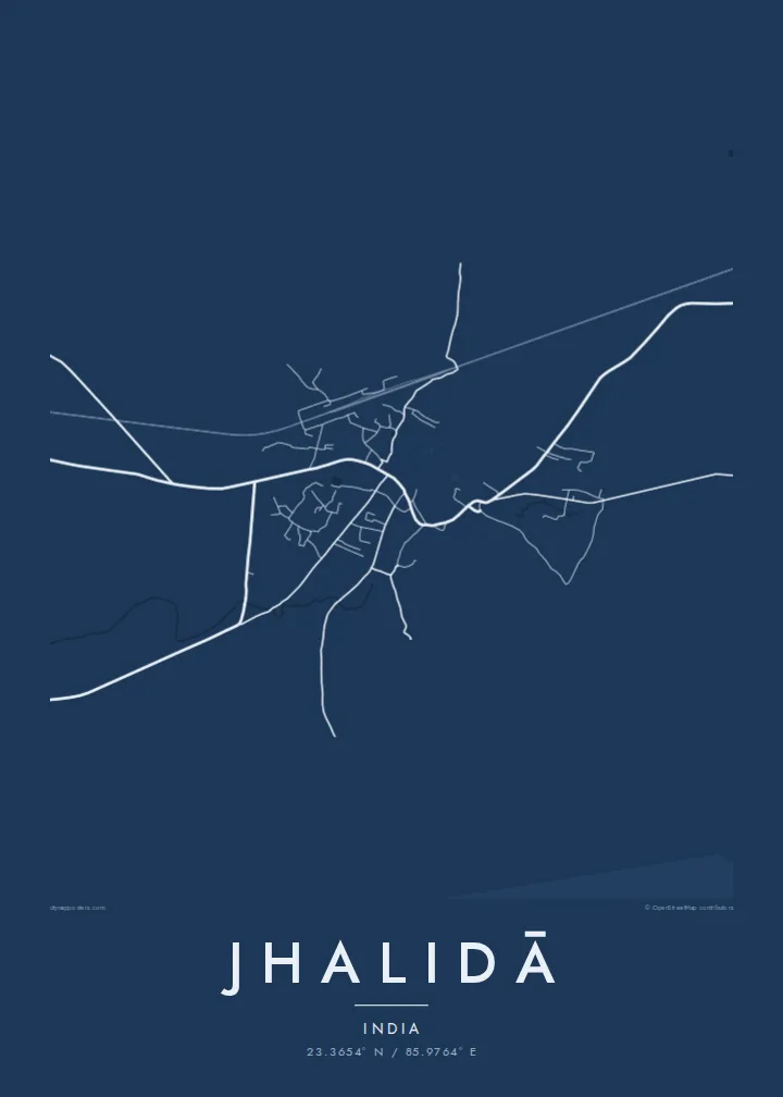
The heart of Jhalidā is a dense cluster of lanes and shops that serves nearby villages, forming the busiest and most detailed part of the map.
Minimalistische kaartposter · India
23.3654° N / 85.9764° E
A small town on the Chota Nagpur plateau near the Jharkhand border, with roads winding through rolling farmland



Eén stad, vijf sferen
Tik op een stijl om hem aan de muur te zien. Elke stijl kost hetzelfde — geprint, ingelijst of als HD-bestanden.
 Werkelijke pixels · 24 × 36″ printbestand
Haarscherp gedrukt
Dit is een uitsnede op ware grootte van het echte printbestand. Elke poster — geprint, ingelijst of gedownload — wordt op onze servers gerenderd op 300 DPI, tot 7,200 × 10,800 pixels, zodat zelfs de kleinste straatjes scherp blijven op een print van 24 × 36″.
Aan de muur


De kaart
Jhalidā, often written Jhalda, lies in Purulia district in the far west of West Bengal, close to the border with Jharkhand. The town sits on the eastern edge of the Chota Nagpur plateau, a landscape of low hills, laterite soil and scattered forest. From above, it is a compact cluster of streets surrounded by fields and small water bodies.
The town serves as a local market centre for the surrounding villages. Its streets are not laid out on a grid but follow the gentle terrain, curving and branching as they leave the centre. A railway line passes nearby, adding a long straight stroke to the map.
A Jhalidā map poster shows a small plateau town in its setting. The busy centre forms a tight knot of lines, while the surrounding countryside is sparse and open. The result is a calm design with plenty of room around the town, well suited to the Paper or Classic black & white styles.
The heart of Jhalidā is a dense cluster of lanes and shops that serves nearby villages, forming the busiest and most detailed part of the map.
Around the town, the undulating land of the Chota Nagpur plateau is dotted with fields and ponds, giving the poster a quiet, open border.
Roads leave the centre on curving paths that follow the terrain, linking Jhalidā to the surrounding villages and to the border region with Jharkhand.
Maak hem persoonlijk
Voeg een datum, een naam of je eigen tekst toe, en wissel van stijl, formaat of oriëntatie.
De gratis voorbeeldweergave is lage resolutie met watermerk. Prints en HD-bestanden worden gerenderd op 300 DPI, tot 7,200 × 10,800 px, zonder watermerk.
Waarom Jhalidā
For families from Purulia or anyone who grew up in this corner of West Bengal, Jhalidā's map is a familiar outline worth keeping on the wall. It is a personal image rather than a tourist souvenir, and that is what makes it meaningful.
Personalise the title, subtitle and coordinates line to mark a family home or an important date. Choose from five styles and download HD print files for $9, or order a printed poster with an optional wooden frame.
Bestel de poster Jhalidā| Printformaat | Resolutie | Bestanden |
|---|---|---|
| 30 × 40 cm (11.8 × 15.7″) | 3,543 × 4,724 px | PNG · PDF |
| 29.7 × 42 cm (A3, 11.7 × 16.5″) | 3,508 × 4,961 px | PNG · PDF |
| 42 × 59.4 cm (A2, 16.5 × 23.4″) | 4,961 × 7,016 px | PNG · PDF |
| 45.7 × 61 cm (18 × 24″) | 5,400 × 7,200 px | PNG · PDF |
| 50 × 70 cm (19.7 × 27.6″) | 5,906 × 8,268 px | PNG · PDF |
| 61 × 91.4 cm (24 × 36″) | 7,200 × 10,800 px | PNG · PDF |
Ter vergelijking: de gratis preview is 900 px breed, heeft een watermerk en is bedoeld voor schermen. De HD-bestanden hebben tot 8× de resolutie in elke richting en worden haarscherp geprint op volledig posterformaat.
Kies bovenaan de pagina een stijl en kies dan voor Geprinte Poster — een formaat en eventueel een lijst — of Digitale HD-bestanden. Afrekenen kost één stap, en je bestelpagina wordt direct bijgewerkt zodra de betaling is verwerkt.
Hij wordt geprint op premium mat papier van 200 g/m² in een van zes formaten, van 30 × 40 cm tot 24 × 36″. Geprinte posters beginnen vanaf {printFrom}, verzending inbegrepen.
Ja. Kies een massief houten lijst in zwart, wit, natuurlijk eiken of donker hout. Inclusief breukvast glas en direct op te hangen. Ingelijste posters beginnen vanaf {framedFrom}, verzending inbegrepen.
Verzending is wereldwijd gratis. Elke poster wordt gedrukt door de dichtstbijzijnde van onze drukpartners in meer dan 30 landen en is meestal binnen 3–7 werkdagen bij je. Je volgt de status en track & trace onder Mijn bestellingen. In een paar landen duurt het 2–5 weken, en waar we nog niet naartoe verzenden, laat de site dat je zien voordat je betaalt.
Stuur ons binnen 14 dagen na levering een foto en we printen hem gratis opnieuw of betalen je terug.
Ja. Pas in de editor op deze pagina de titel, de ondertitel en de coördinatenregel aan zoals je wilt, en kies een stijl en formaat. Geprinte, ingelijste en digitale bestellingen gebruiken allemaal precies jouw ontwerp.
Voor $9 krijg je PNG-bestanden op 300 DPI en printklare PDF's in alle zes formaten, zonder watermerk, om overal te printen. Nog niet zeker? Download eerst een gratis voorbeeld met watermerk.
In de buurt
