Main through-road
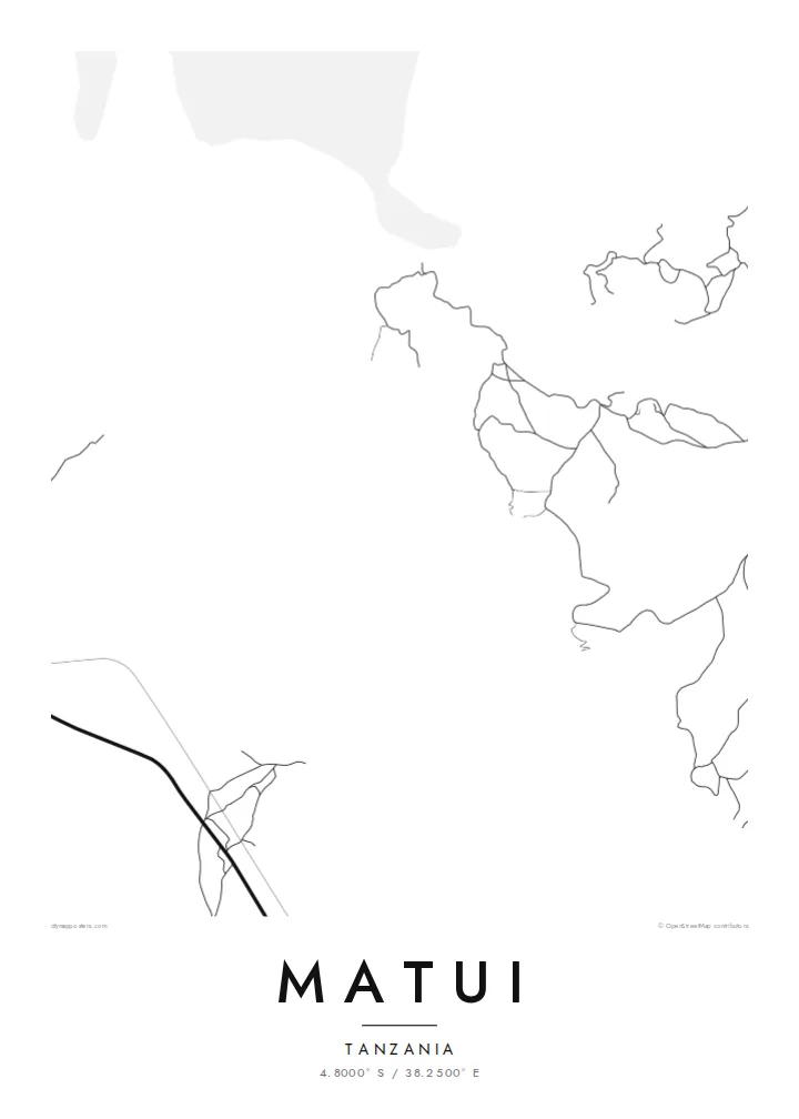
The principal road crosses the area and joins Matui to surrounding towns. On the poster it is the strongest line, with smaller routes hanging off it.
Minimalistische kaartposter · Tanzania
4.8000° S / 38.2500° E
A settlement among the hills of inland Tanga Region, linked by winding roads and footpaths across cultivated slopes.


Eén stad, vijf sferen
Tik op een stijl om hem aan de muur te zien. Elke stijl kost hetzelfde — geprint, ingelijst of als HD-bestanden.
 Werkelijke pixels · 24 × 36″ printbestand
Haarscherp gedrukt
Dit is een uitsnede op ware grootte van het echte printbestand. Elke poster — geprint, ingelijst of gedownload — wordt op onze servers gerenderd op 300 DPI, tot 7,200 × 10,800 pixels, zodat zelfs de kleinste straatjes scherp blijven op een print van 24 × 36″.
Aan de muur


De kaart
Matui is a community in the Tanga Region of northeastern Tanzania, inland from the coast among hills and farmland. The settlement is not laid out on a formal grid. Homes and plots are spread along roads and paths that follow the lie of the land, giving the map an organic, uneven pattern.
A few main routes carry traffic through the area and connect Matui to neighbouring villages and larger towns. From these, narrower tracks branch off toward fields and homesteads, bending around slopes and crossing small valleys. Most of the frame is farmland and open ground, with built-up areas in modest clusters.
Detailed records of Matui are sparse, so a Matui map poster is mainly a portrait of place: the pattern of roads and paths people use every day, set in the hill country of inland Tanga. For those with personal ties here, that simple geography is what matters.
The principal road crosses the area and joins Matui to surrounding towns. On the poster it is the strongest line, with smaller routes hanging off it.
Footpaths and tracks wind across the slopes toward homes and fields, forming a fine, irregular network that follows the terrain.
Farmland fills much of the frame with open space. It highlights how rural this part of Tanga Region is and how lightly the settlement sits on it.
Maak hem persoonlijk
Voeg een datum, een naam of je eigen tekst toe, en wissel van stijl, formaat of oriëntatie.
De gratis voorbeeldweergave is lage resolutie met watermerk. Prints en HD-bestanden worden gerenderd op 300 DPI, tot 7,200 × 10,800 px, zonder watermerk.
Waarom Matui
A map of Matui is a personal object, meaningful to people born there, families with roots in the area, or visitors who spent time in the community. It records a place that seldom appears on printed maps.
Set your own title, subtitle and coordinates line, for example a family name or the year of a visit. Then choose from Classic black & white, Noir, Paper, Blueprint and Sand, and download HD files or order a print.
Bestel de poster Matui| Printformaat | Resolutie | Bestanden |
|---|---|---|
| 30 × 40 cm (11.8 × 15.7″) | 3,543 × 4,724 px | PNG · PDF |
| 29.7 × 42 cm (A3, 11.7 × 16.5″) | 3,508 × 4,961 px | PNG · PDF |
| 42 × 59.4 cm (A2, 16.5 × 23.4″) | 4,961 × 7,016 px | PNG · PDF |
| 45.7 × 61 cm (18 × 24″) | 5,400 × 7,200 px | PNG · PDF |
| 50 × 70 cm (19.7 × 27.6″) | 5,906 × 8,268 px | PNG · PDF |
| 61 × 91.4 cm (24 × 36″) | 7,200 × 10,800 px | PNG · PDF |
Ter vergelijking: de gratis preview is 900 px breed, heeft een watermerk en is bedoeld voor schermen. De HD-bestanden hebben tot 8× de resolutie in elke richting en worden haarscherp geprint op volledig posterformaat.
Kies bovenaan de pagina een stijl en kies dan voor Geprinte Poster — een formaat en eventueel een lijst — of Digitale HD-bestanden. Afrekenen kost één stap, en je bestelpagina wordt direct bijgewerkt zodra de betaling is verwerkt.
Hij wordt geprint op premium mat papier van 200 g/m² in een van zes formaten, van 30 × 40 cm tot 24 × 36″. Geprinte posters beginnen vanaf $39, verzending inbegrepen.
Ja. Kies een massief houten lijst in zwart, wit, natuurlijk eiken of donker hout. Inclusief breukvast glas en direct op te hangen. Ingelijste posters beginnen vanaf $99, verzending inbegrepen.
Verzending is wereldwijd gratis. Elke poster wordt gedrukt door de dichtstbijzijnde van onze drukpartners in meer dan 30 landen en is meestal binnen 3–7 werkdagen bij je. Je volgt de status en track & trace onder Mijn bestellingen. In een paar landen duurt het 2–5 weken, en waar we nog niet naartoe verzenden, laat de site dat je zien voordat je betaalt.
Stuur ons binnen 14 dagen na levering een foto en we printen hem gratis opnieuw of betalen je terug.
Ja. Pas in de editor op deze pagina de titel, de ondertitel en de coördinatenregel aan zoals je wilt, en kies een stijl en formaat. Geprinte, ingelijste en digitale bestellingen gebruiken allemaal precies jouw ontwerp.
Voor $9 krijg je PNG-bestanden op 300 DPI en printklare PDF's in alle zes formaten, zonder watermerk, om overal te printen. Nog niet zeker? Download eerst een gratis voorbeeld met watermerk.
