The historic hill
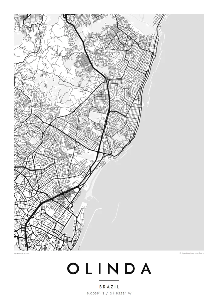
The old town's streets twist over and around the hills, forming an irregular web that stands out clearly against the straighter blocks of the surrounding districts.
Minimalistische kaartposter · Brazilië
8.0089° S / 34.8553° W
Colonial lanes climbing green hills above the Atlantic, with the larger grid of Recife pressing close to the south.


Eén stad, vijf sferen
Tik op een stijl om hem aan de muur te zien. Elke stijl kost hetzelfde — geprint, ingelijst of als HD-bestanden.
 Werkelijke pixels · 24 × 36″ printbestand
Haarscherp gedrukt
Dit is een uitsnede op ware grootte van het echte printbestand. Elke poster — geprint, ingelijst of gedownload — wordt op onze servers gerenderd op 300 DPI, tot 7,200 × 10,800 pixels, zodat zelfs de kleinste straatjes scherp blijven op een print van 24 × 36″.
Aan de muur


De kaart
Olinda sits on a cluster of hills just north of Recife, and its map is unlike the flat grids of many Brazilian coastal cities. The historic centre is a knot of short, winding streets that bend around the slopes, linking churches and convents set on the high points, while the land drops toward the ocean on the eastern side.
Founded by the Portuguese in the 1530s, the town was one of the earliest colonial centres in Brazil, and its historic core was listed as a UNESCO World Heritage Site in 1982. From the hilltop square of Alto da Sé, the view reaches across tiled rooftops and gardens to the sea and the high-rises of Recife.
An Olinda map poster shows the contrast between that irregular old core and the more regular neighbourhoods that spread north along the coast. Beyond its architecture, the town is famous for its street carnival, when giant puppets are carried through the same steep lanes the map traces in fine black lines.
The old town's streets twist over and around the hills, forming an irregular web that stands out clearly against the straighter blocks of the surrounding districts.
A long coastline runs along the eastern edge, with beaches and seafront roads tracing a gentle line that frames the city from the ocean side.
To the south, Olinda merges into Recife with no visible break, so the map carries the sense of a small historic town attached to a much larger metropolis.
Maak hem persoonlijk
Voeg een datum, een naam of je eigen tekst toe, en wissel van stijl, formaat of oriëntatie.
De gratis voorbeeldweergave is lage resolutie met watermerk. Prints en HD-bestanden worden gerenderd op 300 DPI, tot 7,200 × 10,800 px, zonder watermerk.
Waarom Olinda
Olinda is a place people remember through their feet: the climbs, the church steps, the carnival crowds. A map of those lanes makes a fitting keepsake of a trip to Pernambuco, a honeymoon, or a family with roots in the northeast of Brazil.
Add a title, a subtitle such as a carnival year, and a line of coordinates, then pick one of five styles. Paper and Sand suit the colonial mood, while Noir brings out the web of streets. Files come as a 300 DPI PNG and a print-ready PDF.
Bestel de poster Olinda| Printformaat | Resolutie | Bestanden |
|---|---|---|
| 30 × 40 cm11.8 × 15.7″ | 3,543 × 4,724 px | PNG · PDF |
| 29.7 × 42 cm (A3)11.7 × 16.5″ | 3,508 × 4,961 px | PNG · PDF |
| 42 × 59.4 cm (A2)16.5 × 23.4″ | 4,961 × 7,016 px | PNG · PDF |
| 45.7 × 61 cm18 × 24″ | 5,400 × 7,200 px | PNG · PDF |
| 50 × 70 cm19.7 × 27.6″ | 5,906 × 8,268 px | PNG · PDF |
| 61 × 91.4 cm24 × 36″ | 7,200 × 10,800 px | PNG · PDF |
Ter vergelijking: de gratis preview is 900 px breed, heeft een watermerk en is bedoeld voor schermen. De HD-bestanden hebben tot 8× de resolutie in elke richting en worden haarscherp geprint op volledig posterformaat.
Kies bovenaan de pagina een stijl en kies dan voor Geprinte Poster — een formaat en eventueel een lijst — of Digitale HD-bestanden. Afrekenen kost één stap, en je bestelpagina wordt direct bijgewerkt zodra de betaling is verwerkt.
Hij wordt geprint op premium mat papier van 200 g/m² in een van zes formaten, van 30 × 40 cm tot 24 × 36″. Geprinte posters beginnen vanaf $39, verzending inbegrepen.
Ja. Kies een massief houten lijst in zwart, wit, natuurlijk eiken of donker hout. Inclusief breukvast glas en direct op te hangen. Ingelijste posters beginnen vanaf $99, verzending inbegrepen.
Verzending is gratis naar 60+ landen. Elke poster wordt gedrukt door de dichtstbijzijnde van onze drukpartners in 30+ landen en komt meestal binnen 3–7 werkdagen aan. Je volgt de status en de tracking onder Mijn bestellingen. In een paar landen duurt het 2–5 weken, en als we nog niet naar jouw land verzenden, laat de site dat zien voordat je betaalt.
Stuur ons binnen 14 dagen na levering een foto en we printen hem gratis opnieuw of betalen je terug.
Ja. Pas in de editor op deze pagina de titel, de ondertitel en de coördinatenregel aan zoals je wilt, en kies een stijl en formaat. Geprinte, ingelijste en digitale bestellingen gebruiken allemaal precies jouw ontwerp.
Voor $9 krijg je PNG-bestanden op 300 DPI en printklare PDF's in alle zes formaten, zonder watermerk, om overal te printen. Nog niet zeker? Download eerst een gratis voorbeeld met watermerk.
In de buurt
