Main highway
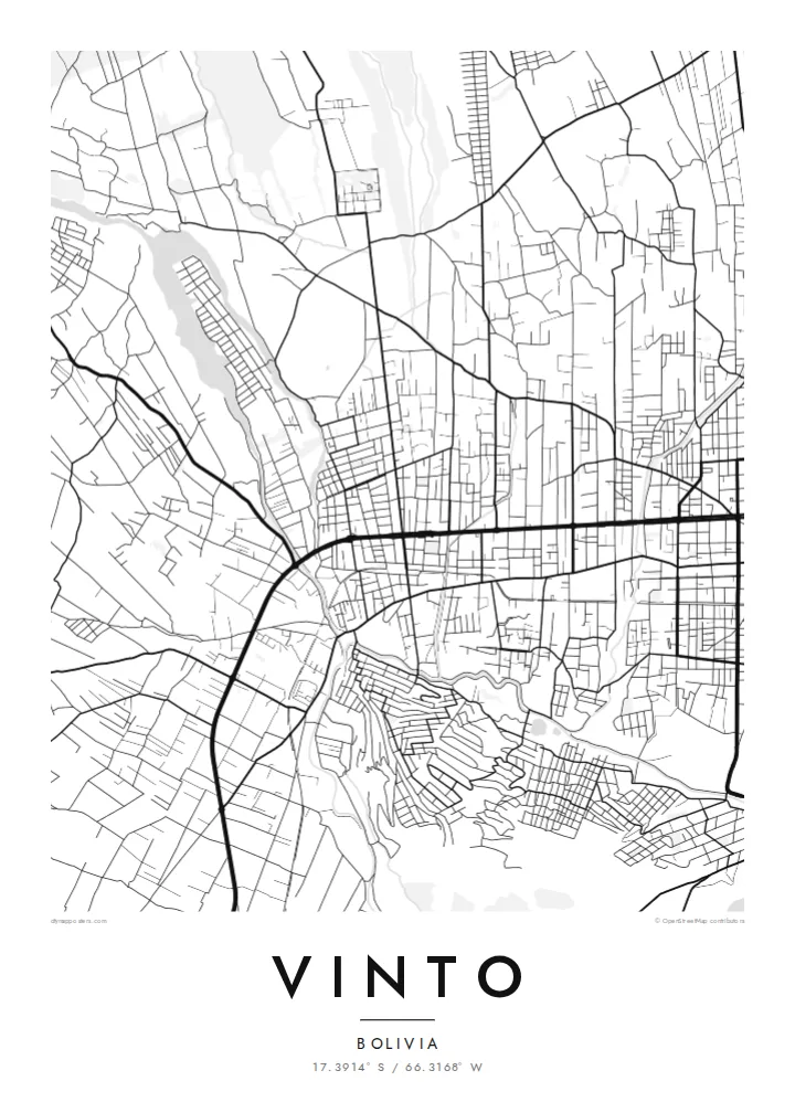
The road running west from Cochabamba passes through Vinto in a long, straight line, the backbone of the town and the clearest feature on the map.
Minimalistische kaartposter · Bolivia
17.3914° S / 66.3168° W
A valley town west of Cochabamba, stretched along the highway between farmland, riverbeds and the Tunari range.


Eén stad, vijf sferen
Tik op een stijl om hem aan de muur te zien. Elke stijl kost hetzelfde — geprint, ingelijst of als HD-bestanden.
 Werkelijke pixels · 24 × 36″ printbestand
Haarscherp gedrukt
Dit is een uitsnede op ware grootte van het echte printbestand. Elke poster — geprint, ingelijst of gedownload — wordt op onze servers gerenderd op 300 DPI, tot 7,200 × 10,800 pixels, zodat zelfs de kleinste straatjes scherp blijven op een print van 24 × 36″.
Aan de muur


De kaart
Vinto lies in the Cochabamba Valley of central Bolivia, west of the city of Cochabamba, and its map follows the logic of the valley floor. The main highway runs through in a long line, with the town's streets arranged along and around it. On either side, a mix of residential blocks, farm plots and smaller roads fills the flat land, which rises to the north toward the mountains.
The municipality is part of the wider urban area that has grown along the valley west of Cochabamba, linking a chain of towns along the main road. Much of the surrounding land has been farmed for generations, and the Tunari range forms the high northern boundary of the valley, visible from almost anywhere in town.
A Vinto map poster presents a place in transition, where a compact town centre, the strong axis of the highway and a loose pattern of fields and newer housing all meet. The composition is simple and clear, suitable for anyone who grew up in the valley or has family roots in this part of Cochabamba.
The road running west from Cochabamba passes through Vinto in a long, straight line, the backbone of the town and the clearest feature on the map.
A compact area of regular blocks around the central plaza forms the core of the town, denser and more structured than the surrounding land.
Outside the centre, small plots, irrigation channels and dirt roads cover the valley floor, giving the map a light, uneven texture that fades toward the hills.
Maak hem persoonlijk
Voeg een datum, een naam of je eigen tekst toe, en wissel van stijl, formaat of oriëntatie.
De gratis voorbeeldweergave is lage resolutie met watermerk. Prints en HD-bestanden worden gerenderd op 300 DPI, tot 7,200 × 10,800 px, zonder watermerk.
Waarom Vinto
For families from Vinto, many of whom now live in Cochabamba, Santa Cruz, Spain or Argentina, a map of the town is a quiet, lasting reminder of home.
Personalise the title and subtitle, perhaps with a family name or a date, and edit the coordinates line. Pick one of five styles: Classic black & white, Noir, Paper, Blueprint or Sand. Digital files include six print sizes.
Bestel de poster Vinto| Printformaat | Resolutie | Bestanden |
|---|---|---|
| 30 × 40 cm (11.8 × 15.7″) | 3,543 × 4,724 px | PNG · PDF |
| 29.7 × 42 cm (A3, 11.7 × 16.5″) | 3,508 × 4,961 px | PNG · PDF |
| 42 × 59.4 cm (A2, 16.5 × 23.4″) | 4,961 × 7,016 px | PNG · PDF |
| 45.7 × 61 cm (18 × 24″) | 5,400 × 7,200 px | PNG · PDF |
| 50 × 70 cm (19.7 × 27.6″) | 5,906 × 8,268 px | PNG · PDF |
| 61 × 91.4 cm (24 × 36″) | 7,200 × 10,800 px | PNG · PDF |
Ter vergelijking: de gratis preview is 900 px breed, heeft een watermerk en is bedoeld voor schermen. De HD-bestanden hebben tot 8× de resolutie in elke richting en worden haarscherp geprint op volledig posterformaat.
Kies bovenaan de pagina een stijl en kies dan voor Geprinte Poster — een formaat en eventueel een lijst — of Digitale HD-bestanden. Afrekenen kost één stap, en je bestelpagina wordt direct bijgewerkt zodra de betaling is verwerkt.
Hij wordt geprint op premium mat papier van 200 g/m² in een van zes formaten, van 30 × 40 cm tot 24 × 36″. Geprinte posters beginnen vanaf $39, verzending inbegrepen.
Ja. Kies een massief houten lijst in zwart, wit, natuurlijk eiken of donker hout. Inclusief breukvast glas en direct op te hangen. Ingelijste posters beginnen vanaf $99, verzending inbegrepen.
Verzending is wereldwijd gratis. Elke poster wordt gedrukt door de dichtstbijzijnde van onze drukpartners in meer dan 30 landen en is meestal binnen 3–7 werkdagen bij je. Je volgt de status en track & trace onder Mijn bestellingen. In een paar landen duurt het 2–5 weken, en waar we nog niet naartoe verzenden, laat de site dat je zien voordat je betaalt.
Stuur ons binnen 14 dagen na levering een foto en we printen hem gratis opnieuw of betalen je terug.
Ja. Pas in de editor op deze pagina de titel, de ondertitel en de coördinatenregel aan zoals je wilt, en kies een stijl en formaat. Geprinte, ingelijste en digitale bestellingen gebruiken allemaal precies jouw ontwerp.
Voor $9 krijg je PNG-bestanden op 300 DPI en printklare PDF's in alle zes formaten, zonder watermerk, om overal te printen. Nog niet zeker? Download eerst een gratis voorbeeld met watermerk.
