Lac de Créteil
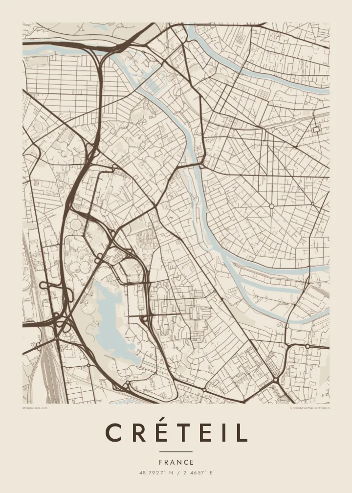
The large artificial lake near the centre of the city forms a smooth, open shape on the map, framed by parks, walkways and residential districts.
Positala ya mapu yosavuta · France
48.7927° N / 2.4657° E
A modern prefecture on a bend of the Marne, planned around a large artificial lake southeast of Paris.


Mzinda umodzi, mawonekedwe asanu
Khudzani sitayelo kuti muwone pa khoma. Masitayelo onse amawononga ndalama zofanana — zosindikizidwa, zokutidwa mu chimango kapena ngati mafayilo a HD.
 Ma pixel enieni · fayilo yosindikiza 24 × 36″
Yowala posindikiza
Awa ndi chithunzi 100% chodulidwa cha fayilo yeniyeni yosindikiza. Poster iliyonse — yosindikizidwa, yokutidwa mu chimango kapena yotsitsidwa — imapangidwa pa maseva athu pa 300 DPI, mpaka ma pixel 7,200 × 10,800, choncho ngakhale misewu yaying'ono kwambiri imakhalabe yowoneka bwino pa kope la 24 × 36″.
Pakhoma


Mapu
Créteil lies southeast of Paris and is the prefecture of the Val-de-Marne department. The Marne River curves along its northern edge, and the map combines an old village core with extensive modern development. The most striking feature is the large artificial lake in the southern part of the city, surrounded by parks, housing and civic buildings.
From the 1960s onward, Créteil was transformed into a new administrative centre, with a prefecture, a university and major housing projects. Among its best-known buildings are the Choux de Créteil, residential towers whose curved balconies resemble cabbage leaves. Line 8 of the Paris Métro ends in the city, linking it directly with the capital.
A Créteil map poster shows a city of contrasts: the curves of the Marne and the islands along its banks, the smooth outline of the lake, and the geometric forms of the planned districts laid out around it. It is an image of postwar ambition shaped by water, a place where modern planning met the landscape of the river valley.
The large artificial lake near the centre of the city forms a smooth, open shape on the map, framed by parks, walkways and residential districts.
The Marne bends around the city's northern edge. Wooded islands and riverside paths add soft curves and form a natural boundary.
Neighbourhoods built from the 1960s onward are laid out in distinctive geometric patterns, from curving slab blocks to clusters of towers around open spaces.
Ipangeni yanu
Onjezani tsiku, dzina kapena mawu anu, sinthani mawonekedwe, kukula kapena momwe yaimira.
Chitsanzo chaulere ndi chotsika mu resolution ndipo chili ndi chizindikiro chothira madzi. Zosindikizidwa ndi mafayilo a HD zimapangidwa pa 300 DPI, mpaka ma px 7,200 × 10,800, popanda chizindikiro chothira madzi.
Chifukwa chiyani Créteil
Students of the university, residents of Val-de-Marne and anyone with ties to the eastern suburbs of Paris hang this map to remember the lake and the river. Its mix of water and modern forms makes an unusually graphic poster.
Personalise the title and subtitle with a neighbourhood, an address or a date, and edit the coordinates line. Choose from five styles, Classic black & white, Noir, Paper, Blueprint and Sand, as HD files or a printed poster shipped from a nearby print partner.
Odara poster ya Créteil| Kukula kosindikiza | Mphamvu ya chithunzi | Mafayilo |
|---|---|---|
| 30 × 40 cm11.8 × 15.7″ | 3,543 × 4,724 px | PNG · PDF |
| 29.7 × 42 cm (A3)11.7 × 16.5″ | 3,508 × 4,961 px | PNG · PDF |
| 42 × 59.4 cm (A2)16.5 × 23.4″ | 4,961 × 7,016 px | PNG · PDF |
| 45.7 × 61 cm18 × 24″ | 5,400 × 7,200 px | PNG · PDF |
| 50 × 70 cm19.7 × 27.6″ | 5,906 × 8,268 px | PNG · PDF |
| 61 × 91.4 cm24 × 36″ | 7,200 × 10,800 px | PNG · PDF |
Poyerekeza, chithunzi chaulere ndi cha 900 px m'lifupi, chili ndi chizindikiro ndipo ndi cha pa sikirini. Mafayilo a HD ali ndi mphamvu yochulukira mpaka 8× mbali iliyonse ndipo amasindikizika bwino pa kukula konse kwa positala.
Sankhani sitayelo kumtunda kwa tsamba, kenako musankhe Poster Yosindikizidwa — kukula ndi, mukafuna, chimango — kapena Mafayilo a Digital HD. Kulipira kumatenga sitepe imodzi, ndipo tsamba la oda yanu limasinthidwa nthawi yomweyo pambuyo pa kulipira.
Imasindikizidwa pa pepala labwino la matte la 200 gsm mu kukula kumodzi mwa zisanu ndi chimodzi, kuyambira 30 × 40 cm mpaka 24 × 36″. Maposita osindikizidwa amayamba pa $39, kutumiza kuphatikizidwa.
Inde. Sankhani chimango cha mtengo wolimba mu utoto wakuda, woyera, oak wachilengedwe kapena mtengo wakuda. Chimabwera ndi galasi losathyoka ndipo chikonzekera kupachikidwa nthawi yomweyo. Maposita a mu chimango amayamba pa $99, kutumiza kuphatikizidwa.
Kutumiza ndi kwaulere kumayiko oposa 60. Positala iliyonse imasindikizidwa ndi mnzathu wosindikiza wapafupi kwambiri mwa anzathu m'mayiko oposa 30, ndipo nthawi zambiri imafika m'masiku 3–7 antchito. Mukhoza kutsatira momwe oda ilili ndi malo ake pa "Maoda Anga". Mayiko ena amatenga masabata 2–5, ndipo kumene sitinayambe kutumiza, tsambali likuuzani musanalipire.
Titumizireni chithunzi masiku 14 kuchokera pa tsiku la kutumiza ndipo tidzaisindikizanso kwaulere kapena kukubwezerani ndalama zanu.
Inde. Mu chida chokonzera pa tsambali, sinthani mutu, mutu wowonjezera ndi mzere wa ma coordinates kukhala chilichonse chomwe mufuna, ndipo sankhani sitayelo ndi kukula. Maoda osindikizidwa, a mu chimango ndi a digital onse amagwiritsa ntchito kapangidwe kanu enieni.
Pa $9 mumalandira mafayilo a PNG a 300 DPI ndi PDF okonzeka kusindikiza mu kukula konse kwa zisanu ndi chimodzi, popanda chizindikiro chothira madzi, kuti musindikize kulikonse. Simunatsimikize? Tsitsani kaye chitsanzo chaulere chokhala ndi chizindikiro chothira madzi.
Pafupi
