Connaught Place
A circular commercial centre built as concentric rings of colonnaded buildings, with roads radiating outward. It is one of the most recognisable geometric shapes in the city.
Positala ya mapu yosavuta · India
28.6519° N / 77.2315° E
A river city of layered capitals, from the walled lanes of Shahjahanabad to the radial avenues of New Delhi


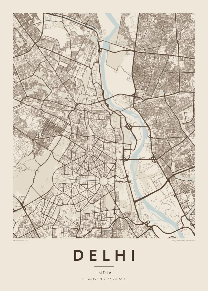
Mzinda umodzi, mawonekedwe asanu
Khudzani sitayelo kuti muwone pa khoma. Masitayelo onse amawononga ndalama zofanana — zosindikizidwa, zokutidwa mu chimango kapena ngati mafayilo a HD.
 Ma pixel enieni · fayilo yosindikiza 24 × 36″
Yowala posindikiza
Awa ndi chithunzi 100% chodulidwa cha fayilo yeniyeni yosindikiza. Poster iliyonse — yosindikizidwa, yokutidwa mu chimango kapena yotsitsidwa — imapangidwa pa maseva athu pa 300 DPI, mpaka ma pixel 7,200 × 10,800, choncho ngakhale misewu yaying'ono kwambiri imakhalabe yowoneka bwino pa kope la 24 × 36″.
Pakhoma


Mapu
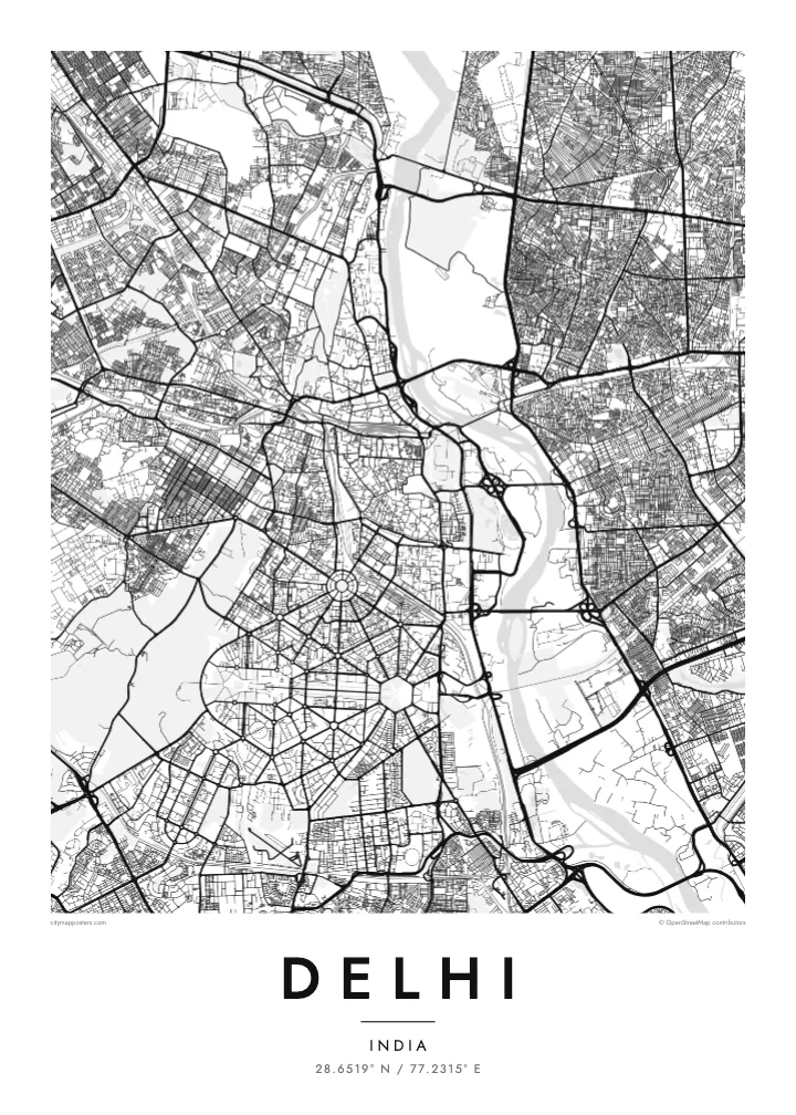
Delhi spreads mainly along the western bank of the Yamuna River, with the forested Ridge, an old extension of the Aravalli hills, running through it from north to south. The city is built in layers, each capital placed beside the last, so the map shows distinct patterns side by side: medieval ruins to the south, the Mughal walled city to the north, and the ordered avenues of New Delhi in between.
Shahjahanabad, now Old Delhi, is a dense web of lanes around the Red Fort and the Jama Masjid, with Chandni Chowk running straight through it. To the south, New Delhi was laid out in the 1910s and 1920s with broad tree-lined avenues, roundabouts and hexagonal blocks. Connaught Place forms a set of concentric circles, and Kartavya Path runs east from Rashtrapati Bhavan to India Gate.
Three UNESCO World Heritage Sites lie within the city: the Red Fort Complex, Humayun’s Tomb and the Qutb Minar with its monuments. A Delhi map poster brings together the contrasts between these eras, the organic lanes of Old Delhi and the formal geometry of the colonial capital, framed by the Ring Road and the Yamuna.
A circular commercial centre built as concentric rings of colonnaded buildings, with roads radiating outward. It is one of the most recognisable geometric shapes in the city.
The ceremonial avenue, formerly Rajpath, runs in a straight line between Rashtrapati Bhavan and India Gate, flanked by lawns and water channels, forming the central axis of New Delhi.
Around the Red Fort and Chandni Chowk, a tight network of lanes and bazaars fills the former walled city, creating the finest, densest texture anywhere on the map.
Ipangeni yanu
Onjezani tsiku, dzina kapena mawu anu, sinthani mawonekedwe, kukula kapena momwe yaimira.
Chitsanzo chaulere ndi chotsika mu resolution ndipo chili ndi chizindikiro chothira madzi. Zosindikizidwa ndi mafayilo a HD zimapangidwa pa 300 DPI, mpaka ma px 7,200 × 10,800, popanda chizindikiro chothira madzi.
Chifukwa chiyani Delhi
Delhi is a city of neighbourhoods and memories: a family house in Old Delhi, college years on the North Campus, a first flat somewhere in the south. A map poster keeps those places in one frame and shows how they connect.
Title it Delhi, New Delhi or the name of your colony, and add a subtitle with a date or a message. Edit the coordinates line as you like, and choose from Classic black & white, Noir, Paper, Blueprint and Sand in any of six print sizes.
Odara poster ya Delhi| Kukula kosindikiza | Mphamvu ya chithunzi | Mafayilo |
|---|---|---|
| 30 × 40 cm11.8 × 15.7″ | 3,543 × 4,724 px | PNG · PDF |
| 29.7 × 42 cm (A3)11.7 × 16.5″ | 3,508 × 4,961 px | PNG · PDF |
| 42 × 59.4 cm (A2)16.5 × 23.4″ | 4,961 × 7,016 px | PNG · PDF |
| 45.7 × 61 cm18 × 24″ | 5,400 × 7,200 px | PNG · PDF |
| 50 × 70 cm19.7 × 27.6″ | 5,906 × 8,268 px | PNG · PDF |
| 61 × 91.4 cm24 × 36″ | 7,200 × 10,800 px | PNG · PDF |
Poyerekeza, chithunzi chaulere ndi cha 900 px m'lifupi, chili ndi chizindikiro ndipo ndi cha pa sikirini. Mafayilo a HD ali ndi mphamvu yochulukira mpaka 8× mbali iliyonse ndipo amasindikizika bwino pa kukula konse kwa positala.
Sankhani sitayelo kumtunda kwa tsamba, kenako musankhe Poster Yosindikizidwa — kukula ndi, mukafuna, chimango — kapena Mafayilo a Digital HD. Kulipira kumatenga sitepe imodzi, ndipo tsamba la oda yanu limasinthidwa nthawi yomweyo pambuyo pa kulipira.
Imasindikizidwa pa pepala labwino la matte la 200 gsm mu kukula kumodzi mwa zisanu ndi chimodzi, kuyambira 30 × 40 cm mpaka 24 × 36″. Maposita osindikizidwa amayamba pa $39, kutumiza kuphatikizidwa.
Inde. Sankhani chimango cha mtengo wolimba mu utoto wakuda, woyera, oak wachilengedwe kapena mtengo wakuda. Chimabwera ndi galasi losathyoka ndipo chikonzekera kupachikidwa nthawi yomweyo. Maposita a mu chimango amayamba pa $99, kutumiza kuphatikizidwa.
Kutumiza ndi kwaulere kumayiko oposa 60. Positala iliyonse imasindikizidwa ndi mnzathu wosindikiza wapafupi kwambiri mwa anzathu m'mayiko oposa 30, ndipo nthawi zambiri imafika m'masiku 3–7 antchito. Mukhoza kutsatira momwe oda ilili ndi malo ake pa "Maoda Anga". Mayiko ena amatenga masabata 2–5, ndipo kumene sitinayambe kutumiza, tsambali likuuzani musanalipire.
Titumizireni chithunzi masiku 14 kuchokera pa tsiku la kutumiza ndipo tidzaisindikizanso kwaulere kapena kukubwezerani ndalama zanu.
Inde. Mu chida chokonzera pa tsambali, sinthani mutu, mutu wowonjezera ndi mzere wa ma coordinates kukhala chilichonse chomwe mufuna, ndipo sankhani sitayelo ndi kukula. Maoda osindikizidwa, a mu chimango ndi a digital onse amagwiritsa ntchito kapangidwe kanu enieni.
Pa $9 mumalandira mafayilo a PNG a 300 DPI ndi PDF okonzeka kusindikiza mu kukula konse kwa zisanu ndi chimodzi, popanda chizindikiro chothira madzi, kuti musindikize kulikonse. Simunatsimikize? Tsitsani kaye chitsanzo chaulere chokhala ndi chizindikiro chothira madzi.
