The Old City walls
The Ottoman walls, completed under Suleiman the Magnificent in the 1530s, enclose the Old City in an unmistakable outline. Gates such as Damascus Gate and Herod's Gate open onto the northern districts.
Positala ya mapu yosavuta · Palestinian Territories
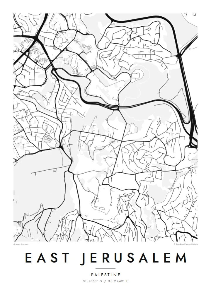
31.7868° N / 35.2449° E
Walled Old City at the centre, the Kidron Valley and Mount of Olives to the east, neighbourhoods spreading north and south


Mzinda umodzi, mawonekedwe asanu
Khudzani sitayelo kuti muwone pa khoma. Masitayelo onse amawononga ndalama zofanana — zosindikizidwa, zokutidwa mu chimango kapena ngati mafayilo a HD.
 Ma pixel enieni · fayilo yosindikiza 24 × 36″
Yowala posindikiza
Awa ndi chithunzi 100% chodulidwa cha fayilo yeniyeni yosindikiza. Poster iliyonse — yosindikizidwa, yokutidwa mu chimango kapena yotsitsidwa — imapangidwa pa maseva athu pa 300 DPI, mpaka ma pixel 7,200 × 10,800, choncho ngakhale misewu yaying'ono kwambiri imakhalabe yowoneka bwino pa kope la 24 × 36″.
Pakhoma


Mapu
From above, East Jerusalem arranges itself around the walled Old City. The walls form a clear, slightly skewed quadrilateral. Roads leave its gates and climb into the hills in every direction. To the east, the ground drops into the Kidron Valley and rises again to the Mount of Olives. Its slopes are marked by terraced cemeteries and a thin line of roads that follows the contours.
North of Damascus Gate, the street pattern becomes denser and more regular. Neighbourhoods such as Sheikh Jarrah spread along the road towards Ramallah. Further out, the map fragments into hilltop quarters separated by wadis and main roads. Because the terrain shapes almost every street, a East Jerusalem map poster reads as much like a relief study as a plan of a city.
The eastern side of the city has been contested since 1967, when Israel took control of the area. Its status remains central to Israeli–Palestinian negotiations. On paper, the lines are quieter. Gates, valleys, ridges and the long road descending towards Jericho are all shown with the same even weight. That lets the geography speak before the politics does.
The Ottoman walls, completed under Suleiman the Magnificent in the 1530s, enclose the Old City in an unmistakable outline. Gates such as Damascus Gate and Herod's Gate open onto the northern districts.
A deep, narrow valley runs north to south between the Old City and the Mount of Olives. On the map it shows as a clean gap between two dense areas of streets.
The ridge east of the Old City carries winding roads and large cemetery grounds. From above, its streets curve with the slope rather than following a grid.
Ipangeni yanu
Onjezani tsiku, dzina kapena mawu anu, sinthani mawonekedwe, kukula kapena momwe yaimira.
Chitsanzo chaulere ndi chotsika mu resolution ndipo chili ndi chizindikiro chothira madzi. Zosindikizidwa ndi mafayilo a HD zimapangidwa pa 300 DPI, mpaka ma px 7,200 × 10,800, popanda chizindikiro chothira madzi.
Chifukwa chiyani East Jerusalem
People who have lived in, studied in or prayed in this part of Jerusalem often want a map that is honest and restrained. A black-and-white plan of streets and slopes keeps the focus on the place itself, not on the headlines.
You can set your own title and add a subtitle with a date, a family name or a line of coordinates. Then choose from five styles: Classic black & white, Noir, Paper, Blueprint or Sand. The same composition can suit a study wall or a quiet hallway.
Odara poster ya East Jerusalem| Kukula kosindikiza | Mphamvu ya chithunzi | Mafayilo |
|---|---|---|
| 30 × 40 cm11.8 × 15.7″ | 3,543 × 4,724 px | PNG · PDF |
| 29.7 × 42 cm (A3)11.7 × 16.5″ | 3,508 × 4,961 px | PNG · PDF |
| 42 × 59.4 cm (A2)16.5 × 23.4″ | 4,961 × 7,016 px | PNG · PDF |
| 45.7 × 61 cm18 × 24″ | 5,400 × 7,200 px | PNG · PDF |
| 50 × 70 cm19.7 × 27.6″ | 5,906 × 8,268 px | PNG · PDF |
| 61 × 91.4 cm24 × 36″ | 7,200 × 10,800 px | PNG · PDF |
Poyerekeza, chithunzi chaulere ndi cha 900 px m'lifupi, chili ndi chizindikiro ndipo ndi cha pa sikirini. Mafayilo a HD ali ndi mphamvu yochulukira mpaka 8× mbali iliyonse ndipo amasindikizika bwino pa kukula konse kwa positala.
Sankhani sitayelo kumtunda kwa tsamba, kenako musankhe Poster Yosindikizidwa — kukula ndi, mukafuna, chimango — kapena Mafayilo a Digital HD. Kulipira kumatenga sitepe imodzi, ndipo tsamba la oda yanu limasinthidwa nthawi yomweyo pambuyo pa kulipira.
Imasindikizidwa pa pepala labwino la matte la 200 gsm mu kukula kumodzi mwa zisanu ndi chimodzi, kuyambira 30 × 40 cm mpaka 24 × 36″. Maposita osindikizidwa amayamba pa $39, kutumiza kuphatikizidwa.
Inde. Sankhani chimango cha mtengo wolimba mu utoto wakuda, woyera, oak wachilengedwe kapena mtengo wakuda. Chimabwera ndi galasi losathyoka ndipo chikonzekera kupachikidwa nthawi yomweyo. Maposita a mu chimango amayamba pa $99, kutumiza kuphatikizidwa.
Kutumiza ndi kwaulere kumayiko oposa 60. Positala iliyonse imasindikizidwa ndi mnzathu wosindikiza wapafupi kwambiri mwa anzathu m'mayiko oposa 30, ndipo nthawi zambiri imafika m'masiku 3–7 antchito. Mukhoza kutsatira momwe oda ilili ndi malo ake pa "Maoda Anga". Mayiko ena amatenga masabata 2–5, ndipo kumene sitinayambe kutumiza, tsambali likuuzani musanalipire.
Titumizireni chithunzi masiku 14 kuchokera pa tsiku la kutumiza ndipo tidzaisindikizanso kwaulere kapena kukubwezerani ndalama zanu.
Inde. Mu chida chokonzera pa tsambali, sinthani mutu, mutu wowonjezera ndi mzere wa ma coordinates kukhala chilichonse chomwe mufuna, ndipo sankhani sitayelo ndi kukula. Maoda osindikizidwa, a mu chimango ndi a digital onse amagwiritsa ntchito kapangidwe kanu enieni.
Pa $9 mumalandira mafayilo a PNG a 300 DPI ndi PDF okonzeka kusindikiza mu kukula konse kwa zisanu ndi chimodzi, popanda chizindikiro chothira madzi, kuti musindikize kulikonse. Simunatsimikize? Tsitsani kaye chitsanzo chaulere chokhala ndi chizindikiro chothira madzi.
Pafupi
