Shrine bay
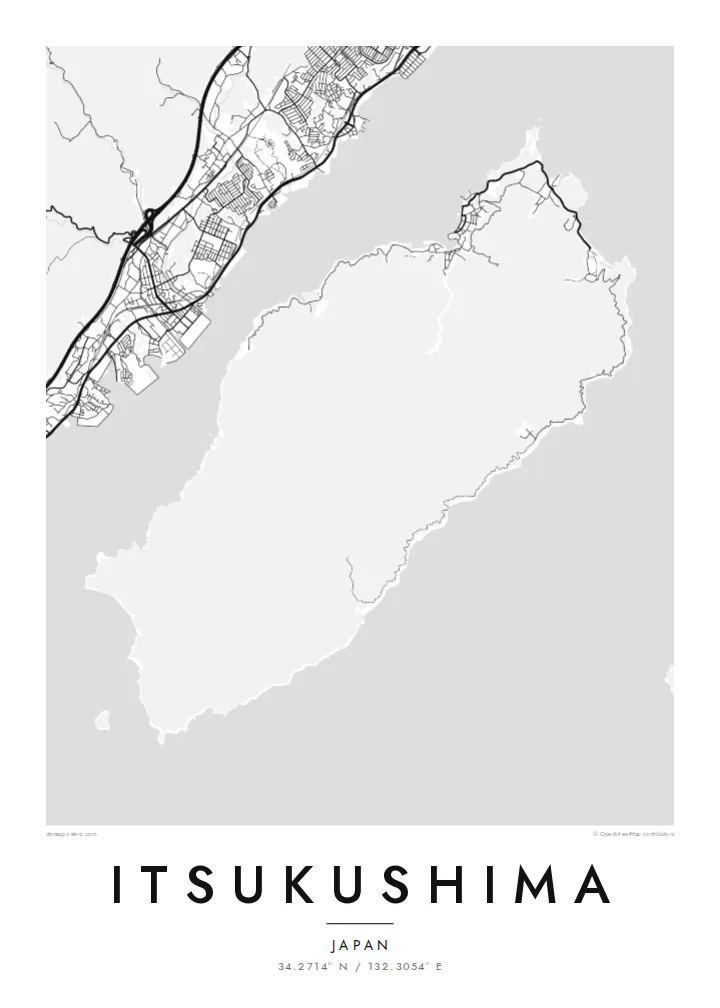
Itsukushima Shrine occupies a small inlet on the north coast, its buildings set on piers over the water. It is a distinctive shape where land and sea overlap.
Positala ya mapu yosavuta · Japan
34.2714° N / 132.3054° E
A mountainous, forested island in Hiroshima Bay, with a small shrine town gathered along its northern shore facing the mainland.


Mzinda umodzi, mawonekedwe asanu
Khudzani sitayelo kuti muwone pa khoma. Masitayelo onse amawononga ndalama zofanana — zosindikizidwa, zokutidwa mu chimango kapena ngati mafayilo a HD.
 Ma pixel enieni · fayilo yosindikiza 24 × 36″
Yowala posindikiza
Awa ndi chithunzi 100% chodulidwa cha fayilo yeniyeni yosindikiza. Poster iliyonse — yosindikizidwa, yokutidwa mu chimango kapena yotsitsidwa — imapangidwa pa maseva athu pa 300 DPI, mpaka ma pixel 7,200 × 10,800, choncho ngakhale misewu yaying'ono kwambiri imakhalabe yowoneka bwino pa kope la 24 × 36″.
Pakhoma


Mapu
Itsukushima, widely known as Miyajima, lies in the northwest of Hiroshima Bay, a short ferry ride from the mainland. It is a steep, heavily wooded island that rises to the summit of Mount Misen, and most of its interior has no roads at all. Settlement is mostly confined to a narrow strip on the northern coast, where the town, the shrine and the ferry pier sit side by side.
Itsukushima Shrine is built over the tidal flats of a small bay, so at high tide its halls and corridors appear to float on the sea. Its great vermilion torii gate stands offshore in the water. The shrine was listed as a UNESCO World Heritage site in 1996, and the island has long been regarded as sacred, with Mount Misen at its spiritual heart.
Tame sika deer wander the streets of the town, and a ropeway climbs from a forested valley toward the summit. An Itsukushima map poster shows the contrast that makes the island special. On one shore there is a tiny, dense cluster of lanes and temples, and behind it a large, wild, roadless mountain slope stretches away to the south.
Itsukushima Shrine occupies a small inlet on the north coast, its buildings set on piers over the water. It is a distinctive shape where land and sea overlap.
The island's sacred peak rises behind the town. Only hiking trails and the ropeway cross its forested slopes, which leaves a wide, quiet space on the map.
A compact cluster of lanes, shops and temples lines the shore between the ferry pier and the shrine. It is the only dense street pattern on the island.
Ipangeni yanu
Onjezani tsiku, dzina kapena mawu anu, sinthani mawonekedwe, kukula kapena momwe yaimira.
Chitsanzo chaulere ndi chotsika mu resolution ndipo chili ndi chizindikiro chothira madzi. Zosindikizidwa ndi mafayilo a HD zimapangidwa pa 300 DPI, mpaka ma px 7,200 × 10,800, popanda chizindikiro chothira madzi.
Chifukwa chiyani Itsukushima
Itsukushima is often the calmest memory of a trip to Japan: the torii at dusk, the deer, the climb up Misen. Its map balances a delicate cluster of lanes against broad, empty slopes, and it suits a quiet room, a study or anywhere you want a restful image that means something.
Set your own title, add the date of your visit to the subtitle and adjust the coordinates line. Choose among five styles; Paper feels close to traditional printmaking. Download the HD files for $9 in six sizes, or order a printed matte poster with an optional wooden frame.
Odara poster ya Itsukushima| Kukula kosindikiza | Mphamvu ya chithunzi | Mafayilo |
|---|---|---|
| 30 × 40 cm11.8 × 15.7″ | 3,543 × 4,724 px | PNG · PDF |
| 29.7 × 42 cm (A3)11.7 × 16.5″ | 3,508 × 4,961 px | PNG · PDF |
| 42 × 59.4 cm (A2)16.5 × 23.4″ | 4,961 × 7,016 px | PNG · PDF |
| 45.7 × 61 cm18 × 24″ | 5,400 × 7,200 px | PNG · PDF |
| 50 × 70 cm19.7 × 27.6″ | 5,906 × 8,268 px | PNG · PDF |
| 61 × 91.4 cm24 × 36″ | 7,200 × 10,800 px | PNG · PDF |
Poyerekeza, chithunzi chaulere ndi cha 900 px m'lifupi, chili ndi chizindikiro ndipo ndi cha pa sikirini. Mafayilo a HD ali ndi mphamvu yochulukira mpaka 8× mbali iliyonse ndipo amasindikizika bwino pa kukula konse kwa positala.
Sankhani sitayelo kumtunda kwa tsamba, kenako musankhe Poster Yosindikizidwa — kukula ndi, mukafuna, chimango — kapena Mafayilo a Digital HD. Kulipira kumatenga sitepe imodzi, ndipo tsamba la oda yanu limasinthidwa nthawi yomweyo pambuyo pa kulipira.
Imasindikizidwa pa pepala labwino la matte la 200 gsm mu kukula kumodzi mwa zisanu ndi chimodzi, kuyambira 30 × 40 cm mpaka 24 × 36″. Maposita osindikizidwa amayamba pa $39, kutumiza kuphatikizidwa.
Inde. Sankhani chimango cha mtengo wolimba mu utoto wakuda, woyera, oak wachilengedwe kapena mtengo wakuda. Chimabwera ndi galasi losathyoka ndipo chikonzekera kupachikidwa nthawi yomweyo. Maposita a mu chimango amayamba pa $99, kutumiza kuphatikizidwa.
Kutumiza ndi kwaulere kumayiko oposa 60. Positala iliyonse imasindikizidwa ndi mnzathu wosindikiza wapafupi kwambiri mwa anzathu m'mayiko oposa 30, ndipo nthawi zambiri imafika m'masiku 3–7 antchito. Mukhoza kutsatira momwe oda ilili ndi malo ake pa "Maoda Anga". Mayiko ena amatenga masabata 2–5, ndipo kumene sitinayambe kutumiza, tsambali likuuzani musanalipire.
Titumizireni chithunzi masiku 14 kuchokera pa tsiku la kutumiza ndipo tidzaisindikizanso kwaulere kapena kukubwezerani ndalama zanu.
Inde. Mu chida chokonzera pa tsambali, sinthani mutu, mutu wowonjezera ndi mzere wa ma coordinates kukhala chilichonse chomwe mufuna, ndipo sankhani sitayelo ndi kukula. Maoda osindikizidwa, a mu chimango ndi a digital onse amagwiritsa ntchito kapangidwe kanu enieni.
Pa $9 mumalandira mafayilo a PNG a 300 DPI ndi PDF okonzeka kusindikiza mu kukula konse kwa zisanu ndi chimodzi, popanda chizindikiro chothira madzi, kuti musindikize kulikonse. Simunatsimikize? Tsitsani kaye chitsanzo chaulere chokhala ndi chizindikiro chothira madzi.
Pafupi
