Wakamiya-ōji
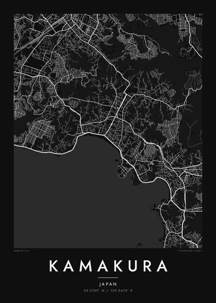
The straight processional avenue runs from the Hachimangū shrine to the sea, a single decisive line through the centre that gives the whole map its orientation.
Positala ya mapu yosavuta · Japan
35.3109° N / 139.5470° E
A former shogun's capital enclosed by wooded hills on three sides, opening south onto the curve of Sagami Bay.



Mzinda umodzi, mawonekedwe asanu
Khudzani sitayelo kuti muwone pa khoma. Masitayelo onse amawononga ndalama zofanana — zosindikizidwa, zokutidwa mu chimango kapena ngati mafayilo a HD.
 Ma pixel enieni · fayilo yosindikiza 24 × 36″
Yowala posindikiza
Awa ndi chithunzi 100% chodulidwa cha fayilo yeniyeni yosindikiza. Poster iliyonse — yosindikizidwa, yokutidwa mu chimango kapena yotsitsidwa — imapangidwa pa maseva athu pa 300 DPI, mpaka ma pixel 7,200 × 10,800, choncho ngakhale misewu yaying'ono kwambiri imakhalabe yowoneka bwino pa kope la 24 × 36″.
Pakhoma


Mapu
Kamakura was the seat of Japan's first shogunate from the late twelfth century, and it was chosen partly for its shape. Hills close in on the north, east and west, while the south opens onto the sea, a natural fortress reached through narrow cuttings in the ridges. On a map that bowl is still easy to read: dense streets in the lowland, green folds all around.
At the centre runs Wakamiya-ōji, a straight avenue laid out from Tsurugaoka Hachimangū shrine down to the beach at Yuigahama. It is the clearest axis in the city and the spine around which everything else falls into place. To the west, in the Hase district, the Great Buddha of Kōtoku-in sits in the open air, a bronze figure cast in the thirteenth century.
A Kamakura map poster holds a remarkable amount in one frame: the ceremonial avenue, the beach curving toward the headland, temple grounds tucked into valleys and lanes that wind into the hills. It is a favourite with people who have visited from Tokyo or Yokohama, and a meaningful map for anyone interested in Japanese history.
The straight processional avenue runs from the Hachimangū shrine to the sea, a single decisive line through the centre that gives the whole map its orientation.
The beach forms a smooth arc along Sagami Bay at the southern edge of the city, a clean boundary between dense streets and open water.
Temples and shrines sit in narrow valleys cut into the surrounding hills, visible on the map as small pockets of paths and buildings reached by winding lanes.
Ipangeni yanu
Onjezani tsiku, dzina kapena mawu anu, sinthani mawonekedwe, kukula kapena momwe yaimira.
Chitsanzo chaulere ndi chotsika mu resolution ndipo chili ndi chizindikiro chothira madzi. Zosindikizidwa ndi mafayilo a HD zimapangidwa pa 300 DPI, mpaka ma px 7,200 × 10,800, popanda chizindikiro chothira madzi.
Chifukwa chiyani Kamakura
Kamakura is often a day of quiet memories: the walk to the Great Buddha, the beach at sunset, a temple garden in the hills. A map captures the whole day in one image, and the city's shape makes it recognisable at a glance.
Personalise the title, subtitle and coordinates line, for example with the date of a trip or a honeymoon, and choose one of five styles: Classic black & white, Noir, Paper, Blueprint or Sand. Paper suits the historic streets especially well.
Odara poster ya Kamakura| Kukula kosindikiza | Mphamvu ya chithunzi | Mafayilo |
|---|---|---|
| 30 × 40 cm (11.8 × 15.7″) | 3,543 × 4,724 px | PNG · PDF |
| 29.7 × 42 cm (A3, 11.7 × 16.5″) | 3,508 × 4,961 px | PNG · PDF |
| 42 × 59.4 cm (A2, 16.5 × 23.4″) | 4,961 × 7,016 px | PNG · PDF |
| 45.7 × 61 cm (18 × 24″) | 5,400 × 7,200 px | PNG · PDF |
| 50 × 70 cm (19.7 × 27.6″) | 5,906 × 8,268 px | PNG · PDF |
| 61 × 91.4 cm (24 × 36″) | 7,200 × 10,800 px | PNG · PDF |
Poyerekeza, chithunzi chaulere ndi cha 900 px m'lifupi, chili ndi chizindikiro ndipo ndi cha pa sikirini. Mafayilo a HD ali ndi mphamvu yochulukira mpaka 8× mbali iliyonse ndipo amasindikizika bwino pa kukula konse kwa positala.
Sankhani sitayelo kumtunda kwa tsamba, kenako musankhe Poster Yosindikizidwa — kukula ndi, mukafuna, chimango — kapena Mafayilo a Digital HD. Kulipira kumatenga sitepe imodzi, ndipo tsamba la oda yanu limasinthidwa nthawi yomweyo pambuyo pa kulipira.
Imasindikizidwa pa pepala labwino la matte la 200 gsm mu kukula kumodzi mwa zisanu ndi chimodzi, kuyambira 30 × 40 cm mpaka 24 × 36″. Maposita osindikizidwa amayamba pa $39, kutumiza kuphatikizidwa.
Inde. Sankhani chimango cha mtengo wolimba mu utoto wakuda, woyera, oak wachilengedwe kapena mtengo wakuda. Chimabwera ndi galasi losathyoka ndipo chikonzekera kupachikidwa nthawi yomweyo. Maposita a mu chimango amayamba pa $99, kutumiza kuphatikizidwa.
Kutumiza ndi kwaulere padziko lonse lapansi. Positala iliyonse imasindikizidwa ndi mnzathu wosindikiza wapafupi kwambiri mwa anzathu m'maiko opitirira 30 ndipo nthawi zambiri imafika m'masiku antchito 3–7. Mukhoza kuona momwe zilili ndi kutsata positalayo pa Maoda Anga. Maiko ena amatenga masabata 2–5, ndipo kumene sitinayambe kutumiza, tsambali limakuuzani musanalipire.
Titumizireni chithunzi masiku 14 kuchokera pa tsiku la kutumiza ndipo tidzaisindikizanso kwaulere kapena kukubwezerani ndalama zanu.
Inde. Mu chida chokonzera pa tsambali, sinthani mutu, mutu wowonjezera ndi mzere wa ma coordinates kukhala chilichonse chomwe mufuna, ndipo sankhani sitayelo ndi kukula. Maoda osindikizidwa, a mu chimango ndi a digital onse amagwiritsa ntchito kapangidwe kanu enieni.
Pa $9 mumalandira mafayilo a PNG a 300 DPI ndi PDF okonzeka kusindikiza mu kukula konse kwa zisanu ndi chimodzi, popanda chizindikiro chothira madzi, kuti musindikize kulikonse. Simunatsimikize? Tsitsani kaye chitsanzo chaulere chokhala ndi chizindikiro chothira madzi.
Pafupi
