Vltava and its bridges
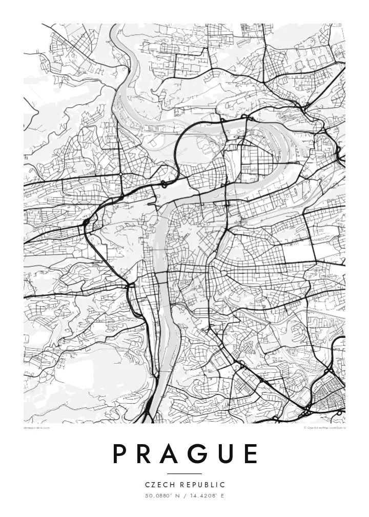
The river curves through the city in a broad S, crossed by Charles Bridge and a series of later bridges. Several islands divide the channel.
Positala ya mapu yosavuta · Czechia
50.0880° N / 14.4208° E
A city built along a deep bend of the Vltava, with the castle on one bank and the Old Town on the other.


Mzinda umodzi, mawonekedwe asanu
Khudzani sitayelo kuti muwone pa khoma. Masitayelo onse amawononga ndalama zofanana — zosindikizidwa, zokutidwa mu chimango kapena ngati mafayilo a HD.
 Ma pixel enieni · fayilo yosindikiza 24 × 36″
Yowala posindikiza
Awa ndi chithunzi 100% chodulidwa cha fayilo yeniyeni yosindikiza. Poster iliyonse — yosindikizidwa, yokutidwa mu chimango kapena yotsitsidwa — imapangidwa pa maseva athu pa 300 DPI, mpaka ma pixel 7,200 × 10,800, choncho ngakhale misewu yaying'ono kwambiri imakhalabe yowoneka bwino pa kope la 24 × 36″.
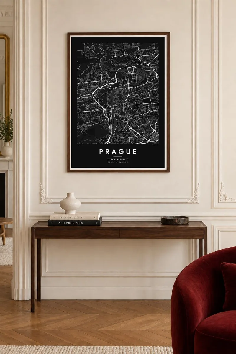
Pakhoma


Mapu
The Vltava flows north through Prague in a wide S-shaped curve and divides the city into two clearly different halves. On the left bank, the castle complex stretches along a ridge above Malá Strana, with the green slopes of Petřín hill to the south. On the right bank are the Old Town and the New Town, whose streets gather toward the river from the flatter ground to the east.
Charles Bridge, begun in 1357, links the two banks and remains one of the most recognisable elements of any Prague map poster. Upstream and downstream, a series of later bridges crosses the river at regular intervals, and islands such as Kampa and Střelecký ostrov divide the water. The Old Town's streets meet at the square with the astronomical clock, first installed in 1410.
The New Town was founded by Charles IV in 1348 and was laid out on an ambitious scale for its time. Wenceslas Square and Charles Square are still among the largest open spaces in the city. To the south, the fortress of Vyšehrad sits above the river on a rocky outcrop. Together these layers make Prague one of Europe's most detailed and rewarding maps.
The river curves through the city in a broad S, crossed by Charles Bridge and a series of later bridges. Several islands divide the channel.
On the left bank, the long castle complex follows the ridge above the Lesser Town. The winding lanes of Malá Strana descend from it toward the river.
Charles IV's fourteenth-century plan introduced large squares and wide streets. Wenceslas Square is still the long, clear rectangle at the centre of the modern city.
Ipangeni yanu
Onjezani tsiku, dzina kapena mawu anu, sinthani mawonekedwe, kukula kapena momwe yaimira.
Chitsanzo chaulere ndi chotsika mu resolution ndipo chili ndi chizindikiro chothira madzi. Zosindikizidwa ndi mafayilo a HD zimapangidwa pa 300 DPI, mpaka ma px 7,200 × 10,800, popanda chizindikiro chothira madzi.
Chifukwa chiyani Prague
Prague is where many people studied, fell in love or spent a significant trip, and its river, bridges and castle create one of the most balanced city maps in Europe. It works at both small and large sizes.
Add a title such as Praha, a subtitle and your own coordinates or date, and choose Classic black & white, Noir, Paper, Blueprint or Sand. Download HD files or order a print with an optional wooden frame.
Odara poster ya Prague| Kukula kosindikiza | Mphamvu ya chithunzi | Mafayilo |
|---|---|---|
| 30 × 40 cm (11.8 × 15.7″) | 3,543 × 4,724 px | PNG · PDF |
| 29.7 × 42 cm (A3, 11.7 × 16.5″) | 3,508 × 4,961 px | PNG · PDF |
| 42 × 59.4 cm (A2, 16.5 × 23.4″) | 4,961 × 7,016 px | PNG · PDF |
| 45.7 × 61 cm (18 × 24″) | 5,400 × 7,200 px | PNG · PDF |
| 50 × 70 cm (19.7 × 27.6″) | 5,906 × 8,268 px | PNG · PDF |
| 61 × 91.4 cm (24 × 36″) | 7,200 × 10,800 px | PNG · PDF |
Poyerekeza, chithunzi chaulere ndi cha 900 px m'lifupi, chili ndi chizindikiro ndipo ndi cha pa sikirini. Mafayilo a HD ali ndi mphamvu yochulukira mpaka 8× mbali iliyonse ndipo amasindikizika bwino pa kukula konse kwa positala.
Sankhani sitayelo kumtunda kwa tsamba, kenako musankhe Poster Yosindikizidwa — kukula ndi, mukafuna, chimango — kapena Mafayilo a Digital HD. Kulipira kumatenga sitepe imodzi, ndipo tsamba la oda yanu limasinthidwa nthawi yomweyo pambuyo pa kulipira.
Imasindikizidwa pa pepala labwino la matte la 200 gsm mu kukula kumodzi mwa zisanu ndi chimodzi, kuyambira 30 × 40 cm mpaka 24 × 36″. Maposita osindikizidwa amayamba pa $39, kutumiza kuphatikizidwa.
Inde. Sankhani chimango cha mtengo wolimba mu utoto wakuda, woyera, oak wachilengedwe kapena mtengo wakuda. Chimabwera ndi galasi losathyoka ndipo chikonzekera kupachikidwa nthawi yomweyo. Maposita a mu chimango amayamba pa $99, kutumiza kuphatikizidwa.
Kutumiza ndi kwaulere padziko lonse lapansi. Positala iliyonse imasindikizidwa ndi mnzathu wosindikiza wapafupi kwambiri mwa anzathu m'maiko opitirira 30 ndipo nthawi zambiri imafika m'masiku antchito 3–7. Mukhoza kuona momwe zilili ndi kutsata positalayo pa Maoda Anga. Maiko ena amatenga masabata 2–5, ndipo kumene sitinayambe kutumiza, tsambali limakuuzani musanalipire.
Titumizireni chithunzi masiku 14 kuchokera pa tsiku la kutumiza ndipo tidzaisindikizanso kwaulere kapena kukubwezerani ndalama zanu.
Inde. Mu chida chokonzera pa tsambali, sinthani mutu, mutu wowonjezera ndi mzere wa ma coordinates kukhala chilichonse chomwe mufuna, ndipo sankhani sitayelo ndi kukula. Maoda osindikizidwa, a mu chimango ndi a digital onse amagwiritsa ntchito kapangidwe kanu enieni.
Pa $9 mumalandira mafayilo a PNG a 300 DPI ndi PDF okonzeka kusindikiza mu kukula konse kwa zisanu ndi chimodzi, popanda chizindikiro chothira madzi, kuti musindikize kulikonse. Simunatsimikize? Tsitsani kaye chitsanzo chaulere chokhala ndi chizindikiro chothira madzi.
Pafupi
