Lagoons and bays
Shallow bays and enclosed lagoons break the coastline in many places. They create a sequence of curved inlets that gives the island a detailed, irregular edge.
Positala ya mapu yosavuta · Indonesia
10.6870° S / 123.1155° E
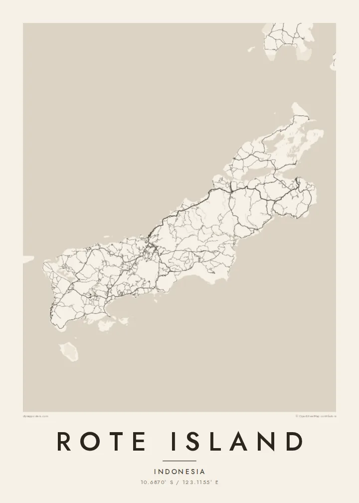
A long, low island just southwest of Timor, its coast scalloped by bays and fringed with lagoons and small islets.




Mzinda umodzi, mawonekedwe asanu
Khudzani sitayelo kuti muwone pa khoma. Masitayelo onse amawononga ndalama zofanana — zosindikizidwa, zokutidwa mu chimango kapena ngati mafayilo a HD.
 Ma pixel enieni · fayilo yosindikiza 24 × 36″
Yowala posindikiza
Awa ndi chithunzi 100% chodulidwa cha fayilo yeniyeni yosindikiza. Poster iliyonse — yosindikizidwa, yokutidwa mu chimango kapena yotsitsidwa — imapangidwa pa maseva athu pa 300 DPI, mpaka ma pixel 7,200 × 10,800, choncho ngakhale misewu yaying'ono kwambiri imakhalabe yowoneka bwino pa kope la 24 × 36″.
Pakhoma


Mapu
Rote, also written Roti, lies off the southwestern tip of Timor in East Nusa Tenggara, near the southern edge of the Indonesian archipelago. It is long and fairly low, stretched roughly from northeast to southwest, with a coastline broken by shallow bays, lagoons and reefs. Smaller islands are scattered around it, especially off the southwestern end.
Much of the island is dry savanna, and the lontar palm has long been central to local life. Its sap is tapped for sugar and drink, and its leaves are used for weaving. The island is also associated with the sasando, a stringed instrument with a resonator made from a lontar leaf. On the southwest coast, Nemberala has become known for its surf.
A Rote Island map poster follows the island's long axis, with a road network that links villages across the dry interior and down to the coast. The main town, Ba'a, sits on the northern side facing Timor, while the bays and lagoons of the southern and western shores give the outline a rich, uneven texture.
Shallow bays and enclosed lagoons break the coastline in many places. They create a sequence of curved inlets that gives the island a detailed, irregular edge.
The main town lies on the northern side of the island and looks across the sea toward Timor. Its streets form the densest cluster of lines on the map.
Off the southwestern end, a scattering of small islands trails into the sea. They include Ndana, often described as the southernmost island of Indonesia.
Ipangeni yanu
Onjezani tsiku, dzina kapena mawu anu, sinthani mawonekedwe, kukula kapena momwe yaimira.
Chitsanzo chaulere ndi chotsika mu resolution ndipo chili ndi chizindikiro chothira madzi. Zosindikizidwa ndi mafayilo a HD zimapangidwa pa 300 DPI, mpaka ma px 7,200 × 10,800, popanda chizindikiro chothira madzi.
Chifukwa chiyani Rote Island
Rote is remembered by surfers who spent weeks waiting for waves at Nemberala and by families whose roots are in its villages. A map poster draws the whole island, from the road to Ba'a to the islets in the far southwest, and gives those memories a quiet, lasting form.
Choose any wording for the title and subtitle, such as a village, a surf break or a date, and edit the coordinates line to match. Classic black & white, Noir, Paper, Blueprint and Sand are all available. The $9 HD set includes six sizes, and there is a free watermarked preview.
Odara poster ya Rote Island| Kukula kosindikiza | Mphamvu ya chithunzi | Mafayilo |
|---|---|---|
| 30 × 40 cm11.8 × 15.7″ | 3,543 × 4,724 px | PNG · PDF |
| 29.7 × 42 cm (A3)11.7 × 16.5″ | 3,508 × 4,961 px | PNG · PDF |
| 42 × 59.4 cm (A2)16.5 × 23.4″ | 4,961 × 7,016 px | PNG · PDF |
| 45.7 × 61 cm18 × 24″ | 5,400 × 7,200 px | PNG · PDF |
| 50 × 70 cm19.7 × 27.6″ | 5,906 × 8,268 px | PNG · PDF |
| 61 × 91.4 cm24 × 36″ | 7,200 × 10,800 px | PNG · PDF |
Poyerekeza, chithunzi chaulere ndi cha 900 px m'lifupi, chili ndi chizindikiro ndipo ndi cha pa sikirini. Mafayilo a HD ali ndi mphamvu yochulukira mpaka 8× mbali iliyonse ndipo amasindikizika bwino pa kukula konse kwa positala.
Sankhani sitayelo kumtunda kwa tsamba, kenako musankhe Poster Yosindikizidwa — kukula ndi, mukafuna, chimango — kapena Mafayilo a Digital HD. Kulipira kumatenga sitepe imodzi, ndipo tsamba la oda yanu limasinthidwa nthawi yomweyo pambuyo pa kulipira.
Imasindikizidwa pa pepala labwino la matte la 200 gsm mu kukula kumodzi mwa zisanu ndi chimodzi, kuyambira 30 × 40 cm mpaka 24 × 36″. Maposita osindikizidwa amayamba pa $39, kutumiza kuphatikizidwa.
Inde. Sankhani chimango cha mtengo wolimba mu utoto wakuda, woyera, oak wachilengedwe kapena mtengo wakuda. Chimabwera ndi galasi losathyoka ndipo chikonzekera kupachikidwa nthawi yomweyo. Maposita a mu chimango amayamba pa $99, kutumiza kuphatikizidwa.
Kutumiza ndi kwaulere kumayiko oposa 60. Positala iliyonse imasindikizidwa ndi mnzathu wosindikiza wapafupi kwambiri mwa anzathu m'mayiko oposa 30, ndipo nthawi zambiri imafika m'masiku 3–7 antchito. Mukhoza kutsatira momwe oda ilili ndi malo ake pa "Maoda Anga". Mayiko ena amatenga masabata 2–5, ndipo kumene sitinayambe kutumiza, tsambali likuuzani musanalipire.
Titumizireni chithunzi masiku 14 kuchokera pa tsiku la kutumiza ndipo tidzaisindikizanso kwaulere kapena kukubwezerani ndalama zanu.
Inde. Mu chida chokonzera pa tsambali, sinthani mutu, mutu wowonjezera ndi mzere wa ma coordinates kukhala chilichonse chomwe mufuna, ndipo sankhani sitayelo ndi kukula. Maoda osindikizidwa, a mu chimango ndi a digital onse amagwiritsa ntchito kapangidwe kanu enieni.
Pa $9 mumalandira mafayilo a PNG a 300 DPI ndi PDF okonzeka kusindikiza mu kukula konse kwa zisanu ndi chimodzi, popanda chizindikiro chothira madzi, kuti musindikize kulikonse. Simunatsimikize? Tsitsani kaye chitsanzo chaulere chokhala ndi chizindikiro chothira madzi.
Pafupi
