Utah grid
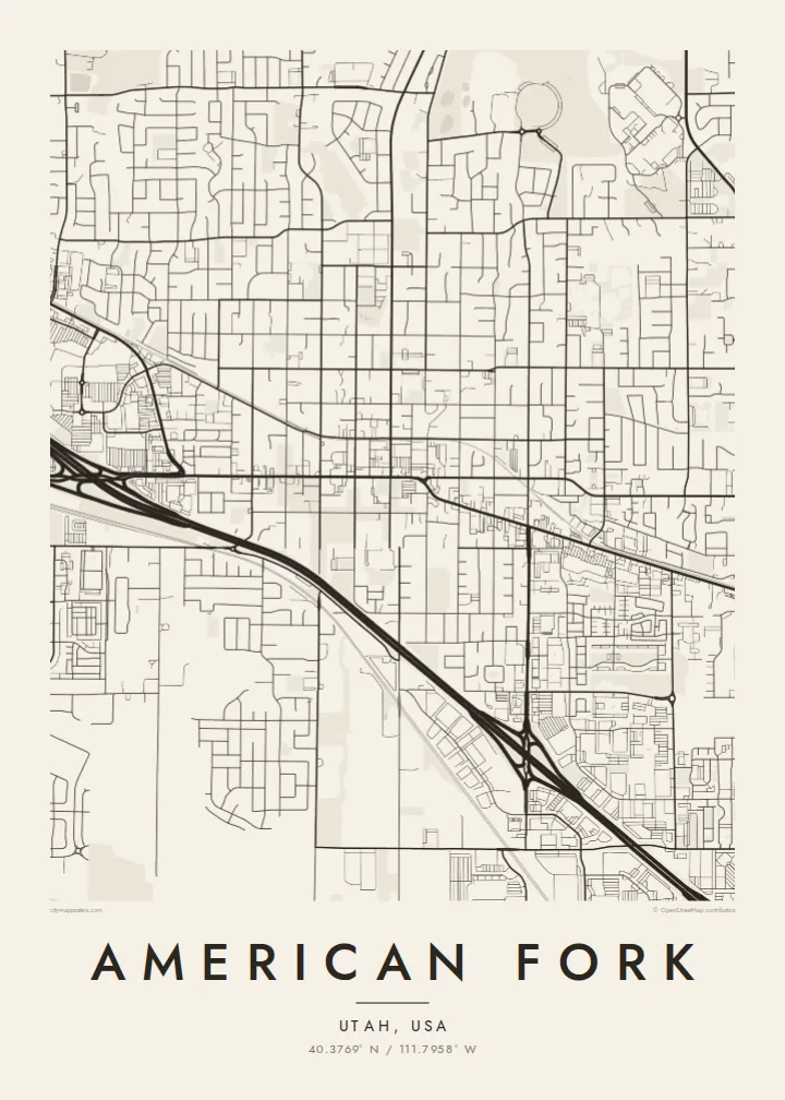
Wide, straight streets aligned to the compass form a regular pattern that repeats across the city, typical of settlements founded by Latter-day Saint pioneers.
Posta faʻafanua faigofie · United States
40.3769° N / 111.7958° W
A Utah valley grid rising from the shore of Utah Lake toward the mouth of a steep canyon under Mount Timpanogos.




Tasi le aai, lagona e lima
Tapi se sitaili e vaai ai i luga o le puipui. E tutusa uma le tau o sitaili — pe lolomiina, faapipiiina, pe avea ma faila HD.
 Pika Moni · Faila Lolomi 24 × 36″
Manino mo le lolomi
O se vaega atoa (100%) lenei mai le faila lolomi moni. O posita uma — pe lolomiina, faapipiiina pe download mai — e faia i luga o a matou server i le 300 DPI, e oo atu i le 7,200 × 10,800 pika, ina ia manino pea auala laiti i luga o se lolomiga 24 × 36″.
I luga o le puipui


Le faʻafanua
American Fork lies at the northern end of Utah Valley, between the shore of Utah Lake and the steep Wasatch front. Its streets follow the numbered grid typical of Utah towns, with wide blocks running straight toward the mountains. From above, the grid climbs gently from the lakeside flats to the foothills, and Interstate 15 crosses it as a long diagonal-free band.
The city takes its name from the American Fork River, which leaves its canyon to the northeast and runs down through the valley toward the lake. American Fork Canyon is home to Timpanogos Cave National Monument, and Mount Timpanogos, one of the most recognisable peaks in the Wasatch, rises above the city to the east.
An American Fork map poster shows the order of a planned Western town against a dramatic natural setting. The grid is regular and calm, the river adds one winding line, and the canyon and lakeshore frame the edges. It is a map that makes sense straight away to anyone who has driven through Utah Valley.
Wide, straight streets aligned to the compass form a regular pattern that repeats across the city, typical of settlements founded by Latter-day Saint pioneers.
The river runs out of its canyon and down through the valley toward Utah Lake, adding the one natural curve through the city's straight lines.
Utah Lake's shore lies to the southwest and the canyon mouth to the northeast, framing the city between water and mountains.
Fai mo oe
Faʻaopoopo se aso, se igoa po o sau lava upu, sui le sitaili, lapoʻa po o le itu.
O le preview e leai se totogi e maualalo le resolution ma iai se watermark. O lolomi ma faila HD e faia i le 300 DPI, e oo atu i le 7,200 × 10,800 px, e aunoa ma se watermark.
Aisea American Fork
American Fork is a place where many families put down roots, and the map suits a first home, a new job at one of the nearby tech campuses or a family that has lived here for generations. The grid looks especially clean on a wall.
Personalise the title and subtitle, add a date or edit the coordinates line, then choose Classic black and white, Noir, Paper, Blueprint or Sand. The HD download costs $9 and includes six print sizes, including 18×24 and 24×36 inches. Printed posters with an optional frame are also available.
Faatau le posita American Fork| Lapoʻa lolomi | Manino | Faila |
|---|---|---|
| 30 × 40 cm11.8 × 15.7″ | 3,543 × 4,724 px | PNG · PDF |
| 29.7 × 42 cm (A3)11.7 × 16.5″ | 3,508 × 4,961 px | PNG · PDF |
| 42 × 59.4 cm (A2)16.5 × 23.4″ | 4,961 × 7,016 px | PNG · PDF |
| 45.7 × 61 cm18 × 24″ | 5,400 × 7,200 px | PNG · PDF |
| 50 × 70 cm19.7 × 27.6″ | 5,906 × 8,268 px | PNG · PDF |
| 61 × 91.4 cm24 × 36″ | 7,200 × 10,800 px | PNG · PDF |
Ae faʻatusatusa, o le faʻataʻitaʻiga e leai se totogi e 900 px le lautele, e iai le faʻailoga vai ma e mo mata. O faila HD e oʻo atu i le 8× le manino i itu taʻitasi ma e lolomi manino i le lapoʻa atoa o le posta.
Filifili se sitaili i le pito i luga o le itulau, ona filifili lea o le Posita Lolomi — se lapopoa ma, afai e te fiafia, se faavaa — po o Faila HD Numera. E na o le tasi laasaga o le Checkout, ma o le a fesuia'i lou itulau o oka i le taimi lava e mae'a ai le totogi.
E lolomiina i luga o pepa matte maualuga le tulaga e 200 gsm, i se tasi o lapopoa e ono, mai le 30 × 40 cm i le 24 × 36″. E amata le tau o posita lolomi mai le $39, aofia ai le auina atu.
Ioe. Filifili se faavaa laau malosi i le lanu uliuli, sina, oak masani, po o le laau pogisa. E aofia ai se tioata e le gau ma ua saunia e tautau i luga. E amata le tau o posita faavaa mai le $99, aofia ai le auina atu.
E leai se totogi o le auina atu i atunuu e 60+. O pepa ata taʻitasi e lolomiina e le tasi o matou paaga lolomi e latalata mai i atunuu e 30+, ma e masani ona taunuu i le 3–7 aso faigaluega. E mafai ona e mulimulitaia le tulaga ma le sailiga i lalo o My Orders. O nisi atunuu e 2–5 vaiaso, ma i nofoaga e lei matou auina atu iai, e taʻu atu e le saite ia te oe a o lei totogi.
Auina mai se ata i totonu o le 14 aso talu ona taunuu, ma o le a matou toe lolomiina e leai se totogi po o le toe faafoi atu lau tupe.
Ioe. I totonu o le editor i lenei itulau, suia le ulutala, le ulutala laititi ma le laina o coordinates i soo se mea e te fiafia i ai, ma filifili se sitaili ma le lapopoa. O oka lolomi, faavaa ma numera e faaaoga uma lava lau mamanu.
Mo le $9 e te maua ai faila PNG 300 DPI ma PDF ua saunia mo le lolomi i lapopoa uma e ono, e aunoa ma se watermark, e mafai ona lolomi i soo se mea. Le mautinoa lava? Download muamua se preview e leai se totogi ma le watermark.
Latalata ane
