The Berkel river
The Berkel crosses the town in a gentle winding line. It is the most recognisable feature on the map and gives the municipality of Berkelland its name.
Posta faʻafanua faigofie · Netherlands
52.1000° N / 6.6486° E
A compact Achterhoek town strung along the Berkel, its streets opening onto a patchwork of fields and wooded farmsteads.


Tasi le aai, lagona e lima
Tapi se sitaili e vaai ai i luga o le puipui. E tutusa uma le tau o sitaili — pe lolomiina, faapipiiina, pe avea ma faila HD.
 Pika Moni · Faila Lolomi 24 × 36″
Manino mo le lolomi
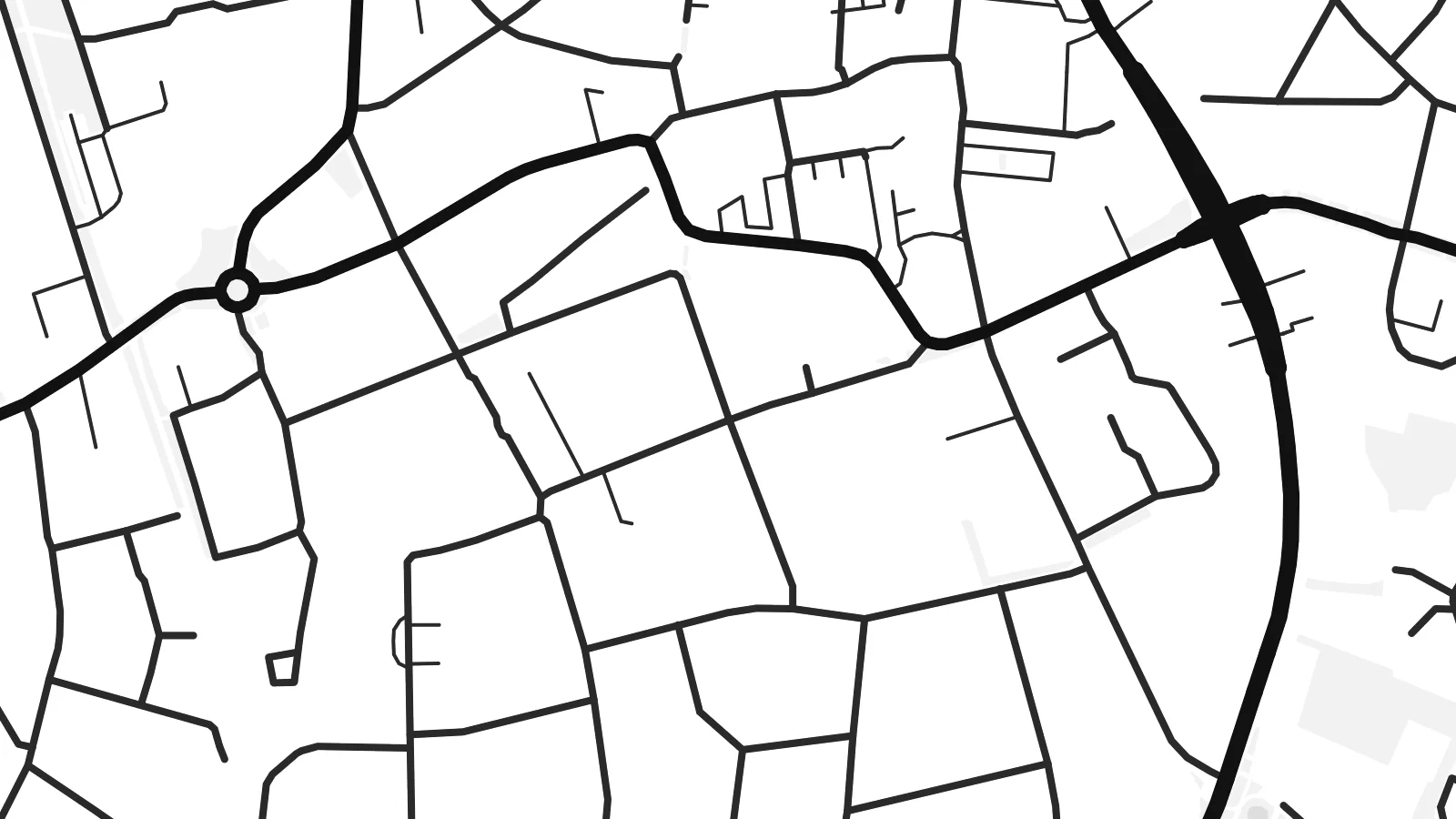
O se vaega atoa (100%) lenei mai le faila lolomi moni. O posita uma — pe lolomiina, faapipiiina pe download mai — e faia i luga o a matou server i le 300 DPI, e oo atu i le 7,200 × 10,800 pika, ina ia manino pea auala laiti i luga o se lolomiga 24 × 36″.
I luga o le puipui


Le faʻafanua
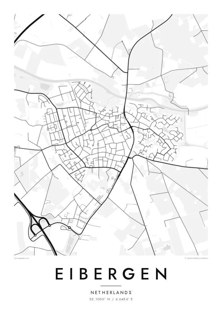
Seen from above, Eibergen is a small, tightly knit town set in the eastern Netherlands, close to the German border. The river Berkel curves through the town, and the main streets gather near it before loosening into residential lanes. Past the last houses the map changes to open farmland with scattered farms, tree lines and narrow country roads, the typical landscape of the Achterhoek.
Eibergen is part of the municipality of Berkelland, which is named after the same river that shapes the town. On paper the Berkel is the thread that holds everything together, a thin winding line that enters from the east and leaves again to the west. The built-up area around it is modest, and that makes the pattern of streets easy to read at a glance.
A Eibergen map poster shows how a Dutch country town fits into its surroundings. The older centre, the newer neighbourhoods and the roads leading out towards nearby villages all show up in clean black lines on a white ground. Because the town is small, the poster can take in a good share of the countryside too, so the open fields around it become part of the picture.
The Berkel crosses the town in a gentle winding line. It is the most recognisable feature on the map and gives the municipality of Berkelland its name.
Around the town the street grid thins into country roads, field boundaries and lines of trees, the quiet, finely divided farmland typical of this corner of Gelderland.
Eibergen lies close to the German border, and the roads leaving town point east as naturally as they point towards the rest of the Netherlands.
Fai mo oe
Faʻaopoopo se aso, se igoa po o sau lava upu, sui le sitaili, lapoʻa po o le itu.
O le preview e leai se totogi e maualalo le resolution ma iai se watermark. O lolomi ma faila HD e faia i le 300 DPI, e oo atu i le 7,200 × 10,800 px, e aunoa ma se watermark.
Aisea Eibergen
For anyone who grew up in Eibergen, or who cycled along the Berkel on long summer evenings, this map is a quiet reminder of home. It suits a hallway or a study, where the detail can be looked at up close without taking over the room.
You can change the title, the subtitle and the coordinates line to mark a family name, a move or an anniversary. Choose Classic black & white, Noir, Paper, Blueprint or Sand to match your room, then download the $9 HD files or order a printed poster, framed if you like.
Faatau le posita Eibergen| Lapoʻa lolomi | Manino | Faila |
|---|---|---|
| 30 × 40 cm (11.8 × 15.7″) | 3,543 × 4,724 px | PNG · PDF |
| 29.7 × 42 cm (A3, 11.7 × 16.5″) | 3,508 × 4,961 px | PNG · PDF |
| 42 × 59.4 cm (A2, 16.5 × 23.4″) | 4,961 × 7,016 px | PNG · PDF |
| 45.7 × 61 cm (18 × 24″) | 5,400 × 7,200 px | PNG · PDF |
| 50 × 70 cm (19.7 × 27.6″) | 5,906 × 8,268 px | PNG · PDF |
| 61 × 91.4 cm (24 × 36″) | 7,200 × 10,800 px | PNG · PDF |
Ae faʻatusatusa, o le faʻataʻitaʻiga e leai se totogi e 900 px le lautele, e iai le faʻailoga vai ma e mo mata. O faila HD e oʻo atu i le 8× le manino i itu taʻitasi ma e lolomi manino i le lapoʻa atoa o le posta.
Filifili se sitaili i le pito i luga o le itulau, ona filifili lea o le Posita Lolomi — se lapopoa ma, afai e te fiafia, se faavaa — po o Faila HD Numera. E na o le tasi laasaga o le Checkout, ma o le a fesuia'i lou itulau o oka i le taimi lava e mae'a ai le totogi.
E lolomiina i luga o pepa matte maualuga le tulaga e 200 gsm, i se tasi o lapopoa e ono, mai le 30 × 40 cm i le 24 × 36″. E amata le tau o posita lolomi mai le $39, aofia ai le auina atu.
Ioe. Filifili se faavaa laau malosi i le lanu uliuli, sina, oak masani, po o le laau pogisa. E aofia ai se tioata e le gau ma ua saunia e tautau i luga. E amata le tau o posita faavaa mai le $99, aofia ai le auina atu.
E leai se totogi mo le uta i le lalolagi atoa. O poster ta'itasi e lolomi e le paaga lolomi e latalata mai i matou i atunuu e 30+, ma e masani ona taunuu i aso faigaluega e 3–7. E mafai ona e mulimuli i le tulaga ma le tracking i le "Aʻu Oka". O nisi atunuu e 2–5 vaiaso, ma i atunuu matou te lei tuuina atu ai, e taʻu atu e le saite iā te oe ae e te leʻi totogiina.
Auina mai se ata i totonu o le 14 aso talu ona taunuu, ma o le a matou toe lolomiina e leai se totogi po o le toe faafoi atu lau tupe.
Ioe. I totonu o le editor i lenei itulau, suia le ulutala, le ulutala laititi ma le laina o coordinates i soo se mea e te fiafia i ai, ma filifili se sitaili ma le lapopoa. O oka lolomi, faavaa ma numera e faaaoga uma lava lau mamanu.
Mo le $9 e te maua ai faila PNG 300 DPI ma PDF ua saunia mo le lolomi i lapopoa uma e ono, e aunoa ma se watermark, e mafai ona lolomi i soo se mea. Le mautinoa lava? Download muamua se preview e leai se totogi ma le watermark.
Latalata ane
