Northwest Jeju coast
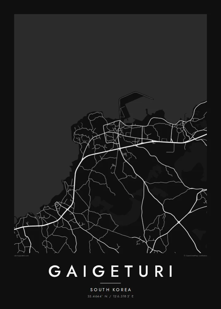
The sea forms one edge of the map. The coastline curves along the island's northwest shore, with roads tracing it closely and lanes running down toward the water.
Posta faʻafanua faigofie · South Korea
33.4644° N / 126.3183° E
A village-scale street pattern on Jeju's northwest shore, set between the sea and the gentle volcanic slopes inland



Tasi le aai, lagona e lima
Tapi se sitaili e vaai ai i luga o le puipui. E tutusa uma le tau o sitaili — pe lolomiina, faapipiiina, pe avea ma faila HD.
 Pika Moni · Faila Lolomi 24 × 36″
Manino mo le lolomi
O se vaega atoa (100%) lenei mai le faila lolomi moni. O posita uma — pe lolomiina, faapipiiina pe download mai — e faia i luga o a matou server i le 300 DPI, e oo atu i le 7,200 × 10,800 pika, ina ia manino pea auala laiti i luga o se lolomiga 24 × 36″.
I luga o le puipui


Le faʻafanua
Gaigeturi lies on the northwestern side of Jeju Island, where the land slopes gently from the coast toward the volcanic heights of the interior. From above, it is a close pattern of lanes and small plots near the shore, with roads leading along the coast and up the slope into farmland.
Jeju's landscape is volcanic, formed by the eruptions that built Hallasan, the mountain at the island's centre. Low walls of dark basalt surround fields and houses in much of the island, and near the coast the road network follows the edge of the land. On a map, the result is a fine mesh of small parcels between the open sea and the hills.
A Gaigeturi map poster shows that meeting point between shore and slope. The coastline gives the design a strong edge, the lanes give it texture, and the roads heading inland hint at the mountain beyond the frame. It is a quiet, detailed image of one small part of an island many people know from holidays.
The sea forms one edge of the map. The coastline curves along the island's northwest shore, with roads tracing it closely and lanes running down toward the water.
Much of Jeju is divided into small fields and plots, often bounded by basalt walls. On the map this becomes a dense, irregular pattern of short lines.
Roads climb gently inland toward the volcanic centre of the island, where Hallasan rises. The map shows a village oriented between sea and mountain.
Fai mo oe
Faʻaopoopo se aso, se igoa po o sau lava upu, sui le sitaili, lapoʻa po o le itu.
O le preview e leai se totogi e maualalo le resolution ma iai se watermark. O lolomi ma faila HD e faia i le 300 DPI, e oo atu i le 7,200 × 10,800 px, e aunoa ma se watermark.
Aisea Gaigeturi
Jeju holds a particular place for many people, whether they grew up on the island, married there or visited once and remembered it. A map of Gaigeturi keeps that memory specific, without the usual tourist views.
The title, subtitle and coordinates line are yours to set, so you can add names or a date. Pick one of five styles, Classic black & white, Noir, Paper, Blueprint or Sand, and choose between $9 HD files or a printed poster.
Faatau le posita Gaigeturi| Lapoʻa lolomi | Manino | Faila |
|---|---|---|
| 30 × 40 cm11.8 × 15.7″ | 3,543 × 4,724 px | PNG · PDF |
| 29.7 × 42 cm (A3)11.7 × 16.5″ | 3,508 × 4,961 px | PNG · PDF |
| 42 × 59.4 cm (A2)16.5 × 23.4″ | 4,961 × 7,016 px | PNG · PDF |
| 45.7 × 61 cm18 × 24″ | 5,400 × 7,200 px | PNG · PDF |
| 50 × 70 cm19.7 × 27.6″ | 5,906 × 8,268 px | PNG · PDF |
| 61 × 91.4 cm24 × 36″ | 7,200 × 10,800 px | PNG · PDF |
Ae faʻatusatusa, o le faʻataʻitaʻiga e leai se totogi e 900 px le lautele, e iai le faʻailoga vai ma e mo mata. O faila HD e oʻo atu i le 8× le manino i itu taʻitasi ma e lolomi manino i le lapoʻa atoa o le posta.
Filifili se sitaili i le pito i luga o le itulau, ona filifili lea o le Posita Lolomi — se lapopoa ma, afai e te fiafia, se faavaa — po o Faila HD Numera. E na o le tasi laasaga o le Checkout, ma o le a fesuia'i lou itulau o oka i le taimi lava e mae'a ai le totogi.
E lolomiina i luga o pepa matte maualuga le tulaga e 200 gsm, i se tasi o lapopoa e ono, mai le 30 × 40 cm i le 24 × 36″. E amata le tau o posita lolomi mai le $39, aofia ai le auina atu.
Ioe. Filifili se faavaa laau malosi i le lanu uliuli, sina, oak masani, po o le laau pogisa. E aofia ai se tioata e le gau ma ua saunia e tautau i luga. E amata le tau o posita faavaa mai le $99, aofia ai le auina atu.
E leai se totogi o le auina atu i atunuu e 60+. O pepa ata taʻitasi e lolomiina e le tasi o matou paaga lolomi e latalata mai i atunuu e 30+, ma e masani ona taunuu i le 3–7 aso faigaluega. E mafai ona e mulimulitaia le tulaga ma le sailiga i lalo o My Orders. O nisi atunuu e 2–5 vaiaso, ma i nofoaga e lei matou auina atu iai, e taʻu atu e le saite ia te oe a o lei totogi.
Auina mai se ata i totonu o le 14 aso talu ona taunuu, ma o le a matou toe lolomiina e leai se totogi po o le toe faafoi atu lau tupe.
Ioe. I totonu o le editor i lenei itulau, suia le ulutala, le ulutala laititi ma le laina o coordinates i soo se mea e te fiafia i ai, ma filifili se sitaili ma le lapopoa. O oka lolomi, faavaa ma numera e faaaoga uma lava lau mamanu.
Mo le $9 e te maua ai faila PNG 300 DPI ma PDF ua saunia mo le lolomi i lapopoa uma e ono, e aunoa ma se watermark, e mafai ona lolomi i soo se mea. Le mautinoa lava? Download muamua se preview e leai se totogi ma le watermark.
Latalata ane
