Hudson riverfront
The river forms the western edge of the town, with the villages' steep, dense streets pressed against the shoreline and the rail line.
Posta faʻafanua faigofie · United States
41.0329° N / 73.8429° W
A Westchester town stretching from the Hudson riverfront across wooded ridges and parkways, with river villages strung along its western edge


Tasi le aai, lagona e lima
Tapi se sitaili e vaai ai i luga o le puipui. E tutusa uma le tau o sitaili — pe lolomiina, faapipiiina, pe avea ma faila HD.
 Pika Moni · Faila Lolomi 24 × 36″
Manino mo le lolomi
O se vaega atoa (100%) lenei mai le faila lolomi moni. O posita uma — pe lolomiina, faapipiiina pe download mai — e faia i luga o a matou server i le 300 DPI, e oo atu i le 7,200 × 10,800 pika, ina ia manino pea auala laiti i luga o se lolomiga 24 × 36″.
I luga o le puipui


Le faʻafanua
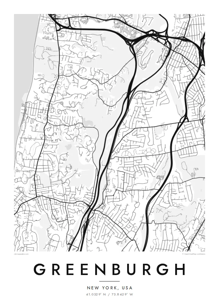
Greenburgh is a town in central Westchester County, New York, stretching from the east bank of the Hudson River inland across a series of low ridges and valleys. It contains several incorporated villages, including Tarrytown, Irvington, Dobbs Ferry, Hastings-on-Hudson, Ardsley and Elmsford, along with large unincorporated areas, so its map is really a collection of distinct communities stitched together.
The river villages cluster along the Hudson, their streets climbing steeply from the waterfront. Inland, parkways and highways follow the valleys from north to south, including the Saw Mill River Parkway, the Sprain Brook Parkway and the Bronx River Parkway. The Old Croton Aqueduct trail runs through the western villages, and the Mario M. Cuomo Bridge reaches the shore at Tarrytown.
A Greenburgh map poster shows this unusual structure well: the wide band of the Hudson on one side, the tight streets of the river villages, and the curving residential roads and wooded parkland inland. The parkways add long flowing lines through the middle, giving the composition a sense of movement from the river toward White Plains.
The river forms the western edge of the town, with the villages' steep, dense streets pressed against the shoreline and the rail line.
The Saw Mill River, Sprain Brook and Bronx River parkways run through the valleys, drawing smooth, curving lines across the wooded residential landscape.
The long Mario M. Cuomo Bridge across the Tappan Zee reaches the east bank at Tarrytown, one of the most recognisable shapes along this stretch of the river.
Fai mo oe
Faʻaopoopo se aso, se igoa po o sau lava upu, sui le sitaili, lapoʻa po o le itu.
O le preview e leai se totogi e maualalo le resolution ma iai se watermark. O lolomi ma faila HD e faia i le 300 DPI, e oo atu i le 7,200 × 10,800 px, e aunoa ma se watermark.
Aisea Greenburgh
People in Greenburgh often identify with a particular village or hamlet, yet the town ties them together. A map covering the riverfront and the ridges beyond makes a thoughtful gift for a new home in Hartsdale, Dobbs Ferry or Irvington, or for someone moving away.
Title the poster with your village, street or family name, add a subtitle or a date and edit the coordinates line. Choose among five styles, including the soft Sand and the dark Noir, and order a printed poster with an optional wooden frame or download HD files.
Faatau le posita Greenburgh| Lapoʻa lolomi | Manino | Faila |
|---|---|---|
| 30 × 40 cm11.8 × 15.7″ | 3,543 × 4,724 px | PNG · PDF |
| 29.7 × 42 cm (A3)11.7 × 16.5″ | 3,508 × 4,961 px | PNG · PDF |
| 42 × 59.4 cm (A2)16.5 × 23.4″ | 4,961 × 7,016 px | PNG · PDF |
| 45.7 × 61 cm18 × 24″ | 5,400 × 7,200 px | PNG · PDF |
| 50 × 70 cm19.7 × 27.6″ | 5,906 × 8,268 px | PNG · PDF |
| 61 × 91.4 cm24 × 36″ | 7,200 × 10,800 px | PNG · PDF |
Ae faʻatusatusa, o le faʻataʻitaʻiga e leai se totogi e 900 px le lautele, e iai le faʻailoga vai ma e mo mata. O faila HD e oʻo atu i le 8× le manino i itu taʻitasi ma e lolomi manino i le lapoʻa atoa o le posta.
Filifili se sitaili i le pito i luga o le itulau, ona filifili lea o le Posita Lolomi — se lapopoa ma, afai e te fiafia, se faavaa — po o Faila HD Numera. E na o le tasi laasaga o le Checkout, ma o le a fesuia'i lou itulau o oka i le taimi lava e mae'a ai le totogi.
E lolomiina i luga o pepa matte maualuga le tulaga e 200 gsm, i se tasi o lapopoa e ono, mai le 30 × 40 cm i le 24 × 36″. E amata le tau o posita lolomi mai le $39, aofia ai le auina atu.
Ioe. Filifili se faavaa laau malosi i le lanu uliuli, sina, oak masani, po o le laau pogisa. E aofia ai se tioata e le gau ma ua saunia e tautau i luga. E amata le tau o posita faavaa mai le $99, aofia ai le auina atu.
E leai se totogi o le auina atu i atunuu e 60+. O pepa ata taʻitasi e lolomiina e le tasi o matou paaga lolomi e latalata mai i atunuu e 30+, ma e masani ona taunuu i le 3–7 aso faigaluega. E mafai ona e mulimulitaia le tulaga ma le sailiga i lalo o My Orders. O nisi atunuu e 2–5 vaiaso, ma i nofoaga e lei matou auina atu iai, e taʻu atu e le saite ia te oe a o lei totogi.
Auina mai se ata i totonu o le 14 aso talu ona taunuu, ma o le a matou toe lolomiina e leai se totogi po o le toe faafoi atu lau tupe.
Ioe. I totonu o le editor i lenei itulau, suia le ulutala, le ulutala laititi ma le laina o coordinates i soo se mea e te fiafia i ai, ma filifili se sitaili ma le lapopoa. O oka lolomi, faavaa ma numera e faaaoga uma lava lau mamanu.
Mo le $9 e te maua ai faila PNG 300 DPI ma PDF ua saunia mo le lolomi i lapopoa uma e ono, e aunoa ma se watermark, e mafai ona lolomi i soo se mea. Le mautinoa lava? Download muamua se preview e leai se totogi ma le watermark.
Latalata ane
