Route Napoléon
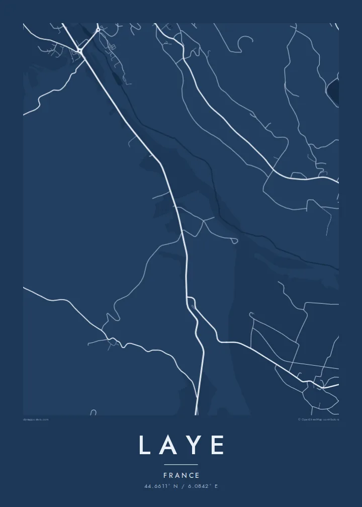
The historic road north from Gap runs through the commune toward the Col Bayard, giving the map a strong line that the smaller lanes branch away from.
Posta faʻafanua faigofie · France
44.6611° N / 6.0842° E
A small commune on the approach to the Col Bayard, where the Route Napoléon climbs north out of the Gap basin.



Tasi le aai, lagona e lima
Tapi se sitaili e vaai ai i luga o le puipui. E tutusa uma le tau o sitaili — pe lolomiina, faapipiiina, pe avea ma faila HD.
 Pika Moni · Faila Lolomi 24 × 36″
Manino mo le lolomi
O se vaega atoa (100%) lenei mai le faila lolomi moni. O posita uma — pe lolomiina, faapipiiina pe download mai — e faia i luga o a matou server i le 300 DPI, e oo atu i le 7,200 × 10,800 pika, ina ia manino pea auala laiti i luga o se lolomiga 24 × 36″.
I luga o le puipui


Le faʻafanua
Laye sits in the Hautes-Alpes a short distance north of Gap, on the slopes leading up to the Col Bayard. The historic Route Napoléon passes through on its way over the pass toward the Champsaur and Grenoble, and on the map it appears as the main line crossing the commune, with smaller lanes branching off toward farms and hamlets.
The village is home to a small ski station, one of the closest to Gap, used mostly by local families and beginners. Its short runs and modest lifts make only a small mark on the landscape, surrounded by meadow, forest and the open ground around the pass. The whole commune covers about eleven square kilometres, so the map stays close and readable.
A Laye map poster is less about grandeur than about a familiar route: the road winding up from the city, a village on the slope, a few ski runs cut into the hillside. For people from Gap and the Champsaur who learned to ski here, or who cross the pass often, it is a very personal piece of geography.
The historic road north from Gap runs through the commune toward the Col Bayard, giving the map a strong line that the smaller lanes branch away from.
The small ski area sits close to the village, its short runs and lifts drawn as a few light strokes against the surrounding meadow and woodland.
Northward the terrain rises toward the Col Bayard, where the road crosses between the Gap basin and the Champsaur valley that opens out beyond it.
Fai mo oe
Faʻaopoopo se aso, se igoa po o sau lava upu, sui le sitaili, lapoʻa po o le itu.
O le preview e leai se totogi e maualalo le resolution ma iai se watermark. O lolomi ma faila HD e faia i le 300 DPI, e oo atu i le 7,200 × 10,800 px, e aunoa ma se watermark.
Aisea Laye
Laye is the kind of place people know from childhood rather than from brochures: the nearby slope for a Sunday afternoon, the pass on the way to family. A clean map of it makes a quietly meaningful gift for anyone rooted in the southern Alps.
Change the title, subtitle and coordinates line to suit, perhaps with a name and a year, and choose one of five styles. Start with a free 900 px preview, then take the high-resolution files for $9 or a printed poster with an optional wooden frame.
Faatau le posita Laye| Lapoʻa lolomi | Manino | Faila |
|---|---|---|
| 30 × 40 cm (11.8 × 15.7″) | 3,543 × 4,724 px | PNG · PDF |
| 29.7 × 42 cm (A3, 11.7 × 16.5″) | 3,508 × 4,961 px | PNG · PDF |
| 42 × 59.4 cm (A2, 16.5 × 23.4″) | 4,961 × 7,016 px | PNG · PDF |
| 45.7 × 61 cm (18 × 24″) | 5,400 × 7,200 px | PNG · PDF |
| 50 × 70 cm (19.7 × 27.6″) | 5,906 × 8,268 px | PNG · PDF |
| 61 × 91.4 cm (24 × 36″) | 7,200 × 10,800 px | PNG · PDF |
Ae faʻatusatusa, o le faʻataʻitaʻiga e leai se totogi e 900 px le lautele, e iai le faʻailoga vai ma e mo mata. O faila HD e oʻo atu i le 8× le manino i itu taʻitasi ma e lolomi manino i le lapoʻa atoa o le posta.
Filifili se sitaili i le pito i luga o le itulau, ona filifili lea o le Posita Lolomi — se lapopoa ma, afai e te fiafia, se faavaa — po o Faila HD Numera. E na o le tasi laasaga o le Checkout, ma o le a fesuia'i lou itulau o oka i le taimi lava e mae'a ai le totogi.
E lolomiina i luga o pepa matte maualuga le tulaga e 200 gsm, i se tasi o lapopoa e ono, mai le 30 × 40 cm i le 24 × 36″. E amata le tau o posita lolomi mai le {printFrom}, aofia ai le auina atu.
Ioe. Filifili se faavaa laau malosi i le lanu uliuli, sina, oak masani, po o le laau pogisa. E aofia ai se tioata e le gau ma ua saunia e tautau i luga. E amata le tau o posita faavaa mai le {framedFrom}, aofia ai le auina atu.
E leai se totogi mo le uta i le lalolagi atoa. O poster ta'itasi e lolomi e le paaga lolomi e latalata mai i matou i atunuu e 30+, ma e masani ona taunuu i aso faigaluega e 3–7. E mafai ona e mulimuli i le tulaga ma le tracking i le "Aʻu Oka". O nisi atunuu e 2–5 vaiaso, ma i atunuu matou te lei tuuina atu ai, e taʻu atu e le saite iā te oe ae e te leʻi totogiina.
Auina mai se ata i totonu o le 14 aso talu ona taunuu, ma o le a matou toe lolomiina e leai se totogi po o le toe faafoi atu lau tupe.
Ioe. I totonu o le editor i lenei itulau, suia le ulutala, le ulutala laititi ma le laina o coordinates i soo se mea e te fiafia i ai, ma filifili se sitaili ma le lapopoa. O oka lolomi, faavaa ma numera e faaaoga uma lava lau mamanu.
Mo le $9 e te maua ai faila PNG 300 DPI ma PDF ua saunia mo le lolomi i lapopoa uma e ono, e aunoa ma se watermark, e mafai ona lolomi i soo se mea. Le mautinoa lava? Download muamua se preview e leai se totogi ma le watermark.
