Indus floodplain
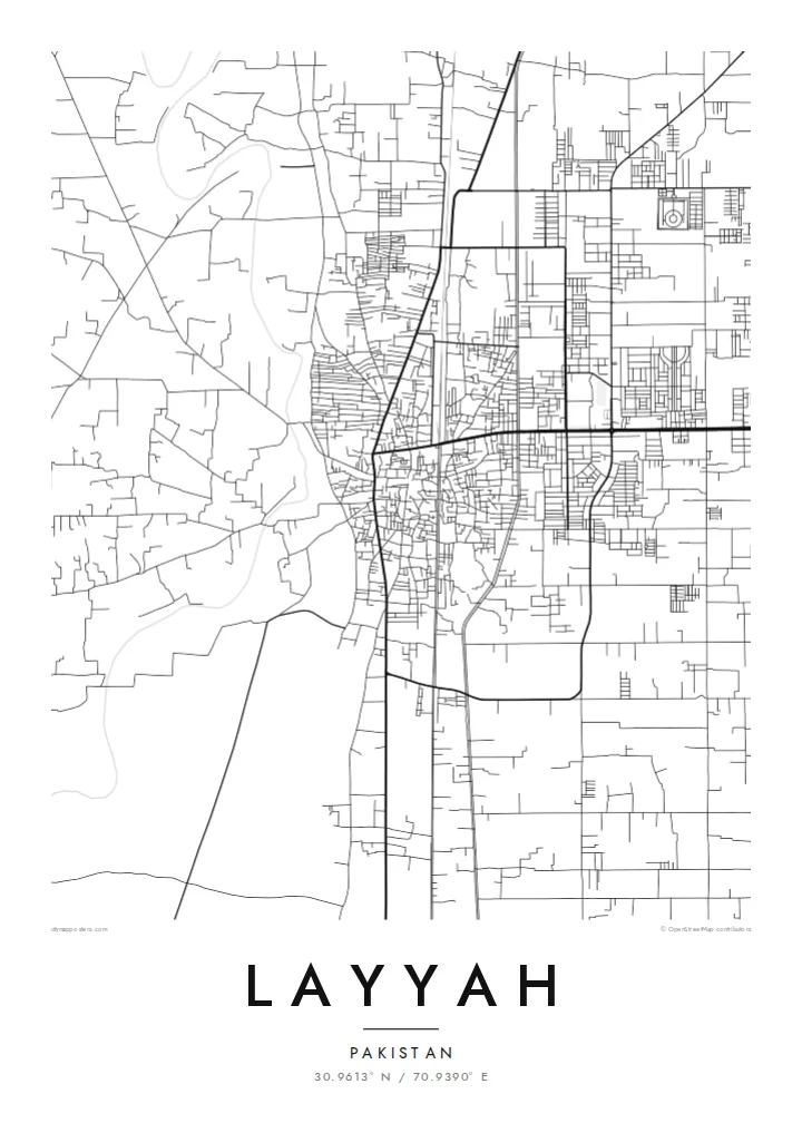
West of the town the river spreads into a wide braided bed of channels and sandbars, a restless landscape that gives the map its most organic shapes.
Posta faʻafanua faigofie · Pakistan
30.9613° N / 70.9390° E
A Punjab town on level ground between the braided Indus floodplain and the sandy expanse of the Thal.


Tasi le aai, lagona e lima
Tapi se sitaili e vaai ai i luga o le puipui. E tutusa uma le tau o sitaili — pe lolomiina, faapipiiina, pe avea ma faila HD.
 Pika Moni · Faila Lolomi 24 × 36″
Manino mo le lolomi
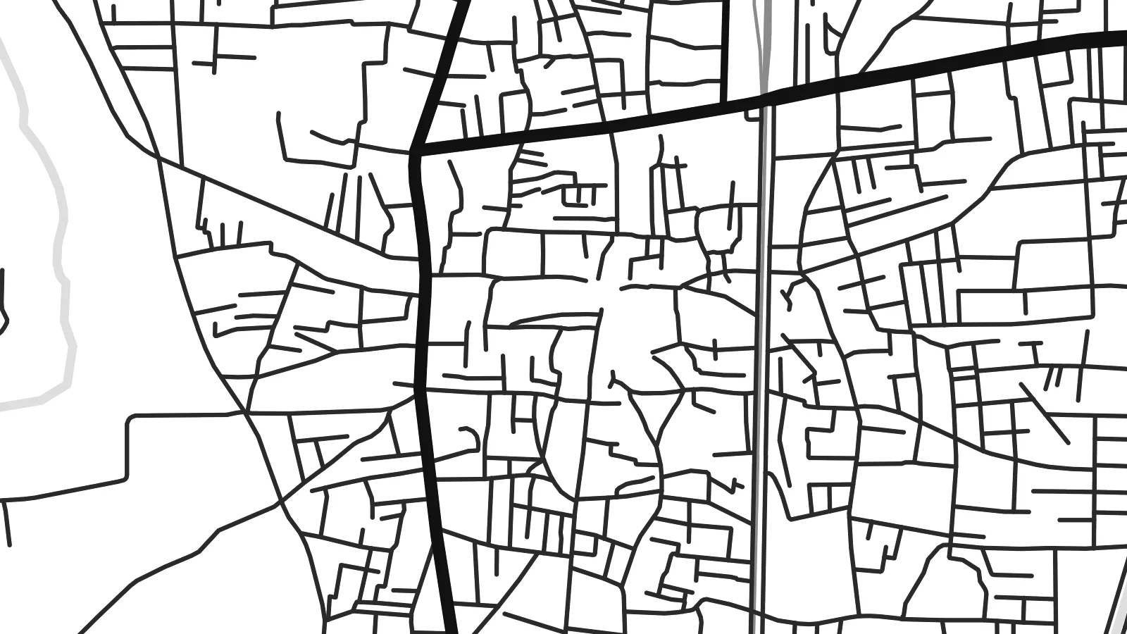
O se vaega atoa (100%) lenei mai le faila lolomi moni. O posita uma — pe lolomiina, faapipiiina pe download mai — e faia i luga o a matou server i le 300 DPI, e oo atu i le 7,200 × 10,800 pika, ina ia manino pea auala laiti i luga o se lolomiga 24 × 36″.
I luga o le puipui


Le faʻafanua
Layyah lies in southwestern Punjab, on the eastern side of the Indus, where the wide river plain meets the drier lands of the Thal. On a map the surroundings are flat and open, crossed by canals, field tracks and scattered villages. The town itself forms a compact centre with roads fanning outward to neighbouring districts, and there are no hills or coastlines to interrupt its plan.
The river's presence is felt more than seen from the streets. To the west, the Indus spreads into a broad bed of channels, sandbars and seasonal floodland that shifts from year to year. To the east, the land becomes sandier and more sparsely settled. The town sits between these two landscapes, and its roads and canals mark the line where irrigation has made steady farming possible.
Layyah is the administrative centre of its district and a market town for the surrounding agricultural area. Its map is quiet and even in texture, a web of local streets rather than grand avenues. A Layyah map poster suits that modesty: a clear network of roads on level ground, with the river country on one side and the Thal on the other, rendered in simple lines.
West of the town the river spreads into a wide braided bed of channels and sandbars, a restless landscape that gives the map its most organic shapes.
Irrigation canals run across the level land around Layyah in long straight lines, dividing fields and guiding roads, and they are among the clearest features on the map.
To the east the ground turns sandier and settlement thins out, so the dense town streets stand out against a lighter, emptier background.
Fai mo oe
Faʻaopoopo se aso, se igoa po o sau lava upu, sui le sitaili, lapoʻa po o le itu.
O le preview e leai se totogi e maualalo le resolution ma iai se watermark. O lolomi ma faila HD e faia i le 300 DPI, e oo atu i le 7,200 × 10,800 px, e aunoa ma se watermark.
Aisea Layyah
For people from Layyah who now live in Lahore, the Gulf or further away, a map of home is a simple thing to keep on the wall. It shows the streets they know without needing any explanation.
You can personalise the title and subtitle, and set the coordinates line or a meaningful date. Five styles are available: Classic black & white, Noir, Paper, Blueprint and Sand, with Sand a natural fit for the Thal landscape nearby.
Faatau le posita Layyah| Lapoʻa lolomi | Manino | Faila |
|---|---|---|
| 30 × 40 cm (11.8 × 15.7″) | 3,543 × 4,724 px | PNG · PDF |
| 29.7 × 42 cm (A3, 11.7 × 16.5″) | 3,508 × 4,961 px | PNG · PDF |
| 42 × 59.4 cm (A2, 16.5 × 23.4″) | 4,961 × 7,016 px | PNG · PDF |
| 45.7 × 61 cm (18 × 24″) | 5,400 × 7,200 px | PNG · PDF |
| 50 × 70 cm (19.7 × 27.6″) | 5,906 × 8,268 px | PNG · PDF |
| 61 × 91.4 cm (24 × 36″) | 7,200 × 10,800 px | PNG · PDF |
Ae faʻatusatusa, o le faʻataʻitaʻiga e leai se totogi e 900 px le lautele, e iai le faʻailoga vai ma e mo mata. O faila HD e oʻo atu i le 8× le manino i itu taʻitasi ma e lolomi manino i le lapoʻa atoa o le posta.
Filifili se sitaili i le pito i luga o le itulau, ona filifili lea o le Posita Lolomi — se lapopoa ma, afai e te fiafia, se faavaa — po o Faila HD Numera. E na o le tasi laasaga o le Checkout, ma o le a fesuia'i lou itulau o oka i le taimi lava e mae'a ai le totogi.
E lolomiina i luga o pepa matte maualuga le tulaga e 200 gsm, i se tasi o lapopoa e ono, mai le 30 × 40 cm i le 24 × 36″. E amata le tau o posita lolomi mai le $39, aofia ai le auina atu.
Ioe. Filifili se faavaa laau malosi i le lanu uliuli, sina, oak masani, po o le laau pogisa. E aofia ai se tioata e le gau ma ua saunia e tautau i luga. E amata le tau o posita faavaa mai le $99, aofia ai le auina atu.
E leai se totogi mo le uta i le lalolagi atoa. O poster ta'itasi e lolomi e le paaga lolomi e latalata mai i matou i atunuu e 30+, ma e masani ona taunuu i aso faigaluega e 3–7. E mafai ona e mulimuli i le tulaga ma le tracking i le "Aʻu Oka". O nisi atunuu e 2–5 vaiaso, ma i atunuu matou te lei tuuina atu ai, e taʻu atu e le saite iā te oe ae e te leʻi totogiina.
Auina mai se ata i totonu o le 14 aso talu ona taunuu, ma o le a matou toe lolomiina e leai se totogi po o le toe faafoi atu lau tupe.
Ioe. I totonu o le editor i lenei itulau, suia le ulutala, le ulutala laititi ma le laina o coordinates i soo se mea e te fiafia i ai, ma filifili se sitaili ma le lapopoa. O oka lolomi, faavaa ma numera e faaaoga uma lava lau mamanu.
Mo le $9 e te maua ai faila PNG 300 DPI ma PDF ua saunia mo le lolomi i lapopoa uma e ono, e aunoa ma se watermark, e mafai ona lolomi i soo se mea. Le mautinoa lava? Download muamua se preview e leai se totogi ma le watermark.
