Bay and shoreline
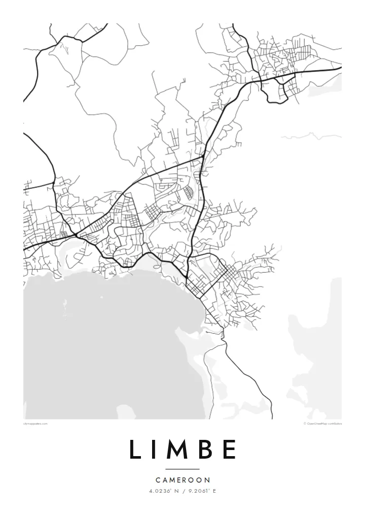
The town curves around a small Atlantic bay. The coastline, with its points and coves, gives the poster its most defining line.
Posta faʻafanua faigofie · Cameroon
4.0236° N / 9.2061° E
A coastal town beneath Mount Cameroon, with dark volcanic beaches, a botanic garden and streets that climb from the bay.


Tasi le aai, lagona e lima
Tapi se sitaili e vaai ai i luga o le puipui. E tutusa uma le tau o sitaili — pe lolomiina, faapipiiina, pe avea ma faila HD.
 Pika Moni · Faila Lolomi 24 × 36″
Manino mo le lolomi
O se vaega atoa (100%) lenei mai le faila lolomi moni. O posita uma — pe lolomiina, faapipiiina pe download mai — e faia i luga o a matou server i le 300 DPI, e oo atu i le 7,200 × 10,800 pika, ina ia manino pea auala laiti i luga o se lolomiga 24 × 36″.
I luga o le puipui


Le faʻafanua
Limbe lies on the Atlantic coast of Cameroon, at the foot of Mount Cameroon, the highest peak in West and Central Africa. The town wraps around a small bay, and behind it the ground begins its long climb toward the volcano. On a map the coastline and the slope set the shape of the town: a curve of streets along the shore that reaches inland wherever the land allows.
The English Baptist missionary Alfred Saker founded the town in 1858, and it was called Victoria until 1982. The Limbe Botanic Garden, established in 1892 during the German colonial period, is still one of its best-known sites. It is a large green space close to the centre and shows as open ground on the map.
Past lava flows from Mount Cameroon have left the nearby beaches dark with volcanic sand, and the coast mixes rocky points with small coves. A Limbe map poster keeps the essential lines of this landscape: shore, slope and streets. It shows a town held between the ocean and one of Africa's active volcanoes.
The town curves around a small Atlantic bay. The coastline, with its points and coves, gives the poster its most defining line.
The historic botanic garden near the centre forms a broad open area among the streets and a calm space in the composition.
Roads lead inland and upward toward the mountain. They thin out as the terrain rises and leave the upper edge of the map open.
Fai mo oe
Faʻaopoopo se aso, se igoa po o sau lava upu, sui le sitaili, lapoʻa po o le itu.
O le preview e leai se totogi e maualalo le resolution ma iai se watermark. O lolomi ma faila HD e faia i le 300 DPI, e oo atu i le 7,200 × 10,800 px, e aunoa ma se watermark.
Aisea Limbe
Limbe is a place of beaches, fishing boats and family weekends by the sea, and for many Cameroonians it is closely tied to home. A map of the town keeps the bay, the mountain and the familiar streets together in one clear image.
Personalise the title, subtitle and coordinates line, for example with Victoria as a subtitle or a meaningful date, and choose from five styles: Classic black & white, Noir, Paper, Blueprint or Sand. Noir suits a town known for its dark volcanic shore.
Faatau le posita Limbe| Lapoʻa lolomi | Manino | Faila |
|---|---|---|
| 30 × 40 cm (11.8 × 15.7″) | 3,543 × 4,724 px | PNG · PDF |
| 29.7 × 42 cm (A3, 11.7 × 16.5″) | 3,508 × 4,961 px | PNG · PDF |
| 42 × 59.4 cm (A2, 16.5 × 23.4″) | 4,961 × 7,016 px | PNG · PDF |
| 45.7 × 61 cm (18 × 24″) | 5,400 × 7,200 px | PNG · PDF |
| 50 × 70 cm (19.7 × 27.6″) | 5,906 × 8,268 px | PNG · PDF |
| 61 × 91.4 cm (24 × 36″) | 7,200 × 10,800 px | PNG · PDF |
Ae faʻatusatusa, o le faʻataʻitaʻiga e leai se totogi e 900 px le lautele, e iai le faʻailoga vai ma e mo mata. O faila HD e oʻo atu i le 8× le manino i itu taʻitasi ma e lolomi manino i le lapoʻa atoa o le posta.
Filifili se sitaili i le pito i luga o le itulau, ona filifili lea o le Posita Lolomi — se lapopoa ma, afai e te fiafia, se faavaa — po o Faila HD Numera. E na o le tasi laasaga o le Checkout, ma o le a fesuia'i lou itulau o oka i le taimi lava e mae'a ai le totogi.
E lolomiina i luga o pepa matte maualuga le tulaga e 200 gsm, i se tasi o lapopoa e ono, mai le 30 × 40 cm i le 24 × 36″. E amata le tau o posita lolomi mai le {printFrom}, aofia ai le auina atu.
Ioe. Filifili se faavaa laau malosi i le lanu uliuli, sina, oak masani, po o le laau pogisa. E aofia ai se tioata e le gau ma ua saunia e tautau i luga. E amata le tau o posita faavaa mai le {framedFrom}, aofia ai le auina atu.
E leai se totogi mo le uta i le lalolagi atoa. O poster ta'itasi e lolomi e le paaga lolomi e latalata mai i matou i atunuu e 30+, ma e masani ona taunuu i aso faigaluega e 3–7. E mafai ona e mulimuli i le tulaga ma le tracking i le "Aʻu Oka". O nisi atunuu e 2–5 vaiaso, ma i atunuu matou te lei tuuina atu ai, e taʻu atu e le saite iā te oe ae e te leʻi totogiina.
Auina mai se ata i totonu o le 14 aso talu ona taunuu, ma o le a matou toe lolomiina e leai se totogi po o le toe faafoi atu lau tupe.
Ioe. I totonu o le editor i lenei itulau, suia le ulutala, le ulutala laititi ma le laina o coordinates i soo se mea e te fiafia i ai, ma filifili se sitaili ma le lapopoa. O oka lolomi, faavaa ma numera e faaaoga uma lava lau mamanu.
Mo le $9 e te maua ai faila PNG 300 DPI ma PDF ua saunia mo le lolomi i lapopoa uma e ono, e aunoa ma se watermark, e mafai ona lolomi i soo se mea. Le mautinoa lava? Download muamua se preview e leai se totogi ma le watermark.
Latalata ane
