Converging country roads
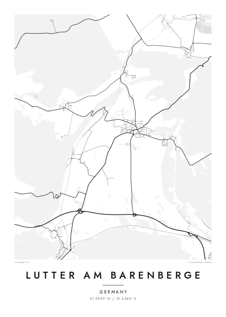
Several local roads meet in the village centre, giving the map a clear focal point from which lines radiate out across the surrounding farmland toward neighbouring villages.
Posta faʻafanua faigofie · Germany
51.9859° N / 10.2545° E
A small village core where country roads meet, framed by open fields and wooded higher ground on the northern edge of the Harz.
Tasi le aai, lagona e lima
Tapi se sitaili e vaai ai i luga o le puipui. E tutusa uma le tau o sitaili — pe lolomiina, faapipiiina, pe avea ma faila HD.
 Pika Moni · Faila Lolomi 24 × 36″
Manino mo le lolomi
O se vaega atoa (100%) lenei mai le faila lolomi moni. O posita uma — pe lolomiina, faapipiiina pe download mai — e faia i luga o a matou server i le 300 DPI, e oo atu i le 7,200 × 10,800 pika, ina ia manino pea auala laiti i luga o se lolomiga 24 × 36″.
I luga o le puipui


Le faʻafanua
Lutter am Barenberge sits in the rolling country north of the Harz, in the district of Goslar in Lower Saxony. On a map the village reads as a compact cluster of streets where several roads converge, with farmland spreading out in broad, irregular parcels and patches of woodland rising toward the higher ground. The name itself points to a nearby hill, the Barenberg, a reminder that the landscape here is shaped by gentle relief rather than flat plain.
The place entered European history in August 1626, when the Battle of Lutter was fought nearby during the Thirty Years' War. Imperial and Catholic League troops under Tilly defeated the army of King Christian IV of Denmark, a defeat that sharply weakened the Danish role in the war. Little of that drama shows on paper today. What remains visible is the quiet agricultural pattern that surrounded the battlefield then and still does now.
Since 2021 Lutter has belonged to the town of Langelsheim, yet it keeps its own distinct outline. A Lutter am Barenberge map poster captures that outline in fine lines: the village streets at the centre, the lanes and field tracks running outward, and the softer texture of forest at the margins. It is a small place, and the poster treats it with the same care as any large city.
Several local roads meet in the village centre, giving the map a clear focal point from which lines radiate out across the surrounding farmland toward neighbouring villages.
Large agricultural parcels surround the built-up area, and their boundaries and tracks form a loose geometric background that contrasts with the denser streets of the village.
Wooded higher ground lies within reach of the village, and the Barenberg that gives Lutter its name hints at the rising terrain that eventually becomes the Harz to the south.
Fai mo oe
Faʻaopoopo se aso, se igoa po o sau lava upu, sui le sitaili, lapoʻa po o le itu.
O le preview e leai se totogi e maualalo le resolution ma iai se watermark. O lolomi ma faila HD e faia i le 300 DPI, e oo atu i le 7,200 × 10,800 px, e aunoa ma se watermark.
Aisea Lutter am Barenberge
For people with family roots in the Goslar district, or for anyone interested in the Thirty Years' War, this map is a quiet way to keep a specific place in view. It is less about spectacle than about recognising the lanes you know, drawn with clarity and restraint.
You can set your own title and subtitle, add a date such as a wedding or a move, and adjust the coordinates line. Choose between Classic black & white, Noir, Paper, Blueprint and Sand, then download HD files for $9 or order a printed poster.
Faatau le posita Lutter am Barenberge| Lapoʻa lolomi | Manino | Faila |
|---|---|---|
| 30 × 40 cm11.8 × 15.7″ | 3,543 × 4,724 px | PNG · PDF |
| 29.7 × 42 cm (A3)11.7 × 16.5″ | 3,508 × 4,961 px | PNG · PDF |
| 42 × 59.4 cm (A2)16.5 × 23.4″ | 4,961 × 7,016 px | PNG · PDF |
| 45.7 × 61 cm18 × 24″ | 5,400 × 7,200 px | PNG · PDF |
| 50 × 70 cm19.7 × 27.6″ | 5,906 × 8,268 px | PNG · PDF |
| 61 × 91.4 cm24 × 36″ | 7,200 × 10,800 px | PNG · PDF |
Ae faʻatusatusa, o le faʻataʻitaʻiga e leai se totogi e 900 px le lautele, e iai le faʻailoga vai ma e mo mata. O faila HD e oʻo atu i le 8× le manino i itu taʻitasi ma e lolomi manino i le lapoʻa atoa o le posta.
Filifili se sitaili i le pito i luga o le itulau, ona filifili lea o le Posita Lolomi — se lapopoa ma, afai e te fiafia, se faavaa — po o Faila HD Numera. E na o le tasi laasaga o le Checkout, ma o le a fesuia'i lou itulau o oka i le taimi lava e mae'a ai le totogi.
E lolomiina i luga o pepa matte maualuga le tulaga e 200 gsm, i se tasi o lapopoa e ono, mai le 30 × 40 cm i le 24 × 36″. E amata le tau o posita lolomi mai le $39, aofia ai le auina atu.
Ioe. Filifili se faavaa laau malosi i le lanu uliuli, sina, oak masani, po o le laau pogisa. E aofia ai se tioata e le gau ma ua saunia e tautau i luga. E amata le tau o posita faavaa mai le $99, aofia ai le auina atu.
E leai se totogi o le auina atu i atunuu e 60+. O pepa ata taʻitasi e lolomiina e le tasi o matou paaga lolomi e latalata mai i atunuu e 30+, ma e masani ona taunuu i le 3–7 aso faigaluega. E mafai ona e mulimulitaia le tulaga ma le sailiga i lalo o My Orders. O nisi atunuu e 2–5 vaiaso, ma i nofoaga e lei matou auina atu iai, e taʻu atu e le saite ia te oe a o lei totogi.
Auina mai se ata i totonu o le 14 aso talu ona taunuu, ma o le a matou toe lolomiina e leai se totogi po o le toe faafoi atu lau tupe.
Ioe. I totonu o le editor i lenei itulau, suia le ulutala, le ulutala laititi ma le laina o coordinates i soo se mea e te fiafia i ai, ma filifili se sitaili ma le lapopoa. O oka lolomi, faavaa ma numera e faaaoga uma lava lau mamanu.
Mo le $9 e te maua ai faila PNG 300 DPI ma PDF ua saunia mo le lolomi i lapopoa uma e ono, e aunoa ma se watermark, e mafai ona lolomi i soo se mea. Le mautinoa lava? Download muamua se preview e leai se totogi ma le watermark.
Latalata ane
