Cape Mesurado
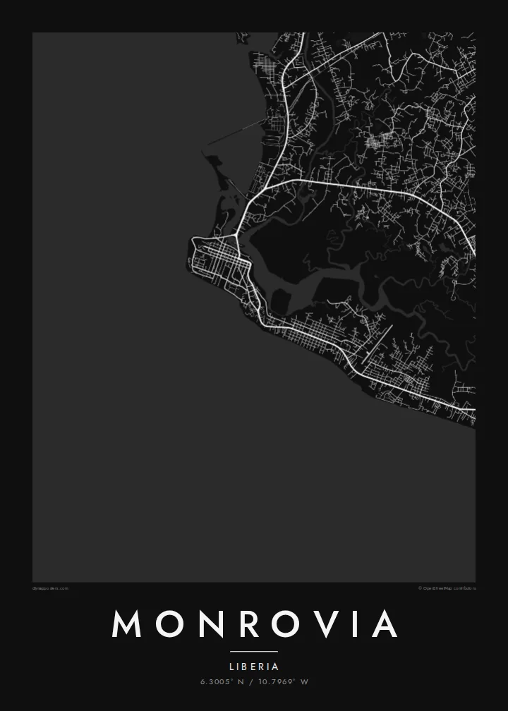
The headland at the tip of the peninsula, where the city was first settled. Its curved shoreline anchors the whole composition and frames the old downtown ridge.
Posta faʻafanua faigofie · Liberia
6.3005° N / 10.7969° W
A narrow cape between the Atlantic and the Mesurado River, with creeks, islands and a long coastal strip.



Tasi le aai, lagona e lima
Tapi se sitaili e vaai ai i luga o le puipui. E tutusa uma le tau o sitaili — pe lolomiina, faapipiiina, pe avea ma faila HD.
 Pika Moni · Faila Lolomi 24 × 36″
Manino mo le lolomi
O se vaega atoa (100%) lenei mai le faila lolomi moni. O posita uma — pe lolomiina, faapipiiina pe download mai — e faia i luga o a matou server i le 300 DPI, e oo atu i le 7,200 × 10,800 pika, ina ia manino pea auala laiti i luga o se lolomiga 24 × 36″.
I luga o le puipui


Le faʻafanua
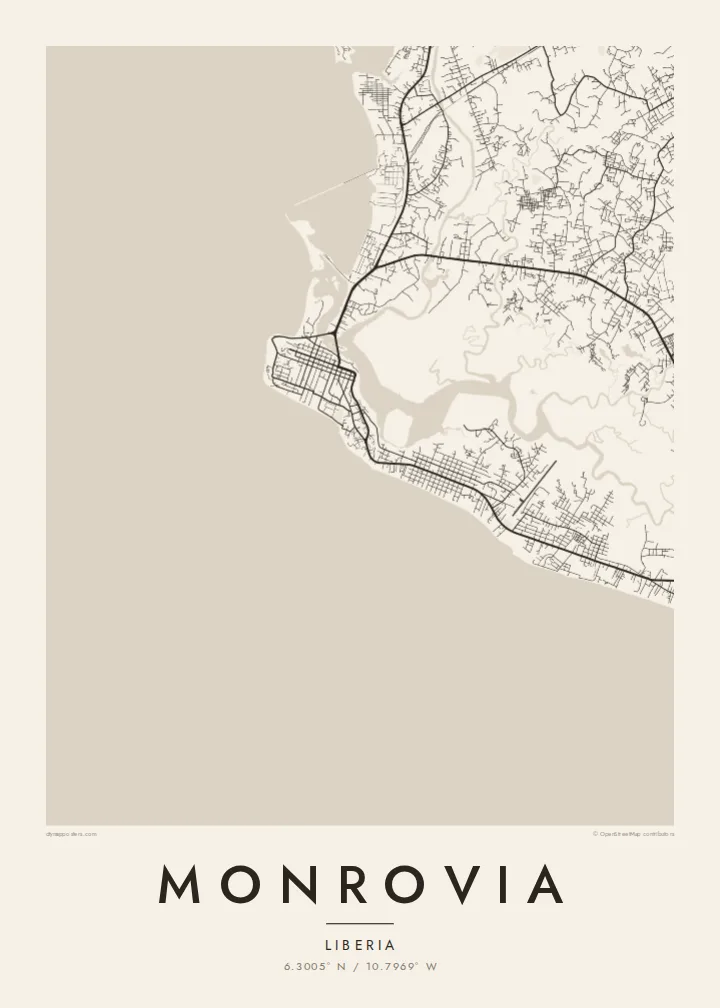
Monrovia occupies Cape Mesurado, a slender peninsula where the Atlantic coast meets the mouth of the Mesurado River. The oldest part of the city climbs the ridge of the cape, with Broad Street and the downtown blocks set along its spine. Behind it, mangrove-lined creeks and wetlands divide the land into irregular pieces, so the map reads as a patchwork of solid ground and water.
Founded in 1822 and named after US President James Monroe, the city later spread southeast along the shore through Sinkor and beyond, following a long corridor parallel to the beach. To the north, Bushrod Island holds the Freeport and sits between the Mesurado and the Saint Paul River, linked to the centre by bridges across the water.
Because so much of Monrovia is defined by coastline and estuary, a Monrovia map poster is as much about water as about streets. The clean sweep of the ocean edge, the tangle of creeks and the narrow built-up strips between them give the design an almost nautical quality, one that stays legible even at the smallest print size.
The headland at the tip of the peninsula, where the city was first settled. Its curved shoreline anchors the whole composition and frames the old downtown ridge.
A low island north of the centre, bounded by the Mesurado and Saint Paul rivers. Its port basin and industrial blocks form a distinct cluster connected by bridges.
The main road running southeast from downtown through Sinkor, roughly parallel to the Atlantic shore. It traces the long, thin growth of the city along the coast.
Fai mo oe
Faʻaopoopo se aso, se igoa po o sau lava upu, sui le sitaili, lapoʻa po o le itu.
O le preview e leai se totogi e maualalo le resolution ma iai se watermark. O lolomi ma faila HD e faia i le 300 DPI, e oo atu i le 7,200 × 10,800 px, e aunoa ma se watermark.
Aisea Monrovia
For Liberians abroad, aid workers, diplomats and families with roots in the city, Monrovia is a place defined by its shoreline and its neighbourhoods. A framed map is a calm way to keep that geography close, whether it marks a birthplace, a posting or a return.
Personalise the title and subtitle, add a date or keep the coordinates line as it is, then pick one of five styles; Blueprint and Noir suit the strong coastline especially well. Choose a $9 set of HD files for home printing, or order a matte print with an optional wooden frame.
Faatau le posita Monrovia| Lapoʻa lolomi | Manino | Faila |
|---|---|---|
| 30 × 40 cm11.8 × 15.7″ | 3,543 × 4,724 px | PNG · PDF |
| 29.7 × 42 cm (A3)11.7 × 16.5″ | 3,508 × 4,961 px | PNG · PDF |
| 42 × 59.4 cm (A2)16.5 × 23.4″ | 4,961 × 7,016 px | PNG · PDF |
| 45.7 × 61 cm18 × 24″ | 5,400 × 7,200 px | PNG · PDF |
| 50 × 70 cm19.7 × 27.6″ | 5,906 × 8,268 px | PNG · PDF |
| 61 × 91.4 cm24 × 36″ | 7,200 × 10,800 px | PNG · PDF |
Ae faʻatusatusa, o le faʻataʻitaʻiga e leai se totogi e 900 px le lautele, e iai le faʻailoga vai ma e mo mata. O faila HD e oʻo atu i le 8× le manino i itu taʻitasi ma e lolomi manino i le lapoʻa atoa o le posta.
Filifili se sitaili i le pito i luga o le itulau, ona filifili lea o le Posita Lolomi — se lapopoa ma, afai e te fiafia, se faavaa — po o Faila HD Numera. E na o le tasi laasaga o le Checkout, ma o le a fesuia'i lou itulau o oka i le taimi lava e mae'a ai le totogi.
E lolomiina i luga o pepa matte maualuga le tulaga e 200 gsm, i se tasi o lapopoa e ono, mai le 30 × 40 cm i le 24 × 36″. E amata le tau o posita lolomi mai le $39, aofia ai le auina atu.
Ioe. Filifili se faavaa laau malosi i le lanu uliuli, sina, oak masani, po o le laau pogisa. E aofia ai se tioata e le gau ma ua saunia e tautau i luga. E amata le tau o posita faavaa mai le $99, aofia ai le auina atu.
E leai se totogi o le auina atu i atunuu e 60+. O pepa ata taʻitasi e lolomiina e le tasi o matou paaga lolomi e latalata mai i atunuu e 30+, ma e masani ona taunuu i le 3–7 aso faigaluega. E mafai ona e mulimulitaia le tulaga ma le sailiga i lalo o My Orders. O nisi atunuu e 2–5 vaiaso, ma i nofoaga e lei matou auina atu iai, e taʻu atu e le saite ia te oe a o lei totogi.
Auina mai se ata i totonu o le 14 aso talu ona taunuu, ma o le a matou toe lolomiina e leai se totogi po o le toe faafoi atu lau tupe.
Ioe. I totonu o le editor i lenei itulau, suia le ulutala, le ulutala laititi ma le laina o coordinates i soo se mea e te fiafia i ai, ma filifili se sitaili ma le lapopoa. O oka lolomi, faavaa ma numera e faaaoga uma lava lau mamanu.
Mo le $9 e te maua ai faila PNG 300 DPI ma PDF ua saunia mo le lolomi i lapopoa uma e ono, e aunoa ma se watermark, e mafai ona lolomi i soo se mea. Le mautinoa lava? Download muamua se preview e leai se totogi ma le watermark.
Latalata ane
