Yahagi River
A wide river running down the western side of the city, with long bridges across it. On the map it gives the whole layout a strong vertical edge.
Posta faʻafanua faigofie · Japan
34.9500° N / 137.1667° E
A castle town on the Yahagi River, where the old Tokaido road bends through low hills and dense Aichi neighbourhoods.



Tasi le aai, lagona e lima
Tapi se sitaili e vaai ai i luga o le puipui. E tutusa uma le tau o sitaili — pe lolomiina, faapipiiina, pe avea ma faila HD.
 Pika Moni · Faila Lolomi 24 × 36″
Manino mo le lolomi
O se vaega atoa (100%) lenei mai le faila lolomi moni. O posita uma — pe lolomiina, faapipiiina pe download mai — e faia i luga o a matou server i le 300 DPI, e oo atu i le 7,200 × 10,800 pika, ina ia manino pea auala laiti i luga o se lolomiga 24 × 36″.
I luga o le puipui


Le faʻafanua
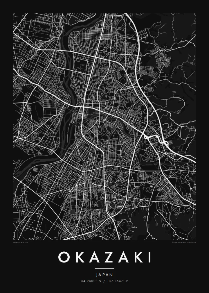
From above, Okazaki reads as a meeting of waters. The Yahagi River runs broadly north to south along the western side of the city, and the smaller Oto River threads east to west to join it. The historic core sits close to where they meet, around the grounds of Okazaki Castle. Newer districts spread outward across the flatter land and climb gradually into wooded hills to the east.
Okazaki is best known as the birthplace of Tokugawa Ieyasu, the founder of the shogunate that governed Japan for over two and a half centuries. The rebuilt castle keep stands in Okazaki Park, whose moats and green space show clearly on a detailed map. The town also grew as a post station on the Tokaido, the old highway linking Edo and Kyoto.
A Okazaki map poster shows how tightly the city is arranged along its rivers. Rail lines and main roads follow the valley floors, and small residential blocks fill the spaces between them. Farther out, the street pattern loosens into looping roads that follow the contours of the hills. In black and white, the pale river channels stand out against the fine grain of streets.
A wide river running down the western side of the city, with long bridges across it. On the map it gives the whole layout a strong vertical edge.
The castle grounds near the rivers' confluence, with moats and open lawns. They form a quiet green space at the centre of the old town.
East of the centre the grid breaks up into winding lanes and wooded slopes, so the dense city gives way to open land.
Fai mo oe
Faʻaopoopo se aso, se igoa po o sau lava upu, sui le sitaili, lapoʻa po o le itu.
O le preview e leai se totogi e maualalo le resolution ma iai se watermark. O lolomi ma faila HD e faia i le 300 DPI, e oo atu i le 7,200 × 10,800 px, e aunoa ma se watermark.
Aisea Okazaki
For people from Okazaki, the map is a way to keep the rivers, the castle park and familiar neighbourhoods on the wall. It also works as a quiet nod to Japanese history for anyone who has walked the old Tokaido route through the town.
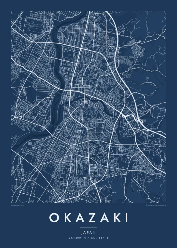
You can personalise the title, subtitle and coordinates line, for example with a family name or a date that matters. Then choose one of five styles: Classic black & white, Noir, Paper, Blueprint or Sand.
Faatau le posita Okazaki| Lapoʻa lolomi | Manino | Faila |
|---|---|---|
| 30 × 40 cm (11.8 × 15.7″) | 3,543 × 4,724 px | PNG · PDF |
| 29.7 × 42 cm (A3, 11.7 × 16.5″) | 3,508 × 4,961 px | PNG · PDF |
| 42 × 59.4 cm (A2, 16.5 × 23.4″) | 4,961 × 7,016 px | PNG · PDF |
| 45.7 × 61 cm (18 × 24″) | 5,400 × 7,200 px | PNG · PDF |
| 50 × 70 cm (19.7 × 27.6″) | 5,906 × 8,268 px | PNG · PDF |
| 61 × 91.4 cm (24 × 36″) | 7,200 × 10,800 px | PNG · PDF |
Ae faʻatusatusa, o le faʻataʻitaʻiga e leai se totogi e 900 px le lautele, e iai le faʻailoga vai ma e mo mata. O faila HD e oʻo atu i le 8× le manino i itu taʻitasi ma e lolomi manino i le lapoʻa atoa o le posta.
Filifili se sitaili i le pito i luga o le itulau, ona filifili lea o le Posita Lolomi — se lapopoa ma, afai e te fiafia, se faavaa — po o Faila HD Numera. E na o le tasi laasaga o le Checkout, ma o le a fesuia'i lou itulau o oka i le taimi lava e mae'a ai le totogi.
E lolomiina i luga o pepa matte maualuga le tulaga e 200 gsm, i se tasi o lapopoa e ono, mai le 30 × 40 cm i le 24 × 36″. E amata le tau o posita lolomi mai le $39, aofia ai le auina atu.
Ioe. Filifili se faavaa laau malosi i le lanu uliuli, sina, oak masani, po o le laau pogisa. E aofia ai se tioata e le gau ma ua saunia e tautau i luga. E amata le tau o posita faavaa mai le $99, aofia ai le auina atu.
E leai se totogi mo le uta i le lalolagi atoa. O poster ta'itasi e lolomi e le paaga lolomi e latalata mai i matou i atunuu e 30+, ma e masani ona taunuu i aso faigaluega e 3–7. E mafai ona e mulimuli i le tulaga ma le tracking i le "Aʻu Oka". O nisi atunuu e 2–5 vaiaso, ma i atunuu matou te lei tuuina atu ai, e taʻu atu e le saite iā te oe ae e te leʻi totogiina.
Auina mai se ata i totonu o le 14 aso talu ona taunuu, ma o le a matou toe lolomiina e leai se totogi po o le toe faafoi atu lau tupe.
Ioe. I totonu o le editor i lenei itulau, suia le ulutala, le ulutala laititi ma le laina o coordinates i soo se mea e te fiafia i ai, ma filifili se sitaili ma le lapopoa. O oka lolomi, faavaa ma numera e faaaoga uma lava lau mamanu.
Mo le $9 e te maua ai faila PNG 300 DPI ma PDF ua saunia mo le lolomi i lapopoa uma e ono, e aunoa ma se watermark, e mafai ona lolomi i soo se mea. Le mautinoa lava? Download muamua se preview e leai se totogi ma le watermark.
Latalata ane
