Po Klong Garai hill
The Cham tower complex stands on a small hill near the Tháp Chàm area. On the map it is a compact green patch marking one of the best-preserved Cham sites in Vietnam.
Posta faʻafanua faigofie · Vietnam
11.5643° N / 108.9886° E
A low coastal city by a river mouth and the South China Sea, with Cham towers on its western hill



Tasi le aai, lagona e lima
Tapi se sitaili e vaai ai i luga o le puipui. E tutusa uma le tau o sitaili — pe lolomiina, faapipiiina, pe avea ma faila HD.
 Pika Moni · Faila Lolomi 24 × 36″
Manino mo le lolomi
O se vaega atoa (100%) lenei mai le faila lolomi moni. O posita uma — pe lolomiina, faapipiiina pe download mai — e faia i luga o a matou server i le 300 DPI, e oo atu i le 7,200 × 10,800 pika, ina ia manino pea auala laiti i luga o se lolomiga 24 × 36″.
I luga o le puipui


Le faʻafanua
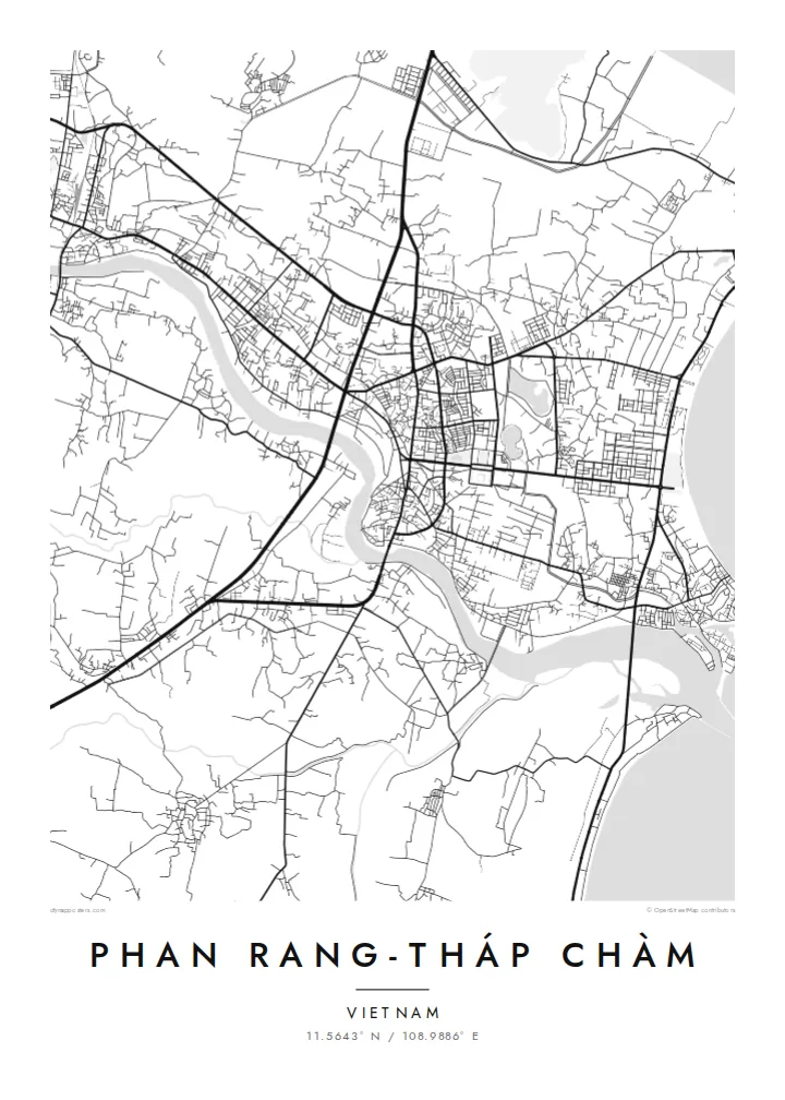
Phan Rang-Tháp Chàm lies in the former Ninh Thuận province, now part of Khánh Hòa, on one of the driest stretches of the Vietnamese coast. The city spreads across flat ground between the Dinh River and the sea. A central grid of streets gives way at the edges to irrigated fields and the vineyards the area is known for.
The double name reflects two parts of one city. Phan Rang is the older commercial centre near the coast. Tháp Chàm, to the west, takes its name from the Cham towers of Po Klong Garai, built around the turn of the fourteenth century on a low hill. The region's Cham heritage remains visible in its temples, villages and festivals.
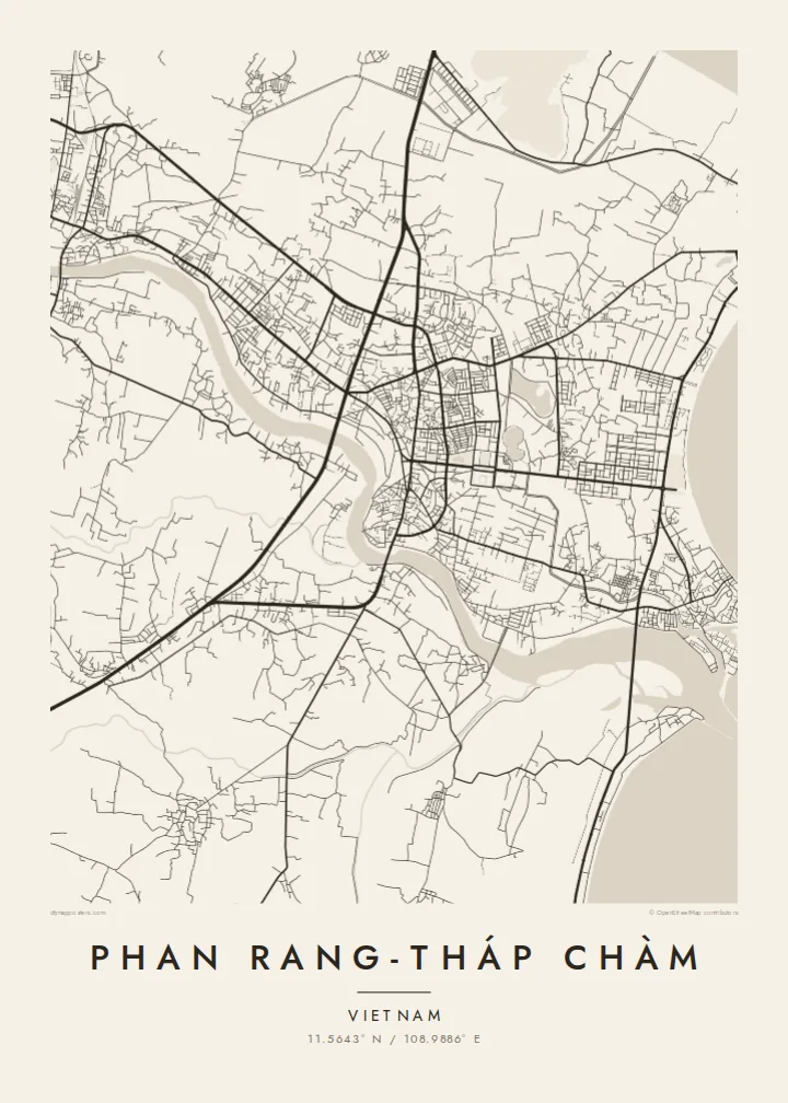
A Phan Rang-Tháp Chàm map poster shows a city stretched between river, railway and sea. It holds a dense core, the long, smooth curve of Ninh Chữ beach to the north-east and the open, sun-baked farmland beyond. In black and white the calm coastline and simple grid make an unusually clear, balanced composition.
The Cham tower complex stands on a small hill near the Tháp Chàm area. On the map it is a compact green patch marking one of the best-preserved Cham sites in Vietnam.
North-east of the centre, the shore curves in a long, smooth bay lined with beachfront roads, one of the cleanest lines in the composition.
The Dinh River runs past the south of the city to the sea. Irrigated fields and vineyards line it, standing out in an otherwise very dry landscape.
Fai mo oe
Faʻaopoopo se aso, se igoa po o sau lava upu, sui le sitaili, lapoʻa po o le itu.
O le preview e leai se totogi e maualalo le resolution ma iai se watermark. O lolomi ma faila HD e faia i le 300 DPI, e oo atu i le 7,200 × 10,800 px, e aunoa ma se watermark.
Aisea Phan Rang-Tháp Chàm
This map suits people with roots in the region's Cham or Kinh communities, travellers who drove the coast road between Nha Trang and Phan Thiết, or anyone who remembers the grapes, the wind and the sea. Its open, airy layout fits a bright, uncluttered room.
Set your own title and subtitle, add a date and edit the coordinates line. The Sand style echoes the dry coastal landscape, and Classic black & white, Noir, Paper and Blueprint are also available. Choose the $9 HD bundle in six sizes or a matte print with an optional frame.
Faatau le posita Phan Rang-Tháp Chàm| Lapoʻa lolomi | Manino | Faila |
|---|---|---|
| 30 × 40 cm11.8 × 15.7″ | 3,543 × 4,724 px | PNG · PDF |
| 29.7 × 42 cm (A3)11.7 × 16.5″ | 3,508 × 4,961 px | PNG · PDF |
| 42 × 59.4 cm (A2)16.5 × 23.4″ | 4,961 × 7,016 px | PNG · PDF |
| 45.7 × 61 cm18 × 24″ | 5,400 × 7,200 px | PNG · PDF |
| 50 × 70 cm19.7 × 27.6″ | 5,906 × 8,268 px | PNG · PDF |
| 61 × 91.4 cm24 × 36″ | 7,200 × 10,800 px | PNG · PDF |
Ae faʻatusatusa, o le faʻataʻitaʻiga e leai se totogi e 900 px le lautele, e iai le faʻailoga vai ma e mo mata. O faila HD e oʻo atu i le 8× le manino i itu taʻitasi ma e lolomi manino i le lapoʻa atoa o le posta.
Filifili se sitaili i le pito i luga o le itulau, ona filifili lea o le Posita Lolomi — se lapopoa ma, afai e te fiafia, se faavaa — po o Faila HD Numera. E na o le tasi laasaga o le Checkout, ma o le a fesuia'i lou itulau o oka i le taimi lava e mae'a ai le totogi.
E lolomiina i luga o pepa matte maualuga le tulaga e 200 gsm, i se tasi o lapopoa e ono, mai le 30 × 40 cm i le 24 × 36″. E amata le tau o posita lolomi mai le $39, aofia ai le auina atu.
Ioe. Filifili se faavaa laau malosi i le lanu uliuli, sina, oak masani, po o le laau pogisa. E aofia ai se tioata e le gau ma ua saunia e tautau i luga. E amata le tau o posita faavaa mai le $99, aofia ai le auina atu.
E leai se totogi o le auina atu i atunuu e 60+. O pepa ata taʻitasi e lolomiina e le tasi o matou paaga lolomi e latalata mai i atunuu e 30+, ma e masani ona taunuu i le 3–7 aso faigaluega. E mafai ona e mulimulitaia le tulaga ma le sailiga i lalo o My Orders. O nisi atunuu e 2–5 vaiaso, ma i nofoaga e lei matou auina atu iai, e taʻu atu e le saite ia te oe a o lei totogi.
Auina mai se ata i totonu o le 14 aso talu ona taunuu, ma o le a matou toe lolomiina e leai se totogi po o le toe faafoi atu lau tupe.
Ioe. I totonu o le editor i lenei itulau, suia le ulutala, le ulutala laititi ma le laina o coordinates i soo se mea e te fiafia i ai, ma filifili se sitaili ma le lapopoa. O oka lolomi, faavaa ma numera e faaaoga uma lava lau mamanu.
Mo le $9 e te maua ai faila PNG 300 DPI ma PDF ua saunia mo le lolomi i lapopoa uma e ono, e aunoa ma se watermark, e mafai ona lolomi i soo se mea. Le mautinoa lava? Download muamua se preview e leai se totogi ma le watermark.
Latalata ane
