Olt reservoirs
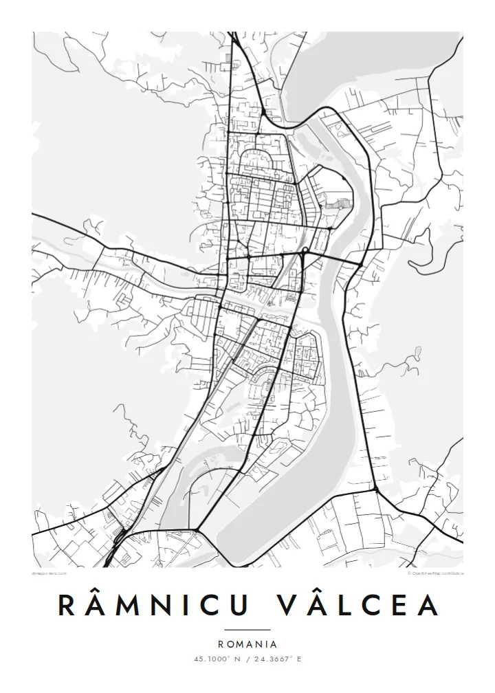
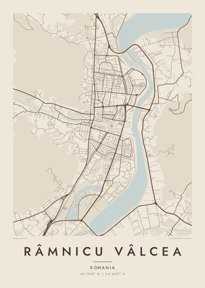
Dams on the Olt widen the river into still lakes beside the city, giving the map broad water shapes instead of a thin river line.
Posta faʻafanua faigofie · Romania
45.1000° N / 24.3667° E
Carpathian foothill city lying along the Olt River, pressed between the water and green hills on its western side


Tasi le aai, lagona e lima
Tapi se sitaili e vaai ai i luga o le puipui. E tutusa uma le tau o sitaili — pe lolomiina, faapipiiina, pe avea ma faila HD.
 Pika Moni · Faila Lolomi 24 × 36″
Manino mo le lolomi
O se vaega atoa (100%) lenei mai le faila lolomi moni. O posita uma — pe lolomiina, faapipiiina pe download mai — e faia i luga o a matou server i le 300 DPI, e oo atu i le 7,200 × 10,800 pika, ina ia manino pea auala laiti i luga o se lolomiga 24 × 36″.
I luga o le puipui


Le faʻafanua
Râmnicu Vâlcea lies in the Olt valley, where the river leaves the Southern Carpathians and heads for the Wallachian plain. The city extends north to south along the water, and hills close in on the west. On a map the result is a long, narrow city: parallel main roads, residential districts in the side valleys, and the river running along the eastern edge.
The Olt is heavily managed here, with dams and reservoirs that widen it into a series of lakes near the city. On the hills, Capela Park forms a wooded patch above the centre. The city has its place in national history too: the song that later became Romania's anthem, Deșteaptă-te, române, is traditionally said to have been sung publicly for the first time here in 1848.
A Râmnicu Vâlcea map poster shows the city's valley shape clearly. The river and its reservoirs form a strong vertical line, the road network follows it, and the hills set a soft boundary on the other side. It is a clear example of a city whose plan comes directly from its terrain.
Dams on the Olt widen the river into still lakes beside the city, giving the map broad water shapes instead of a thin river line.
A wooded hill park rises above the centre on the western side, one of the green masses that hold the city against the river.
Main streets run parallel to the Olt, and neighbourhoods reach into the side valleys. The plan is long and narrow.
Fai mo oe
Faʻaopoopo se aso, se igoa po o sau lava upu, sui le sitaili, lapoʻa po o le itu.
O le preview e leai se totogi e maualalo le resolution ma iai se watermark. O lolomi ma faila HD e faia i le 300 DPI, e oo atu i le 7,200 × 10,800 px, e aunoa ma se watermark.
Aisea Râmnicu Vâlcea
For anyone from Vâlcea County, this map shows the valley they know: the river, the hills and the road north toward the mountains. It also appeals to travellers who have driven the Olt gorge and want a record of the route.
The title, subtitle and coordinates line can all be changed, for example to add a family name or a year. It comes in five styles, Classic black & white, Noir, Paper, Blueprint and Sand, as digital files or a framed print.
Faatau le posita Râmnicu Vâlcea| Lapoʻa lolomi | Manino | Faila |
|---|---|---|
| 30 × 40 cm11.8 × 15.7″ | 3,543 × 4,724 px | PNG · PDF |
| 29.7 × 42 cm (A3)11.7 × 16.5″ | 3,508 × 4,961 px | PNG · PDF |
| 42 × 59.4 cm (A2)16.5 × 23.4″ | 4,961 × 7,016 px | PNG · PDF |
| 45.7 × 61 cm18 × 24″ | 5,400 × 7,200 px | PNG · PDF |
| 50 × 70 cm19.7 × 27.6″ | 5,906 × 8,268 px | PNG · PDF |
| 61 × 91.4 cm24 × 36″ | 7,200 × 10,800 px | PNG · PDF |
Ae faʻatusatusa, o le faʻataʻitaʻiga e leai se totogi e 900 px le lautele, e iai le faʻailoga vai ma e mo mata. O faila HD e oʻo atu i le 8× le manino i itu taʻitasi ma e lolomi manino i le lapoʻa atoa o le posta.
Filifili se sitaili i le pito i luga o le itulau, ona filifili lea o le Posita Lolomi — se lapopoa ma, afai e te fiafia, se faavaa — po o Faila HD Numera. E na o le tasi laasaga o le Checkout, ma o le a fesuia'i lou itulau o oka i le taimi lava e mae'a ai le totogi.
E lolomiina i luga o pepa matte maualuga le tulaga e 200 gsm, i se tasi o lapopoa e ono, mai le 30 × 40 cm i le 24 × 36″. E amata le tau o posita lolomi mai le $39, aofia ai le auina atu.
Ioe. Filifili se faavaa laau malosi i le lanu uliuli, sina, oak masani, po o le laau pogisa. E aofia ai se tioata e le gau ma ua saunia e tautau i luga. E amata le tau o posita faavaa mai le $99, aofia ai le auina atu.
E leai se totogi o le auina atu i atunuu e 60+. O pepa ata taʻitasi e lolomiina e le tasi o matou paaga lolomi e latalata mai i atunuu e 30+, ma e masani ona taunuu i le 3–7 aso faigaluega. E mafai ona e mulimulitaia le tulaga ma le sailiga i lalo o My Orders. O nisi atunuu e 2–5 vaiaso, ma i nofoaga e lei matou auina atu iai, e taʻu atu e le saite ia te oe a o lei totogi.
Auina mai se ata i totonu o le 14 aso talu ona taunuu, ma o le a matou toe lolomiina e leai se totogi po o le toe faafoi atu lau tupe.
Ioe. I totonu o le editor i lenei itulau, suia le ulutala, le ulutala laititi ma le laina o coordinates i soo se mea e te fiafia i ai, ma filifili se sitaili ma le lapopoa. O oka lolomi, faavaa ma numera e faaaoga uma lava lau mamanu.
Mo le $9 e te maua ai faila PNG 300 DPI ma PDF ua saunia mo le lolomi i lapopoa uma e ono, e aunoa ma se watermark, e mafai ona lolomi i soo se mea. Le mautinoa lava? Download muamua se preview e leai se totogi ma le watermark.
Latalata ane
