The railway junction
Tracks approach across the flat plain and divide near the station. They are the longest, straightest lines on the map, and the town is laid out around them.
Posta faʻafanua faigofie · India
25.8130° N / 72.5788° E
A railway town on the dry Rajasthan plain, with tracks fanning out and the wide sandy bed of the Luni nearby




Tasi le aai, lagona e lima
Tapi se sitaili e vaai ai i luga o le puipui. E tutusa uma le tau o sitaili — pe lolomiina, faapipiiina, pe avea ma faila HD.
 Pika Moni · Faila Lolomi 24 × 36″
Manino mo le lolomi
O se vaega atoa (100%) lenei mai le faila lolomi moni. O posita uma — pe lolomiina, faapipiiina pe download mai — e faia i luga o a matou server i le 300 DPI, e oo atu i le 7,200 × 10,800 pika, ina ia manino pea auala laiti i luga o se lolomiga 24 × 36″.
I luga o le puipui


Le faʻafanua
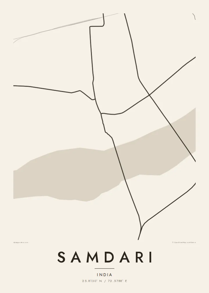
From above, Samdari reads as a compact settlement on the open, arid country of western Rajasthan. The streets gather around the railway station and grow outward in a low, irregular pattern, with lanes branching from a few main roads. Past the last houses the map thins quickly into field boundaries, tracks and dry watercourses. Almost all the drawing sits in the middle of the sheet and empty ground surrounds it.
Samdari is best known as a junction on the line running west from Jodhpur towards Barmer, and the rails give the map its strongest lines. They come in straight across the plain and split near the town, so the sidings and branches look like a small diagram of how the region is connected. The broad, seasonal bed of the Luni River runs through the surrounding district.
A Samdari map poster suits this spareness. In black and white, the tight cluster of lanes stands out against the pale surrounding ground, and the straight railway lines give the page a clear structure. It does not show a famous skyline or a coastline. It shows a working desert town and the lines that link it to the rest of Rajasthan, drawn as plainly as they are on a map.
Tracks approach across the flat plain and divide near the station. They are the longest, straightest lines on the map, and the town is laid out around them.
The lanes are short and packed close together and follow no strict grid. On the page they form a dense knot that looks darker than the open land around it.
Past the town, the map shows sparse field edges, tracks and dry channels. This thin detail is what makes western Rajasthan look so different from a crowded city map.
Fai mo oe
Faʻaopoopo se aso, se igoa po o sau lava upu, sui le sitaili, lapoʻa po o le itu.
O le preview e leai se totogi e maualalo le resolution ma iai se watermark. O lolomi ma faila HD e faia i le 300 DPI, e oo atu i le 7,200 × 10,800 px, e aunoa ma se watermark.
Aisea Samdari
People hang Samdari because it is where they grew up, where their family still lives, or where they changed trains on long journeys across Rajasthan. A map of a small town is rarely sold anywhere else, so having one on the wall carries a personal meaning that a big-city print does not.
You can change the title, subtitle and coordinates line, for example to add a family name, a year or a date that matters. Choose from Classic black & white, Noir, Paper, Blueprint or Sand. The digital HD files cost $9, or you can order a printed poster on matte paper, with an optional wooden frame.
Faatau le posita Samdari| Lapoʻa lolomi | Manino | Faila |
|---|---|---|
| 30 × 40 cm (11.8 × 15.7″) | 3,543 × 4,724 px | PNG · PDF |
| 29.7 × 42 cm (A3, 11.7 × 16.5″) | 3,508 × 4,961 px | PNG · PDF |
| 42 × 59.4 cm (A2, 16.5 × 23.4″) | 4,961 × 7,016 px | PNG · PDF |
| 45.7 × 61 cm (18 × 24″) | 5,400 × 7,200 px | PNG · PDF |
| 50 × 70 cm (19.7 × 27.6″) | 5,906 × 8,268 px | PNG · PDF |
| 61 × 91.4 cm (24 × 36″) | 7,200 × 10,800 px | PNG · PDF |
Ae faʻatusatusa, o le faʻataʻitaʻiga e leai se totogi e 900 px le lautele, e iai le faʻailoga vai ma e mo mata. O faila HD e oʻo atu i le 8× le manino i itu taʻitasi ma e lolomi manino i le lapoʻa atoa o le posta.
Filifili se sitaili i le pito i luga o le itulau, ona filifili lea o le Posita Lolomi — se lapopoa ma, afai e te fiafia, se faavaa — po o Faila HD Numera. E na o le tasi laasaga o le Checkout, ma o le a fesuia'i lou itulau o oka i le taimi lava e mae'a ai le totogi.
E lolomiina i luga o pepa matte maualuga le tulaga e 200 gsm, i se tasi o lapopoa e ono, mai le 30 × 40 cm i le 24 × 36″. E amata le tau o posita lolomi mai le $39, aofia ai le auina atu.
Ioe. Filifili se faavaa laau malosi i le lanu uliuli, sina, oak masani, po o le laau pogisa. E aofia ai se tioata e le gau ma ua saunia e tautau i luga. E amata le tau o posita faavaa mai le $99, aofia ai le auina atu.
E leai se totogi mo le uta i le lalolagi atoa. O poster ta'itasi e lolomi e le paaga lolomi e latalata mai i matou i atunuu e 30+, ma e masani ona taunuu i aso faigaluega e 3–7. E mafai ona e mulimuli i le tulaga ma le tracking i le "Aʻu Oka". O nisi atunuu e 2–5 vaiaso, ma i atunuu matou te lei tuuina atu ai, e taʻu atu e le saite iā te oe ae e te leʻi totogiina.
Auina mai se ata i totonu o le 14 aso talu ona taunuu, ma o le a matou toe lolomiina e leai se totogi po o le toe faafoi atu lau tupe.
Ioe. I totonu o le editor i lenei itulau, suia le ulutala, le ulutala laititi ma le laina o coordinates i soo se mea e te fiafia i ai, ma filifili se sitaili ma le lapopoa. O oka lolomi, faavaa ma numera e faaaoga uma lava lau mamanu.
Mo le $9 e te maua ai faila PNG 300 DPI ma PDF ua saunia mo le lolomi i lapopoa uma e ono, e aunoa ma se watermark, e mafai ona lolomi i soo se mea. Le mautinoa lava? Download muamua se preview e leai se totogi ma le watermark.
Latalata ane
